Karitsa, Pieria
Karitsa
Καρίτσα | |
|---|---|
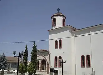 The Church of Agios Dimitrios in Karitsa | |
 Karitsa Location within the regional unit 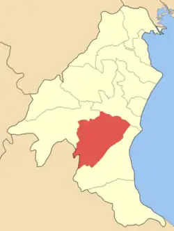 | |
| Coordinates: 40°11′15″N 22°28′55″E / 40.18750°N 22.48194°E | |
| Country | Greece |
| Administrative region | Central Macedonia |
| Regional unit | Pieria |
| Municipality | Dio-Olympos |
| Municipal unit | Dio |
| Elevation | 20 m (70 ft) |
| Population (2021)[1] | |
• Community | 1,843 |
| Time zone | UTC+2 (EET) |
| • Summer (DST) | UTC+3 (EEST) |
| Postal code | 601 00 |
| Area code(s) | 23510 |
| Vehicle registration | KN |
Karitsa (Greek: Καρίτσα) is a lowland Aromanian (Vlach) town of the former Municipality of Dio, which is part of the municipality of Dio-Olympos, in the Pieria regional unit, Central Macedonia, Greece. The population was 1,843 people as of 2021.[1] It is located 13 km south of Katerini.
Livestock farming and tobacco growing are the main occupations of the residents. Also produced is corn, beet, endive, kiwi, and cereals.
References
- ^ a b "Αποτελέσματα Απογραφής Πληθυσμού - Κατοικιών 2021, Μόνιμος Πληθυσμός κατά οικισμό" [Results of the 2021 Population - Housing Census, Permanent population by settlement] (in Greek). Hellenic Statistical Authority. 29 March 2024.