Khao Ok Thalu
| Khao Ok Thalu | |
|---|---|
 | |
| Highest point | |
| Elevation | 177 m (581 ft) |
| Listing | List of mountains in Thailand |
| Coordinates | 7°37′30″N 100°05′30″E / 7.62500°N 100.09167°E |
| Geography | |
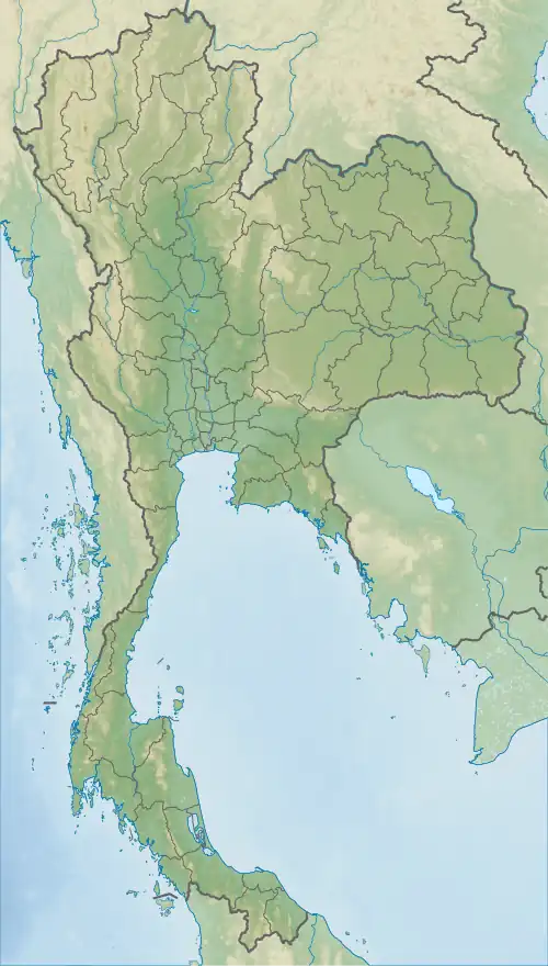 Khao Ok Thalu Thailand | |
| Location | Phatthalung, Thailand |
| Parent range | Tenasserim Hills |
| Geology | |
| Mountain type | karstic |
| Climbing | |
| Easiest route | drive |
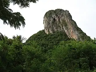
Khao Ok Thalu (Thai: เขาอกทะลุ) or Phukhao Ok Thalu (ภูเขาอกทะลุ), is a mountain in Phatthalung Province, Thailand. It is a karstic formation.
Tourism
This mountain is east of the Phatthalung railway station. It can be accessed from Wat Khuha Sawan via Highway 4047. There is a flight of stairs leading to the mountaintop where there is a Buddhist shrine overlooking the city of Phatthalung. The mountain is named after a hole near the top.
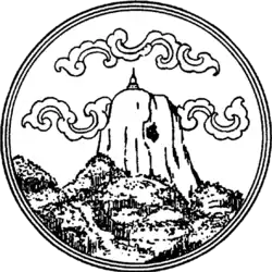
Khao Ok Thalu is an unusually-shaped mountain, clearly visible from afar. It has symbolic significance in Phatthalung[1] and appears in somewhat stylized form on the provincial seal of PhatThalung.
See also
- List of mountains in Thailand
- Phatthalung Province
- Seals of the provinces of Thailand
- Legend of Khao Ok Thalu
References
External links
- Tourism Authority of Thailand (TAT): Phatthalung
- Phatthalung Official Website Archived 2013-11-28 at the Wayback Machine (in Thai)