Kirchschlag bei Linz
Kirchschlag bei Linz | |
|---|---|
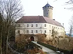 Wildberg castle | |
 Coat of arms | |
 Kirchschlag bei Linz Location within Austria | |
| Coordinates: 48°24′49″N 14°16′41″E / 48.41361°N 14.27806°E | |
| Country | Austria |
| State | Upper Austria |
| District | Urfahr-Umgebung |
| Government | |
| • Mayor | Dr. Gertraud Deim (ÖVP) |
| Area | |
• Total | 16.78 km2 (6.48 sq mi) |
| Elevation | 896 m (2,940 ft) |
| Population (2018-01-01)[2] | |
• Total | 2,138 |
| • Density | 130/km2 (330/sq mi) |
| Time zone | UTC+1 (CET) |
| • Summer (DST) | UTC+2 (CEST) |
| Postal code | 4202 |
| Area code | 0 72 15 |
| Vehicle registration | UU |
| Website | www.kirchschlag.net |
Kirchschlag bei Linz is a municipality in the district of Urfahr-Umgebung in the Austrian state of Upper Austria.
Population
| Year | Pop. | ±% |
|---|---|---|
| 1991 | 1,683 | — |
| 2001 | 1,906 | +13.3% |
References
- ^ "Dauersiedlungsraum der Gemeinden Politischen Bezirke und Bundesländer - Gebietsstand 1.1.2018". Statistics Austria. Retrieved 10 March 2019.
- ^ "Einwohnerzahl 1.1.2018 nach Gemeinden mit Status, Gebietsstand 1.1.2018". Statistics Austria. Retrieved 9 March 2019.
Wikimedia Commons has media related to Kirchschlag bei Linz.