Kleitor
Kleitor
Κλείτωρ | |
|---|---|
 Kleitor Location within the regional unit 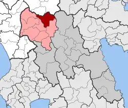 | |
| Coordinates: 37°45′N 22°05′E / 37.750°N 22.083°E | |
| Country | Greece |
| Administrative region | Peloponnese |
| Regional unit | Arcadia |
| Municipality | Gortynia |
| Area | |
| • Municipal unit | 150.6 km2 (58.1 sq mi) |
| Population (2021)[1] | |
| • Municipal unit | 920 |
| • Municipal unit density | 6.1/km2 (16/sq mi) |
| Time zone | UTC+2 (EET) |
| • Summer (DST) | UTC+3 (EEST) |
| Vehicle registration | TP |
Kleitor or Cleitor (Greek: Κλείτωρ) is a former municipality in Arcadia, Peloponnese, Greece. Since the 2011 local government reform it is part of the municipality Gortynia, of which it is a municipal unit.[2] The municipal unit has an area of 150.582 km2.[3] The seat of the municipality was in Mygdalia.
History
Cleitor was a historic and powerful city-state in ancient Greece.
Subdivisions
The municipal unit Kleitor is subdivided into the following communities (constituent villages in brackets):
- Agridi
- Drakovouni
- Kerpini (Kerpini, Ano Kalyvia, Kato Kalyvia)
- Mygdalia (Mygdalia, Palaiopyrgos)
- Pournaria (Pournaria, Mouria)
- Prasino (Prasino, Kalyvia Karnesi)
- Theoktisto
- Valtesiniko (Valtesiniko, Kourouveli, Olomades)
- Xirokarotaina
Population
| Year | Population |
|---|---|
| 1991 | 2,761 |
| 2001 | 2,584 |
| 2011 | 1,406 |
| 2021 | 920 |
References
- ^ "Αποτελέσματα Απογραφής Πληθυσμού - Κατοικιών 2021, Μόνιμος Πληθυσμός κατά οικισμό" [Results of the 2021 Population - Housing Census, Permanent population by settlement] (in Greek). Hellenic Statistical Authority. 29 March 2024.
- ^ "ΦΕΚ B 1292/2010, Kallikratis reform municipalities" (in Greek). Government Gazette.
- ^ "Population & housing census 2001 (incl. area and average elevation)" (PDF) (in Greek). National Statistical Service of Greece. Archived from the original (PDF) on 2015-09-21.
External links
- . Encyclopædia Britannica. Vol. VI (9th ed.). 1878. p. 8.