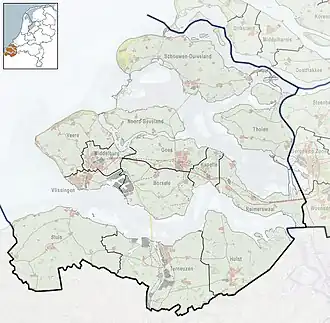
Kleverskerke
Kleverskerke | |
|---|---|
 | |
 Seal | |
 Kleverskerke Location in the province of Zeeland in the Netherlands  Kleverskerke Kleverskerke (Netherlands) | |
| Coordinates: 51°31′N 3°40′E / 51.517°N 3.667°E | |
| Country | |
| Province | Zeeland |
| Municipality | Middelburg |
| Area | |
• Total | 0.07 km2 (0.03 sq mi) |
| Elevation | 2.8 m (9.2 ft) |
| Population (2021)[1] | |
• Total | 60 |
| • Density | 860/km2 (2,200/sq mi) |
| Time zone | UTC+1 (CET) |
| • Summer (DST) | UTC+2 (CEST) |
| Postal code | 4341[1] |
| Dialing code | 0118 |
Kleverskerke is a small village in the Dutch province of Zeeland. It is located in the municipality of Middelburg, about 4 kilometres north-east of the city centre.
History
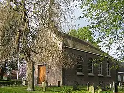
The village was first mentioned in 1251 as Clawarskerke, and means "(private) church of Clawaert (person)".[3] Kleverskerke used to be a free heerlijkheid (=no fief) and a castle was located near the village.[4] Kleverskerke became an independent parish in 1251. The church dates from 1862.[5]
Kleverskerke was home to 194 people in 1840.[4] Kleverskerke was a separate municipality until 1857, when it was merged with Arnemuiden.[6] In 1997, it became part of the municipality of Middelburg.[4]
Gallery
-
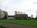 Farm in Kleverskerke
 -
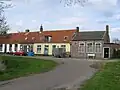 Village street
References
- ^ a b c "Kerncijfers wijken en buurten 2021". Central Bureau of Statistics. Retrieved 20 April 2022.
- ^ "Postcodetool for 4341AA". Actueel Hoogtebestand Nederland (in Dutch). Het Waterschapshuis. Archived from the original on 25 December 2018. Retrieved 20 April 2022.
- ^ "Kleverskerke". Etymologiebank (in Dutch). Retrieved 20 April 2022.
- ^ a b c "Kleverskerke". Plaatsengids (in Dutch). Retrieved 20 April 2022.
- ^ "De Hervormde gemeente van Kleverskerke". Arne Historie (in Dutch). Retrieved 20 April 2022.
- ^ Ad van der Meer and Onno Boonstra, Repertorium van Nederlandse gemeenten, KNAW, 2011.
Wikimedia Commons has media related to Kleverskerke.