Kollumerland en Nieuwkruisland
Kollumerland en Nieuwkruisland
Kollumerlân en Nijkrúslân Kollumerland c.a. | |
|---|---|
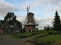 Windmill Rust Roest | |
 Flag  Coat of arms | |
.svg.png) Location in Friesland | |
| Coordinates: 53°17′N 6°8′E / 53.283°N 6.133°E | |
| Country | Netherlands |
| Province | |
| Merged | 2019 |
| Area | |
• Total | 116.35 km2 (44.92 sq mi) |
| • Land | 109.75 km2 (42.37 sq mi) |
| • Water | 6.60 km2 (2.55 sq mi) |
| Elevation | 0.9 m (3.0 ft) |
| Highest elevation | 1.6 m (5.2 ft) |
| Lowest elevation | 0 m (0 ft) |
| Population (January 2021)[3] | |
• Total | data missing |
| Time zone | UTC+1 (CET) |
| • Summer (DST) | UTC+2 (CEST) |
| Postcode | 9291–9299, 9851–9853 |
| Area code | 0511, 0594 |
| Website | www |
Kollumerland en Nieuwkruisland (ⓘ; West Frisian: ⓘ en Nijkrúslân), officially abbreviated as Kollumerland c.a., is a former municipality in the northern Netherlands, located in the province of Friesland. In 2019 it merged with the municipalities of Dongeradeel and Ferwerderadiel to form the new municipality Noardeast-Fryslân.
Population centres
Augsbuurt, Burum, Kollum, Kollumerpomp, Kollumerzwaag, Munnekezijl, Oudwoude, Triemen, Veenklooster, Warfstermolen, Westergeest and Zwagerbosch.[4]
Kollumerland en Nieuwkruisland has a population of 12,775 (1 April 2016, source: CBS).[5]
Topography
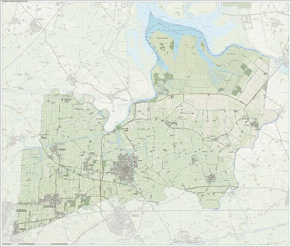
Dutch Topographic map of the municipality of Kollumerland en Nieuwkruisland, June 2015.
Government
The Burum community houses the satellite ground station of the Nationale SIGINT Organisatie.[6]
References
- ^ "Kerncijfers wijken en buurten 2020" [Key figures for neighbourhoods 2020]. StatLine (in Dutch). CBS. 24 July 2020. Retrieved 19 September 2020.
- ^ "Postcodetool for 9291KB". Actueel Hoogtebestand Nederland (in Dutch). Het Waterschapshuis. Archived from the original on 11 February 2017. Retrieved 16 September 2013.
- ^ "Bevolkingsontwikkeling; regio per maand" [Population growth; regions per month]. CBS Statline (in Dutch). CBS. 1 January 2021. Retrieved 2 January 2022.
- ^ "Feiten & cijfers 2016 - Gemeente - Gemeente - Gemeente Kollumerland". Archived from the original on 2016-08-13. Retrieved 2016-06-20.
- ^ "CBS StatLine - Bevolkingsontwikkeling; regio per maand". statline.cbs.nl. Retrieved 2016-06-20.
- ^ "Nationale SIGINT Organisatie." ( Archived 2013-05-22 at the Wayback Machine) Ministry of Defence. Retrieved on 13 June 2013.
External links
 Media related to Kollumerland en Nieuwkruisland at Wikimedia Commons
- Official website
Places adjacent to Kollumerland en Nieuwkruisland | ||||||||||||||||
|---|---|---|---|---|---|---|---|---|---|---|---|---|---|---|---|---|
| ||||||||||||||||