Kollweiler
Kollweiler | |
|---|---|
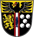
 Coat of arms | |
Location of Kollweiler within Kaiserslautern district 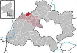 | |
 Kollweiler 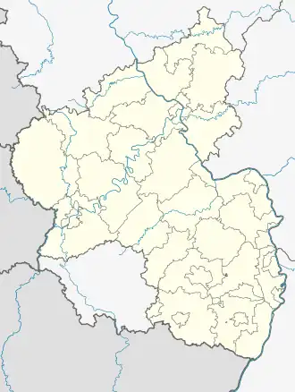 Kollweiler | |
| Coordinates: 49°30′57″N 7°35′04″E / 49.51583°N 7.58444°E | |
| Country | Germany |
| State | Rhineland-Palatinate |
| District | Kaiserslautern |
| Municipal assoc. | Weilerbach |
| Government | |
| • Mayor (2024-) | Timo Müller [1] (FW) |
| Area | |
• Total | 5.57 km2 (2.15 sq mi) |
| Elevation | 335 m (1,099 ft) |
| Population (2023-12-31)[2] | |
• Total | 539 |
| • Density | 97/km2 (250/sq mi) |
| Time zone | UTC+01:00 (CET) |
| • Summer (DST) | UTC+02:00 (CEST) |
| Postal codes | 66879 |
| Dialling codes | 06385 |
| Vehicle registration | KL |
Kollweiler (German pronunciation: [ˈkɔlvaɪlɐ]) is a municipality in the district of Kaiserslautern, in Rhineland-Palatinate, western Germany.
Geography
Kollweiler lies in the Northern Pfalz. To the north are the towns of Jettenbach and Rothselberg, and to the south are the towns of Schwedelbach and Reichenbach-Steegen. The closest city is Kaiserslautern, located 15 km (9.3 mi) to the southeast.
History
Even before the Romans, Celtic descendants settled the area around Kollweiler.
References
- ^ Direktwahlen 2019, Landkreis Kaiserslautern, Landeswahlleiter Rheinland-Pfalz, accessed 9 August 2021.
- ^ Bevölkerungsstand 31. Dezember 2023, Landkreise, Gemeinden, Verbandsgemeinden; Fortschreibung des Zensus 2011 (in German), Statistisches Landesamt Rheinland-Pfalz, 2024