Koman Hydroelectric Power Station
| Komani Hydroelectric Power Station | |
|---|---|
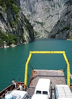 A ferry on the Drin River | |
| Location | Albania |
| Coordinates | 42°06′23″N 19°49′37″E / 42.10639°N 19.82694°E |
| Construction began | 1979 |
| Opening date | 1985 |
| Owner(s) | Albanian Power Corporation |
| Dam and spillways | |
| Type of dam | Rock-fill dam |
| Impounds | Drini River |
| Height | 130 m (427 ft) |
| Length | 275 m (902 ft) |
| Spillway capacity | 3,400 m3/sec |
| Reservoir | |
| Creates | Koman Reservoir |
| Total capacity | 16,000,000,000 m3 (5.7×10¹¹ cu ft) |
| Surface area | 12 km2 (5 sq mi) |
| Maximum water depth | 96 m (315 ft) |
| Power Station | |
| Operator(s) | Albanian Power Corporation |
| Turbines | 4 × 150 MW |
| Installed capacity | 600 MW |
The Koman Hydroelectric Power Station is a large hydroelectric power station (HPP), for which a dam on the Drin River was built. The dam is near the settlement of Koman, northern Albania. It is the second of three dams of the Drin River cascade; the Fierza Hydroelectric Power Station upstream, and the Vau i Dejës Hydroelectric Power Station downstream. The dam, 130m tall, was completed in 1985 and the reservoir was filled with water at full capacity in 1986.[1]
Completed in 1986, the power station consists of four turbines of French origin with a nominal capacity of 150 MW each, totalling the installed capacity to 600 MW.[2]
See also
References
- ^ Paul G. Marinos (1 January 2001). Engineering Geology and the Environment. A.A. Balkema. p. 3707. ISBN 978-90-5410-882-5. Retrieved 26 September 2013.
- ^ Komani Hydro Power Plant
Energy in Albania | |||||||||
|---|---|---|---|---|---|---|---|---|---|
| Oil and gas |
| ||||||||
| Hydroelectric | |||||||||
| Thermal | |||||||||
Dams on the Drin River | |
|---|---|
|