Kosh, Armenia
Kosh
Կոշ | |
|---|---|
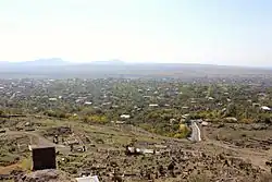 The village of Kosh as viewed from Kosh Berd. | |
 Kosh  Kosh | |
| Coordinates: 40°17′55″N 44°09′15″E / 40.29861°N 44.15417°E | |
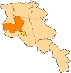
| Country | Armenia |
| Province | Aragatsotn |
| Municipality | Ashtarak |
| Population (2011) | |
• Total | 2,513[1] |
| Time zone | UTC+4 |
| • Summer (DST) | UTC+5 |
Kosh (Armenian: Կոշ) is a village in the Ashtarak Municipality of the Aragatsotn Province of Armenia, 18 km south-west of the district centre Ashtarak. The town is attested as Kvash in early Christian times. In the town are ruins of a 13th-century church - Saint Grigor - and a castle which has yielded Hellenistic pottery remains. There are numerous remains from early Iron Age residential ruins and buildings of large basalt stone blocks.
Gallery
-
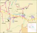 Map of Kosh and the surrounding region.
 -
-
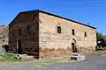 St. Gevorg church of the 19th century
 -
 Kosh Berd (13th century) atop a hill beyond the village cemetery, with the church of St. Grigor (13th century, foreground).
 -
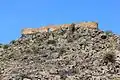 Kosh Berd on a hilltop above the cemetery, 13th century
 -
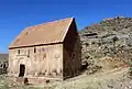
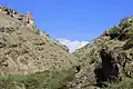 Church of St. Stepanos of the 7th century in the gorge near Kosh.
 -
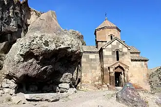 Church of St. Stepanos, 7th century
 -
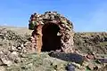 Ruins of the hilltop chapel near the church of St. Stepanos.
 -
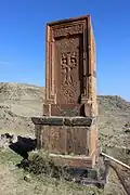 Khachkar monument of 1175 at the hilltop cemetery.
References
- ^ "Aragatsotn (Armenia): Towns and Villages in Municipalities". www.citypopulation.de. Retrieved 2024-11-11.
Wikimedia Commons has media related to Kosh.
- Kosh, Armenia at GEOnet Names Server
- World Gazetteer: Armenia – World-Gazetteer.com
- Report of the results of the 2001 Armenian Census
- Kiesling, Rediscovering Armenia, p. 17, available online at the US embassy to Armenia's website