Kramer, Nebraska
Kramer, Nebraska | |
|---|---|
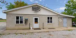 Kramer Community Center | |
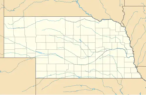 Kramer Location in Nebraska  Kramer Location in the United States | |
| Coordinates: 40°35′18″N 96°52′31″W / 40.58833°N 96.87528°W | |
| Country | United States |
| State | Nebraska |
| County | Lancaster |
| Area | |
• Total | 0.47 sq mi (1.22 km2) |
| • Land | 0.47 sq mi (1.22 km2) |
| • Water | 0.00 sq mi (0.00 km2) |
| Elevation | 1,355 ft (413 m) |
| Population (2020) | |
• Total | 26 |
| • Density | 55.32/sq mi (21.36/km2) |
| Time zone | UTC-6 (Central (CST)) |
| • Summer (DST) | UTC-5 (CDT) |
| ZIP codes | 68333 |
| FIPS code | 25720 |
| GNIS feature ID | 2806913[2] |
Kramer is an unincorporated rural village in Lancaster County, Nebraska, United States.[2] There is a grainary there, a restaurant, and a community hall, and no other businesses or services. The population was 26 at the 2020 census.
History
Kramer was founded in 1888.[3] It was named for Mr. Kramer, the original owner of the town site.[4]
A post office was established in Kramer in 1889, and remained in operation until it was discontinued in 1955.[5]
Demographics
| Census | Pop. | Note | %± |
|---|---|---|---|
| 2020 | 26 | — | |
| U.S. Decennial Census[6] | |||
References
- ^ "ArcGIS REST Services Directory". United States Census Bureau. Retrieved September 18, 2022.
- ^ a b c U.S. Geological Survey Geographic Names Information System: Kramer, Nebraska
- ^ Burr, George L. (1921). History of Hamilton and Clay Counties, Nebraska, Volume 1. S.J. Clarke Publishing Company. p. 126.
- ^ Fitzpatrick, Lillian L. (1960). Nebraska Place-Names. University of Nebraska Press. p. 92. ISBN 0-8032-5060-6.
{{cite book}}: ISBN / Date incompatibility (help) A 1925 edition is available for download at University of Nebraska—Lincoln Digital Commons. - ^ "Lancaster County". Jim Forte Postal History. Retrieved August 19, 2014.
- ^ "Census of Population and Housing". Census.gov. Retrieved June 4, 2016.
Municipalities and communities of Lancaster County, Nebraska, United States | ||
|---|---|---|
| Cities |  | |
| Villages | ||
| CDPs | ||
| Other communities | ||
| Footnotes | ‡This populated place also has portions in an adjacent county or counties | |