Kreypau
Kreypau | |
|---|---|
 Coat of arms | |
Location of Kreypau | |
 Kreypau 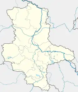 Kreypau | |
| Coordinates: 51°20′N 12°3′E / 51.333°N 12.050°E | |
| Country | Germany |
| State | Saxony-Anhalt |
| District | Saalekreis |
| Town | Leuna |
| Area | |
• Total | 12.38 km2 (4.78 sq mi) |
| Elevation | 87 m (285 ft) |
| Population (2006-12-31) | |
• Total | 337 |
| • Density | 27/km2 (71/sq mi) |
| Time zone | UTC+01:00 (CET) |
| • Summer (DST) | UTC+02:00 (CEST) |
| Postal codes | 06231 |
| Dialling codes | 03462 |
Kreypau is a village and a former municipality in the district of Saalekreis, in Saxony-Anhalt, Germany. Since 31 December 2009, it is part of the town Leuna.
Geography
Kreypau is located between Leuna and Leipzig on the right bank of the river Saale.
History
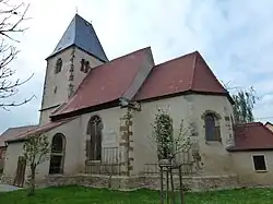
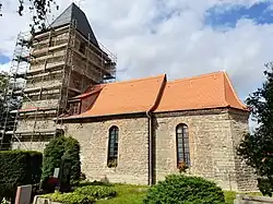
Kreypau was a small farming village. The village church was built in 1550/51, the tower in 1530. The village church of Wölkau was not used from 1996 until its renovation on 2018/2019.
-
%252C_view_of_the_village.jpg) View of the village Kreypau
View of the village Kreypau -
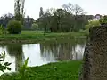
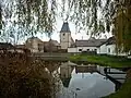 Pond and church in Kreypau
 -
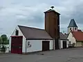 Fire station in Kreypau
 -
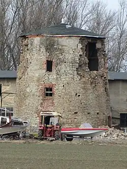 Ruin of windmill in Kreypau, 2011
 -
 River Saale at former ferry crossing near Kreypau. Leuna is in the background
 -
 Old Saale riverbed near Kreypau
 -
.jpg) Aerial photo 2021
Aerial photo 2021 -
 Construction works for the Saale-Elster-Kanal in Kreypau, in the background Leuna
 -
 West side of the ruined canal lock, Wüsteneutzsch