Kumberg
Kumberg | |
|---|---|
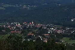 View of Kumberg | |
 Coat of arms | |
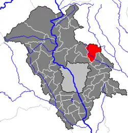 Location within Graz-Umgebung district | |
 Kumberg Location within Austria | |
| Coordinates: 47°09′34″N 15°32′03″E / 47.15944°N 15.53417°E | |
| Country | Austria |
| State | Styria |
| District | Graz-Umgebung |
| Government | |
| • Mayor | Franz Gruber (ÖVP) |
| Area | |
• Total | 29.27 km2 (11.30 sq mi) |
| Elevation | 526 m (1,726 ft) |
| Population (2018-01-01)[2] | |
• Total | 3,843 |
| • Density | 130/km2 (340/sq mi) |
| Time zone | UTC+1 (CET) |
| • Summer (DST) | UTC+2 (CEST) |
| Postal code | 8062 |
| Area code | 03132 |
| Vehicle registration | GU |
| Website | www.kumberg.at |
Kumberg is a municipality in the district of Graz-Umgebung in the Austrian state of Styria. It has 3909 inhabitants (as of January 1, 2021).
Population
| Year | Pop. | ±% |
|---|---|---|
| 1869 | 1,770 | — |
| 1880 | 1,829 | +3.3% |
| 1890 | 1,871 | +2.3% |
| 1900 | 1,971 | +5.3% |
| 1910 | 1,939 | −1.6% |
| 1923 | 1,944 | +0.3% |
| 1934 | 2,014 | +3.6% |
| 1939 | 1,956 | −2.9% |
| 1951 | 1,999 | +2.2% |
| 1961 | 2,054 | +2.8% |
| 1971 | 2,273 | +10.7% |
| 1981 | 2,373 | +4.4% |
| 1991 | 2,716 | +14.5% |
| 2001 | 3,067 | +12.9% |
| 2011 | 3,569 | +16.4% |
References
- ^ "Dauersiedlungsraum der Gemeinden Politischen Bezirke und Bundesländer - Gebietsstand 1.1.2018". Statistics Austria. Retrieved 10 March 2019.
- ^ "Einwohnerzahl 1.1.2018 nach Gemeinden mit Status, Gebietsstand 1.1.2018". Statistics Austria. Retrieved 9 March 2019.