Lèze
| Lèze | |
|---|---|
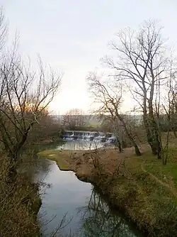 The Lèze in Beaumont-sur-Lèze | |
  | |
| Location | |
| Country | France |
| Region | Occitanie |
| Physical characteristics | |
| Source | |
| • location | La Bastide-de-Sérou |
| • coordinates | 43°02′02″N 01°29′03″E / 43.03389°N 1.48417°E |
| • elevation | 570 m (1,870 ft) |
| Mouth | |
• location | Ariège |
• coordinates | 43°27′48″N 01°25′07″E / 43.46333°N 1.41861°E |
• elevation | 155 m (509 ft) |
| Length | 70.2 km (43.6 mi) |
| Basin size | 351 km2 (136 sq mi) |
| Discharge | |
| • average | 2.01 m3/s (71 cu ft/s) |
| Basin features | |
| Progression | Ariège→ Garonne→ Gironde estuary→ Atlantic Ocean |
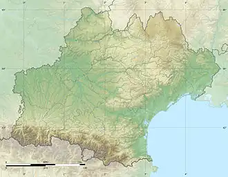
The Lèze (French pronunciation: ['lɛzə]) is a 70.2 km (43.6 mi) long river in the Ariège and Haute-Garonne départements, southwestern France.[1] Its source is in La Bastide-de-Sérou. It flows generally north. It is a left tributary of the Ariège into which it flows between Labarthe-sur-Lèze and Clermont-le-Fort.
Départements and communes along its course
This list is ordered from source to mouth:
- Ariège: La Bastide-de-Sérou, Aigues-Juntes, Gabre, Montégut-Plantaurel, Monesple, Pailhès, Artigat, Le Fossat, Sainte-Suzanne, Saint-Ybars
- Haute-Garonne: Massabrac, Castagnac
- Ariège: Lézat-sur-Lèze
- Haute-Garonne: Saint-Sulpice-sur-Lèze, Montaut, Beaumont-sur-Lèze, Lagardelle-sur-Lèze, Vernet, Labarthe-sur-Lèze, Clermont-le-Fort
References