L'Île-Cadieux
L'Île-Cadieux | |
|---|---|
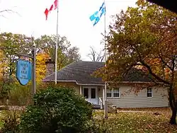 Town hall | |
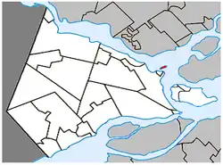 Location within Vaudreuil-Soulanges RCM | |
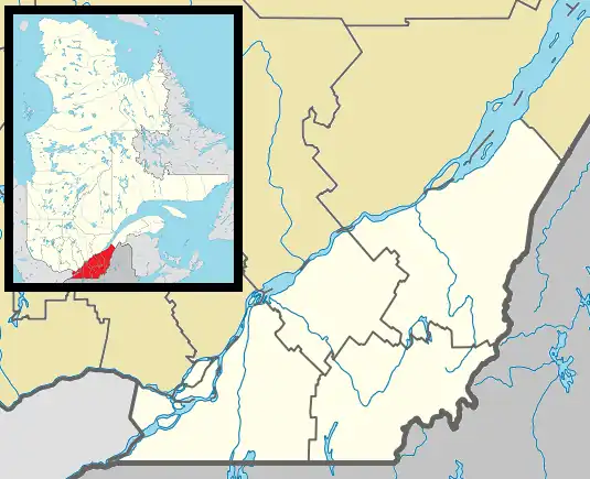 L'Île-Cadieux Location in southern Quebec | |
| Coordinates: 45°26′N 74°01′W / 45.433°N 74.017°W[1] | |
| Country | Canada |
| Province | Quebec |
| Region | Montérégie |
| RCM | Vaudreuil-Soulanges |
| Constituted | March 21, 1922 |
| Government | |
| • Mayor | Daniel Martel |
| • Federal riding | Vaudreuil-Soulanges |
| • Prov. riding | Vaudreuil |
| Area | |
• Total | 8.90 km2 (3.44 sq mi) |
| • Land | 0.59 km2 (0.23 sq mi) |
| Population (2016)[4] | |
• Total | 126 |
| • Density | 212.3/km2 (550/sq mi) |
| • Pop 2011-2016 | |
| • Dwellings | 64 |
| Time zone | UTC−5 (EST) |
| • Summer (DST) | UTC−4 (EDT) |
| Postal code(s) | |
| Area codes | 450 and 579 |
| Highways | No major routes |
| Website | www |
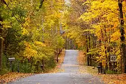
L'Île-Cadieux (French pronunciation: [lil kadjø]) is a village and municipality in the Montérégie region of Quebec, Canada, part of the Vaudreuil-Soulanges Regional County Municipality. It is located on and contiguous with Cadieux Island, which projects into Lake of Two Mountains just north off Vaudreuil-sur-le-Lac. The population as of the Canada 2011 Census was 105.
History
The island was formerly known as Vaudreuil Island but was named "Île à Cadieu" in an unpublished document of the second half of the nineteenth century. This name could be a reference to one of two Cadieux, Pierre and Hyacinthe, who owned land in the first concession along the Cove of Vaudreuil at that time.[5]
In 1922, the municipality was formed by separating from the Parish Municipality of Saint-Michel-de-Vaudreuil.[5]
Demographics
| Year | Pop. | ±% |
|---|---|---|
| 1976 | 75 | — |
| 1981 | 99 | +32.0% |
| 1986 | 113 | +14.1% |
| 1991 | 140 | +23.9% |
| 1996 | 121 | −13.6% |
| 2001 | 127 | +5.0% |
| 2006 | 128 | +0.8% |
| 2011 | 105 | −18.0% |
| 2016 | 126 | +20.0% |
| Source: Statistics Canada[6] | ||
In the 2021 Census of Population conducted by Statistics Canada, L'Île-Cadieux had a population of 120 living in 55 of its 64 total private dwellings, a change of -4.8% from its 2016 population of 126. With a land area of 0.59 km2 (0.23 sq mi), it had a population density of 203.4/km2 (526.8/sq mi) in 2021.[7]
| 2021 | 2016 | 2011 | |
|---|---|---|---|
| Population | 120 (-4.8% from 2016) | 126 (20.0% from 2011) | 105 (-18.0% from 2006) |
| Land area | 0.59 km2 (0.23 sq mi) | 0.59 km2 (0.23 sq mi) | 0.57 km2 (0.22 sq mi) |
| Population density | 204.8/km2 (530/sq mi) | 212.3/km2 (550/sq mi) | 185.2/km2 (480/sq mi) |
| Median age | 59.2 (M: 61.6, F: 54.8) | 57.0 (M: 57.2, F: 56.8) | 57.1 (M: 60.0, F: 54.2) |
| Private dwellings | 64 (total) 55 (occupied) | 64 (total) | 59 (total) |
| Median household income | $131,584 | $.N/A |
| Canada Census Mother Tongue - L'Île-Cadieux, Quebec[6] | ||||||||||||||||||
|---|---|---|---|---|---|---|---|---|---|---|---|---|---|---|---|---|---|---|
| Census | Total | French
|
English
|
French & English
|
Other
| |||||||||||||
| Year | Responses | Count | Trend | Pop % | Count | Trend | Pop % | Count | Trend | Pop % | Count | Trend | Pop % | |||||
2016
|
125
|
75 | 60.0% | 30 | 24.0% | 0 | 0.0% | 20 | 16.0% | |||||||||
2011
|
105
|
60 | 57.1% | 25 | 23.8% | 0 | 0.0% | 20 | 19.1% | |||||||||
2006
|
125
|
50 | 40.0% | 45 | 36.0% | 0 | 0.0% | 30 | 24.0% | |||||||||
2001
|
125
|
95 | 76.0% | 15 | 12.0% | 0 | 0.0% | 15 | 12.0% | |||||||||
1996
|
120
|
65 | n/a | 54.2% | 20 | n/a | 16.7% | 0 | n/a | 0.0% | 35 | n/a | 29.2% | |||||
Local government
List of former mayors:[11]
- William G. Bailey (1922-1929)
- William Robert Eakin (1929-1932)
- Nelson Webster Howard (1932-1938)
- James Fergus (1938-1953, 1955-1967)
- Douglas Bremner (1953-1955)
- A. M. Leslie (1967-1977)
- J. G. Weiss (1977-1981)
- Michel Derenne (1981-1989)
- Peter Jackson (1989-1993, 1994-2002)
- Réal Rainville (1993-1994)
- Pierre Montesano (2002-2005)
- Marc-André Léger (2005-2013)
- Paul Herbach (2013-2017)
- Daniel Martel (2017–present)
Education
Commission Scolaire des Trois-Lacs operates Francophone schools.[12] It is zoned to École Saint-Michel and École Sainte-Madeleine in Vaudreuil-Dorion.[13]
Lester B. Pearson School Board operates Anglophone schools. It is zoned to Mount Pleasant Elementary School in Hudson.[14]
See also
References
- ^ "Banque de noms de lieux du Québec: Reference number 177367". toponymie.gouv.qc.ca (in French). Commission de toponymie du Québec.
- ^ a b "Ministère des Affaires municipales, des Régions et de l'Occupation du territoire: L'Île-Cadieux". Archived from the original on 2015-12-08. Retrieved 2012-03-11.
- ^ "Parliament of Canada Federal Riding History: VAUDREUIL--SOULANGES (Quebec)". Archived from the original on 2009-06-18. Retrieved 2009-03-25.
- ^ a b "L'Île-Cadieux (Code 2471095) Census Profile". 2016 census. Government of Canada - Statistics Canada.
- ^ a b "L'Île-Cadieux (Ville)" (in French). Commission de toponymie du Québec. Retrieved 2009-02-05.
- ^ a b 1996, 2001, 2006, 2011, 2016 census
- ^ "Population and dwelling counts: Canada, provinces and territories, and census subdivisions (municipalities), Quebec". Statistics Canada. February 9, 2022. Retrieved August 29, 2022.
- ^ "2021 Community Profiles". 2021 Canadian census. Statistics Canada. February 4, 2022. Retrieved 2023-10-19.
- ^ "2016 Community Profiles". 2016 Canadian census. Statistics Canada. August 12, 2021. Retrieved 2021-11-09.
- ^ "2011 Community Profiles". 2011 Canadian census. Statistics Canada. March 21, 2019. Retrieved 2013-05-19.
- ^ "Répertoire des entités géopolitiques: L'Île-Cadieux (ville) 21.3.1922 - ..." www.mairesduquebec.com. Institut généalogique Drouin. Retrieved 9 November 2021.
- ^ "Les écoles et les centres". Commission Scolaire des Trois-Lacs. Retrieved 18 January 2013.
- ^ "Liste des bassins desservis par les écoles en 2017-2018." Commission Scolaire des Trois-Lacs. Retrieved on September 30, 2017.
- ^ "School Board Map Archived 2017-09-21 at the Wayback Machine." Lester B. Pearson School Board. Retrieved on September 28, 2017.
External links
Adjacent Municipal Subdivisions | |
|---|---|
| Cities & towns | |
|---|---|
| Municipalities | |
| Villages | |
| |