La Sierra, Cauca
La Sierra, Cauca | |
|---|---|
Municipality and town | |
.svg.png) Flag  Seal | |
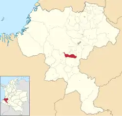 Location of the municipality and town of La Sierra, Cauca in the Cauca Department of Colombia. | |
| Country | |
| Department | Cauca Department |
| Area | |
• Total | 217 km2 (84 sq mi) |
| Population (Census 2018[2]) | |
• Total | 9,935 |
| • Density | 46/km2 (120/sq mi) |
| Time zone | UTC-5 (Colombia Standard Time) |
| Climate | Cfb |
La Sierra is a town and municipality in the Cauca Department, Colombia.
Climate
La Sierra has a subtropical highland climate (Köppen Cfb) with pleasant mornings and warm afternoons year-round, accompanied by moderate to little rainfall from June to September and heavy to very heavy rainfall from October to May.
| Climate data for La Sierra (Sierra La), elevation 1,870 m (6,140 ft), (1981–2010) | |||||||||||||
|---|---|---|---|---|---|---|---|---|---|---|---|---|---|
| Month | Jan | Feb | Mar | Apr | May | Jun | Jul | Aug | Sep | Oct | Nov | Dec | Year |
| Mean daily maximum °C (°F) | 21.8 (71.2) |
22.0 (71.6) |
22.1 (71.8) |
21.9 (71.4) |
22.1 (71.8) |
22.2 (72.0) |
22.9 (73.2) |
23.6 (74.5) |
23.7 (74.7) |
22.6 (72.7) |
21.4 (70.5) |
21.2 (70.2) |
22.3 (72.1) |
| Daily mean °C (°F) | 17.5 (63.5) |
17.8 (64.0) |
17.9 (64.2) |
17.8 (64.0) |
18.0 (64.4) |
18.1 (64.6) |
18.3 (64.9) |
18.7 (65.7) |
18.6 (65.5) |
17.9 (64.2) |
17.3 (63.1) |
17.3 (63.1) |
17.9 (64.2) |
| Mean daily minimum °C (°F) | 14.3 (57.7) |
14.4 (57.9) |
14.4 (57.9) |
14.6 (58.3) |
14.7 (58.5) |
14.6 (58.3) |
14.4 (57.9) |
14.4 (57.9) |
14.3 (57.7) |
14.1 (57.4) |
14.0 (57.2) |
14.2 (57.6) |
14.4 (57.9) |
| Average precipitation mm (inches) | 296.7 (11.68) |
201.4 (7.93) |
233.8 (9.20) |
225.6 (8.88) |
182.7 (7.19) |
76.6 (3.02) |
39.6 (1.56) |
41.4 (1.63) |
106.1 (4.18) |
309.9 (12.20) |
399.0 (15.71) |
372.2 (14.65) |
2,485.1 (97.84) |
| Average precipitation days | 19 | 16 | 20 | 22 | 21 | 15 | 9 | 9 | 12 | 22 | 24 | 24 | 214 |
| Average relative humidity (%) | 88 | 87 | 88 | 88 | 87 | 83 | 76 | 72 | 75 | 83 | 89 | 90 | 84 |
| Mean monthly sunshine hours | 133.3 | 110.1 | 108.5 | 99.0 | 111.6 | 135.0 | 164.3 | 170.5 | 132.0 | 114.7 | 99.0 | 114.7 | 1,492.7 |
| Mean daily sunshine hours | 4.3 | 3.9 | 3.5 | 3.3 | 3.6 | 4.5 | 5.3 | 5.5 | 4.4 | 3.7 | 3.3 | 3.7 | 4.1 |
| Source: Instituto de Hidrologia Meteorologia y Estudios Ambientales[3] | |||||||||||||
References
- ^ "Municipalities of Colombia". statoids. Retrieved 10 May 2020.
- ^ "Censo Nacional de Población y Vivienda 2018" (in Spanish). DANE. Retrieved 10 May 2020.
- ^ "Promedios Climatológicos 1981–2010" (in Spanish). Instituto de Hidrologia Meteorologia y Estudios Ambientales. Archived from the original on 15 August 2016. Retrieved 17 June 2024.
2°15′N 76°50′W / 2.250°N 76.833°W