Lac-Boisbouscache
Lac-Boisbouscache | |
|---|---|
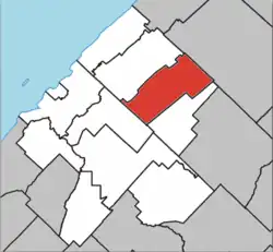 Location within Les Basques RCM | |
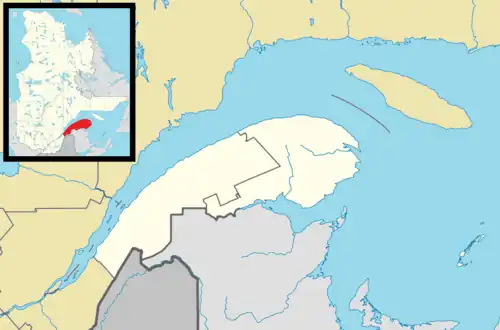 Lac-Boisbouscache Location in eastern Quebec | |
| Coordinates: 48°08′N 68°50′W / 48.133°N 68.833°W[1] | |
| Country | |
| Province | |
| Region | Bas-Saint-Laurent |
| RCM | Les Basques |
| Government | |
| • Federal riding | Rimouski—La Matapédia |
| • Prov. riding | Rivière-du-Loup–Témiscouata |
| Area | |
• Total | 101.80 km2 (39.31 sq mi) |
| • Land | 99.39 km2 (38.37 sq mi) |
| Population | |
• Total | 0 |
| • Density | 0/km2 (0/sq mi) |
| • Pop 2006-2011 | |
| • Dwellings | 17 |
| Time zone | UTC−5 (EST) |
| • Summer (DST) | UTC−4 (EDT) |
| Highways | No major routes |
Lac-Boisbouscache (French pronunciation: [lak bwabuskaʃ]) is an unorganized territory in the Canadian province of Quebec, located in the Les Basques Regional County Municipality.
Demographics
Population
| Year | Pop. | ±% |
|---|---|---|
| 1991 | 0 | — |
| 1996 | 0 | 0.00% |
| 2001 | 0 | 0.00% |
| 2006 | 0 | 0.00% |
| 2011 | 0 | 0.00% |
See also
References
- ^ "Banque de noms de lieux du Québec: Reference number 149452". toponymie.gouv.qc.ca (in French). Commission de toponymie du Québec.
- ^ a b "Répertoire des municipalités: Geographic code 11902". www.mamh.gouv.qc.ca (in French). Ministère des Affaires municipales et de l'Habitation.
- ^ a b "Lac-Boisbouscache (Code 2411902) Census Profile". 2011 census. Government of Canada - Statistics Canada.
- ^ Statistics Canada: 1996, 2001, 2006, 2011 census
Adjacent Municipal Subdivisions | ||||||||||||||||
|---|---|---|---|---|---|---|---|---|---|---|---|---|---|---|---|---|
| ||||||||||||||||
| Cities & towns | |
|---|---|
| Municipalities | |
| Parishes | |
| Unorganized territories | |
| |