Lac-Casault
Lac-Casault | |
|---|---|
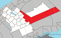 Location within La Matapédia RCM. | |
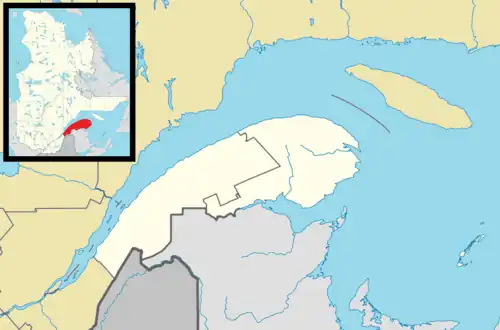 Lac-Casault Location in eastern Quebec. | |
| Coordinates: 48°30′N 67°09′W / 48.500°N 67.150°W[1] | |
| Country | |
| Province | |
| Region | Bas-Saint-Laurent |
| RCM | La Matapédia |
| Constituted | unspecified |
| Government | |
| • Federal riding | Rimouski—La Matapédia |
| • Prov. riding | Matane-Matapédia |
| Area | |
• Total | 1,423.00 km2 (549.42 sq mi) |
| • Land | 1,428.21 km2 (551.43 sq mi) |
| There is an apparent contradiction between two authoritative sources | |
| Population | |
• Total | 30 |
| • Density | 0.0/km2 (0/sq mi) |
| • Pop 2016-2021 | |
| • Dwellings | 142 |
| Time zone | UTC-5 (EST) |
| • Summer (DST) | UTC-4 (EDT) |
| Highways | |
Lac-Casault (French pronunciation: [lak kazo]) is an unorganized territory in the Bas-Saint-Laurent region of Quebec, Canada.
The small eponymous Lake Casault is located near the village of St-Alexandre-des-Lacs and was named in honour of Louis-Napoléon Casault (1823–1908).[4]
Demographics
Population trend:[5]
- Population in 2021: 30
- Population in 2016: 0
- Population in 2011: 5
- Population in 2006: 20
- Population in 2001: 0
- Population in 1996: 0
- Population in 1991: 3
Private dwellings occupied by usual residents: 24 (total dwellings: 142)
See also
References
- ^ "Banque de noms de lieux du Québec: Reference number 149682". toponymie.gouv.qc.ca (in French). Commission de toponymie du Québec.
- ^ a b "Lac-Casault". Répertoire des municipalités (in French). Ministère des Affaires municipales, des Régions et de l'Occupation du territoire. Retrieved 2012-02-01.
- ^ a b "Lac-Casault census profile". 2021 Census data. Statistics Canada. Retrieved 2022-03-18.
- ^ "Lac Casault" (in French). Commission de toponymie du Québec. Retrieved 2012-02-01.
- ^ Statistics Canada: 1996, 2001, 2006, 2011, 2016, 2021census
Adjacent Municipal Subdivisions | |
|---|---|
| Cities & towns | |
|---|---|
| Municipalities | |
| Parishes | |
| Villages | |
| Unorganized territories | |
| |