Lac-au-Brochet
Lac-au-Brochet | |
|---|---|
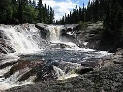 Cascades on the Volant River | |
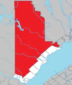 Location within La Haute-Côte-Nord RCM | |
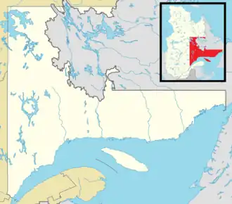 Lac-au-Brochet Location in Côte-Nord region of Quebec | |
| Coordinates: 49°40′N 69°36′W / 49.667°N 69.600°W[1] | |
| Country | Canada |
| Province | Quebec |
| Region | Côte-Nord |
| RCM | La Haute-Côte-Nord |
| Constituted | January 1, 1986 |
| Government | |
| • Federal riding | Côte-Nord—Kawawachikamach—Nitassinan |
| • Prov. riding | René-Lévesque |
| Area | |
• Total | 10,279.41 km2 (3,968.90 sq mi) |
| • Land | 9,360.33 km2 (3,614.04 sq mi) |
| Population (2021)[3] | |
• Total | 0 |
| • Density | 0.0/km2 (0/sq mi) |
| • Pop (2016-21) | |
| • Dwellings | 7 |
| Time zone | UTC−5 (EST) |
| • Summer (DST) | UTC−4 (EDT) |
| Highways | No major routes |
Lac-au-Brochet (French pronunciation: [lak o bʁɔʃɛ]) is an unorganized territory in the Côte-Nord region of Quebec, Canada. It makes up over 83% of the La Haute-Côte-Nord Regional County Municipality.
The community of Labrieville (49°18′00″N 69°33′50″W / 49.30000°N 69.56389°W) is located approximately in the centre of the territory along the Betsiamites River. Named after Napoléon-Alexandre Labrie, bishop of the Diocese of Golfe St-Laurent, it was established in the 1950s as a work camp to accommodate Hydro-Québec workers constructing the Bersimis-1 and Bersimis-2 generating stations. The company town was fully serviced with a hospital, hotel, bank, and shopping plaza. Upon completion of the hydro-electric facilities, Hydro-Québec tried to find another buyer for the town. But this proved unsuccessful, and they transferred most houses and businesses to Forestville in 1974.[4] The community now serves as an access point to the Labrieville ZEC but doesn't have any permanent resident.
The eponymous Brochet Lake is about 20 kilometres (12 mi) north-east of the Pipmuacan Reservoir and just over 30 kilometres (19 mi) north of Labrieville. It has a surface area of nearly 45 square kilometres (17 sq mi), and is drained by the Brochet River, a tributary of the Betsiamites. Named after the northern pike (French: brochet), the Montagnais called it Tshinusheu Shakikan, also meaning Pike Lake.[5]
Demographics
| Year | Pop. | ±% |
|---|---|---|
| 1991 | 0 | — |
| 1996 | 3 | — |
| 2001 | 0 | −100.0% |
| 2006 | 0 | 0.00% |
| 2011 | 0 | 0.00% |
| 2016 | 5 | — |
| 2021 | 0 | −100.0% |
| Source: Statistics Canada[6] | ||
See also
References
- ^ "Banque de noms de lieux du Québec: Reference number 149767". toponymie.gouv.qc.ca (in French). Commission de toponymie du Québec.
- ^ a b "Répertoire des municipalités: Geographic code 95902". www.mamh.gouv.qc.ca (in French). Ministère des Affaires municipales et de l'Habitation. Retrieved 2024-07-16.
- ^ a b "Lac-au-Brochet (Code 2495902) Census Profile". 2021 census. Government of Canada - Statistics Canada. Retrieved 2024-07-16.
- ^ "Labrieville". Histoires oubliées (in French). Les Productions Vic Pelletier inc. Retrieved 2010-06-21.
- ^ "Lac au Brochet" (in French). Commission de toponymie du Québec. Retrieved 2009-06-21.
- ^ 1996, 2001, 2006, 2011, 2016, 2021 census
Adjacent Municipal Subdivisions | |
|---|---|
| Cities & towns | |
|---|---|
| Municipalities | |
| Villages | |
| Unorganized territories | |
| Native reserves (unassociated with RCM) | |
| |