Lake Waramaug State Park
| Lake Waramaug State Park | |
|---|---|
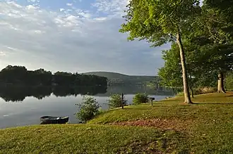 Lake Waramaug with Mount Bushnell in the distance | |
 Lake Waramaug State Park  Lake Waramaug State Park | |
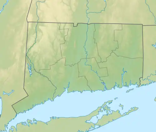
| Location | Kent, Connecticut, United States |
| Coordinates | 41°42′23″N 73°22′57″W / 41.70639°N 73.38250°W |
| Area | 95 acres (38 ha) |
| Elevation | 692 ft (211 m)[1] |
| Established | 1920 |
| Administered by | Connecticut Department of Energy and Environmental Protection |
| Designation | Connecticut state park |
| Website | Official website |
Lake Waramaug State Park is a 95-acre (38 ha) public recreation area located on the northwest shore of Lake Waramaug in the town of Kent, Litchfield County, Connecticut.[2] The state park's first 75 acres (30 ha) were purchased by the state in 1920.[3][4] The park offers swimming, fishing, picnicking, camping, and a launch for car-top boating and canoeing.[5]
References
- ^ "Lake Waramaug". Geographic Names Information System. United States Geological Survey, United States Department of the Interior.
- ^ "Lake Waramaug State Park". Connecticut Department of Energy and Environmental Protection. Retrieved August 19, 2024.
- ^ Report of the State Park and Forest Commission to the Governor 1926 (Report). Hartford, Conn.: State of Connecticut. December 30, 1926. p. 16. Retrieved November 18, 2016.
- ^ Grumet, Robert S. (2013). Manhattan to Minisink: American Indian Place Names of Greater New York and Vicinity. Norman, Okla.: University of Oklahoma Press. p. 178. ISBN 978-0-8061-8913-0.
- ^ "Waramaug Lake Boat Launch". Connecticut Department of Energy and Environmental Protection. January 25, 2023. Retrieved August 19, 2024.
External links
Wikimedia Commons has media related to Lake Waramaug State Park.
- Lake Waramaug State Park Connecticut Department of Energy and Environmental Protection