Lamjung Himal
| Lamjung Himal | |
|---|---|
 Lamjung Himal | |
| Highest point | |
| Elevation | 6,983 m (22,910 ft) |
| Prominence | 550 m (1,800 ft) |
| Isolation | 8.24 km (5.12 mi) |
| Coordinates | 28°29′22″N 84°11′21″E / 28.489544929348035°N 84.18918965732392°E |
| Geography | |
 Lamjung Himal 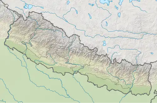 Lamjung Himal | |
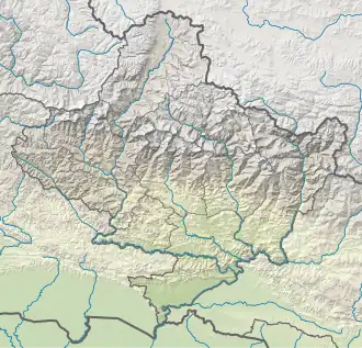
| Country | Nepal |
| Province | Gandaki Province |
| District(s) | Kaski, and Manang |
| Parent range | Annapurna |
| Climbing | |
| First ascent | 1974 |
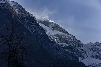
Lamjung Himal also known as Lamjing Kailas is a mountain located in Gandaki Province, Nepal at an elevation of 6,983 metres (22,910 ft).[1][2] A subpeak of Annapurna II, Lamjung Himal is the southeasternmost mountain in the Annapurna range. It was first climbed in 1974 by Derrick Chamberlain and Phillip Neame.[1]
References
- ^ a b "Lamjung Himal". Nepal Himal Peak Profile. Retrieved 15 October 2021.
- ^ Allard, Dorothy Jean (9 May 2000). The subalpine fir forest zone of Lamjung Himal, Nepal: vegetation types, forest dynamics and human impacts (Thesis thesis). University of Cambridge.