Lasseter Highway
Lasseter Highway | |
|---|---|
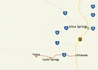 | |
Map of central Australia with Lasseter Highway highlighted in red | |
| General information | |
| Type | Highway |
| Length | 244 km (152 mi) |
| Route number(s) | |
| Major junctions | |
| West end | |
| |
| East end | |
| Location(s) | |
| Major settlements | Yulara, Curtin Springs, Mount Ebenezer |
| Highway system | |
Lasseter Highway is a fully sealed 244 km (152 mi) highway in the Northern Territory of Australia.[1] It connects Yulara, Kata Tjuta and Uluru east to the Stuart Highway at Erldunda.[2] The highway is named after Lewis Hubert (Harold Bell) Lasseter, who claimed to have discovered a fabulously rich gold reef (Lasseter's Reef) west of Kata Tjuta.[3]
Junctions
| Location | km[4] | mi | Destinations | Notes | |
|---|---|---|---|---|---|
| Yulara | 0 | 0.0 | Route 4 continues to Kata Tjuta then to the Western Australian border becoming the Great Central Road | ||
| Yulara Drive | |||||
| 1.5 | 0.93 | Giles Street | |||
| Petermann | 95 | 59 | Mulga Park Road | ||
| 180 | 110 | ||||
| Ghan | 288 | 179 | |||
| 1.000 mi = 1.609 km; 1.000 km = 0.621 mi | |||||
-
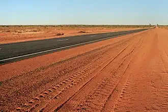 Looking east along the Lasseter Highway toward Erldunda
 -
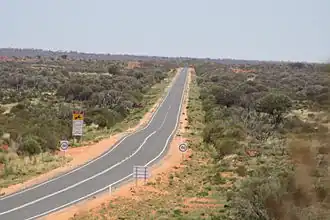 Lasseter Highway at Mount Conner Lookout near Lake Amadeus, March 2010
 -
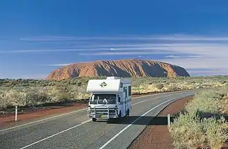 Driving on the Lasseter Highway near the Uluru-Kata Tjuta National Park in the Northern Territory.
See also
References
- ^ Hema, Maps (2007). Australia Road and 4WD Atlas (Map). Eight Mile Plains Queensland: Hema Maps. pp. 100–101. ISBN 978-1-86500-456-3.
- ^ Department of Transport (April 1998). "Map of all NT Roads" (PDF). Northern Territory Government. Archived from the original (PDF) on 5 May 2013. Retrieved 13 January 2014.
- ^ Brooks, Sally (2 September 2011). "Photo essay" (PDF). Centralian Advocate. p. 7. Archived (PDF) from the original on 3 June 2014. Retrieved 3 June 2014.
- ^ "Lasseter Highway" (Map). Google Maps. Retrieved 18 January 2017.
Road infrastructure in Northern Territory | ||
|---|---|---|
| National highways | ||
| Highways | ||
| Major urban roads | ||
| Outback tracks and numbered state routes | ||