Laténa
Laténa | |
|---|---|
 Flag  Coat of arms | |
Location of Laténa | |
 Laténa 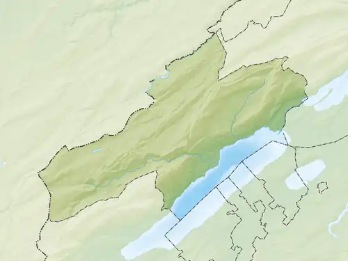 Laténa | |
| Coordinates: 47°01′N 6°59′E / 47.017°N 6.983°E | |
| Country | Switzerland |
| Canton | Neuchâtel |
| Government | |
| • Mayor | Maire |
| Area | |
• Total | 26.02 km2 (10.05 sq mi) |
| Population (December 2022) | |
• Total | 11,625 |
| • Density | 450/km2 (1,200/sq mi) |
| Time zone | UTC+01:00 (Central European Time) |
| • Summer (DST) | UTC+02:00 (Central European Summer Time) |
| Postal code(s) | 2068, 2072, 2073, 2074, 2075 |
| SFOS number | 6513 |
| ISO 3166 code | CH-NE |
| Surrounded by | Cornaux, Cressier, Cudrefin (VD), Gampelen (BE), Ins (BE), Le Landeron, Lignières, Neuchâtel, Val-de-Ruz |
| Twin towns | St. Blasien (Germany) |
| Website | commune-latena SFSO statistics |
Laténa is a municipality in the canton of Neuchâtel in Switzerland. It was created on 1 January 2025 through the merger of Enges, Hauterive, La Tène and Saint-Blaise.[1]
References
- ^ "La commune fusionnée de Laténa verra le jour". rtn.ch. RTN. 2021. Retrieved 1 January 2025.