Lawang Bato
Lawang Bato | |
|---|---|
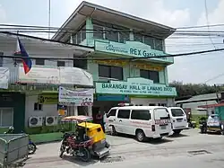 Lawang Bato Barangay Hall | |
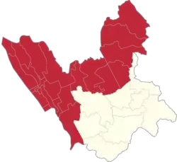 Lawang Bato Location of Lawang Bato in the 1st Valenzuela legislative district | |
| Coordinates: 14°43′48″N 120°59′46″E / 14.73000°N 120.99611°E | |
| Country | Philippines |
| Region | National Capital Region |
| City | Valenzuela |
| Congressional districts | Part of the 1st district of Valenzuela |
| Government | |
| • Barangay Chairman | Orestes Ramirez Tolentino |
| • Sangguniang Kabataan Chairman | Khym Ashley Dulatas |
| Area | |
• Total | 2.875 km2 (1.110 sq mi) |
| Population (2020[1]) | |
• Total | 23,786 |
| • Density | 8,300/km2 (21,000/sq mi) |
| • Households | 5,064 |
Lawang Bato (lit. 'Stone Lake') is a barangay in Valenzuela, Metro Manila, Philippines. The name "Lawang Bato" came from the once rocky land where the barangay once stood.[2]
Demographics
Lawang Bato has a population of 23,786 as of the 2020 census and 5,064 households as of the 2015 census.[3][4]
Education
- Lawang Bato National High School
- Lawang Bato Elementary School
- Charis Christian School of Val. Inc.
- Saint Joseph School of Lawang Bato
References
- ^ PSA. "Lawang Bato Philippine Statistics Authority Republic of the Philippines". psa.gov.ph. Retrieved 2024-03-11.
- ^ PIO, Administrator, Team. "Lawang Bato". City Government of Valenzuela. Retrieved 13 March 2018.
{{cite web}}: CS1 maint: multiple names: authors list (link) - ^ Census of Population (2015). "National Capital Region (NCR)". Total Population by Province, City, Municipality and Barangay. Philippine Statistics Authority. Retrieved 20 June 2016.
- ^ Census of Population (2020). "National Capital Region (NCR)". Total Population by Province, City, Municipality and Barangay. Philippine Statistics Authority. Retrieved 8 July 2021.
Wikimedia Commons has media related to Lawang Bato, Valenzuela.
14°43′48″N 120°59′46″E / 14.73000°N 120.99611°E
| Topics |  | |
|---|---|---|
| Government | ||
| Districts | ||
| Places |
| |