Le Carbet
Le Carbet | |
|---|---|
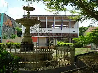 The town hall of Le Carbet | |
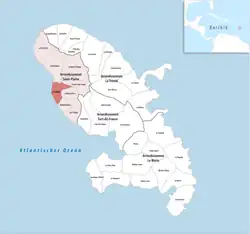 Location of the commune (in red) within Martinique | |
Location of Le Carbet | |
| Coordinates: 14°42′40″N 61°10′50″W / 14.7111°N 61.1806°W | |
| Country | France |
| Overseas region and department | Martinique |
| Arrondissement | Saint-Pierre |
| Intercommunality | CA Pays Nord Martinique |
| Government | |
| • Mayor (2020–2026) | Jean-Claude Ecanvil[1] |
Area 1 | 36.00 km2 (13.90 sq mi) |
| Population (2022)[2] | 3,619 |
| • Density | 100/km2 (260/sq mi) |
| Demonym | Carbétien.ne |
| Time zone | UTC−04:00 (AST) |
| INSEE/Postal code | 97204 /97221 |
| Elevation | 0–570 m (0–1,870 ft) |
| 1 French Land Register data, which excludes lakes, ponds, glaciers > 1 km2 (0.386 sq mi or 247 acres) and river estuaries. | |
Le Carbet (French pronunciation: [lə kaʁbe], [lə kaʁbɛ]; Martinican Creole: Kabé) is a village and commune in the French overseas department of Martinique.
Population
| Year | Pop. | ±% p.a. |
|---|---|---|
| 1967 | 3,364 | — |
| 1974 | 3,128 | −1.03% |
| 1982 | 2,711 | −1.77% |
| 1990 | 3,014 | +1.33% |
| 1999 | 3,316 | +1.07% |
| 2007 | 3,722 | +1.45% |
| 2012 | 3,736 | +0.08% |
| 2017 | 3,535 | −1.10% |
| Source: INSEE[3] | ||
See also
References
- ^ "Répertoire national des élus: les maires" (in French). data.gouv.fr, Plateforme ouverte des données publiques françaises. 4 May 2022.
- ^ "Populations de référence 2022" (in French). The National Institute of Statistics and Economic Studies. 19 December 2024.
- ^ Population en historique depuis 1968, INSEE
External links
- Base Mérimée: Search for heritage in the commune, Ministère français de la Culture. (in French)
Wikimedia Commons has media related to Le Carbet.