Levis, Yonne
Levis | |
|---|---|
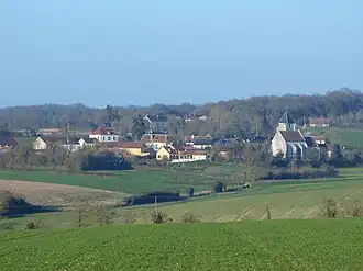 A general view of Levis | |
.svg.png) Coat of arms | |
Location of Levis | |
 Levis  Levis | |
| Coordinates: 47°39′15″N 3°19′32″E / 47.6542°N 3.3256°E | |
| Country | France |
| Region | Bourgogne-Franche-Comté |
| Department | Yonne |
| Arrondissement | Auxerre |
| Canton | Vincelles |
Area 1 | 12.08 km2 (4.66 sq mi) |
| Population (2022)[1] | 222 |
| • Density | 18/km2 (48/sq mi) |
| Time zone | UTC+01:00 (CET) |
| • Summer (DST) | UTC+02:00 (CEST) |
| INSEE/Postal code | 89222 /89520 |
| Elevation | 208–300 m (682–984 ft) |
| 1 French Land Register data, which excludes lakes, ponds, glaciers > 1 km2 (0.386 sq mi or 247 acres) and river estuaries. | |
Levis is a commune in the Yonne department in Bourgogne-Franche-Comté in north-central France. It lies on the boundary between the natural regions of Puisaye and Forterre.
See also
References
- ^ "Populations de référence 2022" (in French). The National Institute of Statistics and Economic Studies. 19 December 2024.
Wikimedia Commons has media related to Levis (Yonne).