Lhotka (Frýdek-Místek District)
Lhotka | |
|---|---|
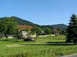 Lhotka with Ondřejník hill in the background | |
_vlajka.jpg) Flag _CoA.svg.png) Coat of arms | |
 Lhotka Location in the Czech Republic | |
| Coordinates: 49°35′50″N 18°17′54″E / 49.59722°N 18.29833°E | |
| Country | |
| Region | Moravian-Silesian |
| District | Frýdek-Místek |
| First mentioned | 1359 |
| Area | |
• Total | 7.21 km2 (2.78 sq mi) |
| Elevation | 433 m (1,421 ft) |
| Population (2025-01-01)[1] | |
• Total | 601 |
| • Density | 83/km2 (220/sq mi) |
| Time zone | UTC+1 (CET) |
| • Summer (DST) | UTC+2 (CEST) |
| Postal code | 739 47 |
| Website | www |
Lhotka is a municipality and village in Frýdek-Místek District in the Moravian-Silesian Region of the Czech Republic. It has about 600 inhabitants.
Demographics
| Year | Pop. | ±% |
|---|---|---|
| 1869 | 464 | — |
| 1880 | 475 | +2.4% |
| 1890 | 477 | +0.4% |
| 1900 | 547 | +14.7% |
| 1910 | 551 | +0.7% |
| 1921 | 521 | −5.4% |
| 1930 | 559 | +7.3% |
| 1950 | 515 | −7.9% |
| 1961 | 553 | +7.4% |
| 1970 | 520 | −6.0% |
| 1980 | 461 | −11.3% |
| 1991 | 415 | −10.0% |
| 2001 | 432 | +4.1% |
| 2011 | 501 | +16.0% |
| 2021 | 543 | +8.4% |
| Source: Censuses[2][3] | ||
References
- ^ "Population of Municipalities – 1 January 2025". Czech Statistical Office. 2025-05-16.
- ^ "Historický lexikon obcí České republiky 1869–2011" (in Czech). Czech Statistical Office. 2015-12-21.
- ^ "Population Census 2021: Population by sex". Public Database. Czech Statistical Office. 2021-03-27.
External links
Wikimedia Commons has media related to Lhotka (Frýdek-Místek District).