Ligueil
Ligueil | |
|---|---|
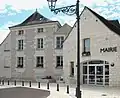
 The church in Ligueil | |
.svg.png) Coat of arms | |
Location of Ligueil | |
 Ligueil  Ligueil | |
| Coordinates: 47°02′37″N 0°49′11″E / 47.0436°N 0.8197°E | |
| Country | France |
| Region | Centre-Val de Loire |
| Department | Indre-et-Loire |
| Arrondissement | Loches |
| Canton | Descartes |
| Intercommunality | Loches Sud Touraine |
| Government | |
| • Mayor (2020–2026) | Michel Guignaudeau[1] |
Area 1 | 29.72 km2 (11.47 sq mi) |
| Population (2022)[2] | 2,113 |
| • Density | 71/km2 (180/sq mi) |
| Time zone | UTC+01:00 (CET) |
| • Summer (DST) | UTC+02:00 (CEST) |
| INSEE/Postal code | 37130 /37240 |
| Elevation | 66–128 m (217–420 ft) |
| 1 French Land Register data, which excludes lakes, ponds, glaciers > 1 km2 (0.386 sq mi or 247 acres) and river estuaries. | |
Ligueil (French pronunciation: [liɡœj] ⓘ) is a commune in the Indre-et-Loire department in central France.
Geography
Ligueil is close to the former border of Vichy France.
Population
| Year | Pop. | ±% p.a. |
|---|---|---|
| 1968 | 2,245 | — |
| 1975 | 2,379 | +0.83% |
| 1982 | 2,413 | +0.20% |
| 1990 | 2,201 | −1.14% |
| 1999 | 2,166 | −0.18% |
| 2007 | 2,175 | +0.05% |
| 2012 | 2,246 | +0.64% |
| 2017 | 2,188 | −0.52% |
| Source: INSEE[3] | ||
International relations
Ligueil is twinned with:
 Hungerford, United Kingdom[4]
See also
References
- ^ "Répertoire national des élus: les maires". data.gouv.fr, Plateforme ouverte des données publiques françaises (in French). 2 December 2020.
- ^ "Populations de référence 2022" (in French). The National Institute of Statistics and Economic Studies. 19 December 2024.
- ^ Population en historique depuis 1968, INSEE
- ^ "British towns twinned with French towns". Archant Community Media Ltd. Archived from the original on 5 July 2013. Retrieved 11 July 2013.
-
 Ligueil
 -
 Ligueil
 -
 Ligueil
 -
 Ligueil
 -
 Ligueil
 -
 Ligueil
 -
 Ligueil
Wikimedia Commons has media related to Ligueil.