Lincoln Township, Nodaway County, Missouri
Lincoln Township | |
|---|---|
 Possum Walk Hotel located in eastern Lincoln Township | |
 | |
| Coordinates: 40°30′28″N 95°08′10″W / 40.5077489°N 95.1361298°W | |
| Country | United States |
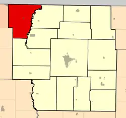
| State | Missouri |
| County | Nodaway |
| Erected | 1866 |
| Area | |
• Total | 66.03 sq mi (171.0 km2) |
| • Land | 65.96 sq mi (170.8 km2) |
| • Water | 0.07 sq mi (0.2 km2) 0.11% |
| Elevation | 981 ft (299 m) |
| Population | |
• Total | 323 |
| • Density | 4.9/sq mi (1.9/km2) |
| FIPS code | 29-14742824[1] |
| GNIS feature ID | 767092[2] |
Lincoln Township is a township in Nodaway County, Missouri, United States.[2] At the 2020 census, its population was 323.[3] It contains about 68 sections.[4] It's bounded on the east by the Nodaway River and contains one town, Elmo which lies in the center. Dawsonville was a hamlet that existed in its southeast 2.5 miles northwest of Burlington Junction.[4]
Lincoln Township was erected on June 14, 1866, when it was divided from Atchison Township,[4] and named after President Abraham Lincoln.[5] Lamar Station was platted in 1871 to be between Elmo and Clearmont but when the railroad route changed the plan decayed and some buildings were moved to other nearby towns.[4]
References
- ^ a b "MO TIGER County Subdivisions". Missouri Spatial Data Infomration Service. United States Census Bureau. Retrieved April 21, 2025.
- ^ a b c U.S. Geological Survey Geographic Names Information System: Lincoln Township, Nodaway County, Missouri
- ^ a b "Census 2020 DHC Extract Assistance". Missouri Census Data Center. Retrieved April 21, 2025.
- ^ a b c d "Past and present of Nodaway County, Missouri - Volume 1". B.F. Bowen & Company. Retrieved October 31, 2024.
- ^ "Nodaway County Place Names, 1928–1945". The State Historical Society of Missouri. Archived from the original on June 24, 2016. Retrieved November 24, 2016.
Municipalities and communities of Nodaway County, Missouri, United States | ||
|---|---|---|
| Cities | 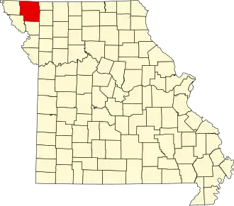 | |
| Villages | ||
| Townships | ||
| Unincorporated Communities | ||
| Extinct Hamlets | ||