Linganamakki Dam
| Linganamakki Dam | |
|---|---|
 | |
| Official name | Linganamakki Reservoir |
| Location | Linganamakki, Sagara Taluk, Karnataka |
| Coordinates | 14°10′32″N 74°50′47″E / 14.175587°N 74.84627°E |
| Construction began | 1964 |
| Dam and spillways | |
| Impounds | Sharavathi River |
| Height | 193 ft |
| Length | 2.74 km |
| Reservoir | |
| Creates | Linganamakki Reservoir |
| Total capacity | 151.75 Tmcft |
| Catchment area | 1991.71 km2 |
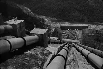
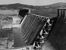
The Linganamakki Dam was constructed by the Karnataka State Government in 1964. Located in the Linganamakki village of Sagara taluk, the dam has a length of 2.74 kilometres (1.70 mi) stretching across the Sharavathi river. It is located about 9 km from Jog Falls on the same river.[1] It has an effective storage capacity of 4.29 cubic km or 151.52 tmc ft of water. The dam is used for generation of hydroelectricity in Sharavathi Valley Hydro Electric Project.
References
| Africa |  | |
|---|---|---|
| Asia | ||
| Australasia |
| |
| Europe |
| |
| North America | ||
| South America |
| |