Lisnarick, County Fermanagh
Lisnarick
| |
|---|---|
 | |
 Lisnarick Location within Northern Ireland | |
| Population | 203 (2021 Census) |
| Irish grid reference | H192588 |
| District | |
| County | |
| Country | Northern Ireland |
| Sovereign state | United Kingdom |
| Post town | ENNISKILLEN |
| Postcode district | BT94 |
| Dialling code | 028, +44 28 |
| UK Parliament | |
| NI Assembly | |
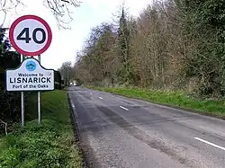
Lisnarick or Lisnarrick (from Irish Lios na nDaróg, meaning 'fort of the (little) oaks') is a small village in County Fermanagh, Northern Ireland, 4 km west of Irvinestown. It is situated in the civil parish of Derryvullan and historic barony of Lurg.[1] The village was once known as Archdalestown after the nearby Castle Archdale.[2] In the 2021 census it had a population of 203.[3]
The village is mostly housing although there is one multi-purpose store, a restaurant, a filling station and a sub-post office. At the middle of the village is a green with horse chestnut trees and a play park. There is also a rath beside the bridge.[4]
History
Rory Maguire was a leader of the Irish Rebellion of 1641 in Fermanagh, and the burning of Lisnarick on 23 October 1641 was the signal for the rebellion to start.[5] Castle Archdale was also destroyed at the time.[2]
Places of interest
Castle Archdale Country Park is on the main Enniskillen to Kesh road (B82), 1 mile on the Enniskillen side of Lisnarick.
See also
References
- ^ "Lisnarrick". Place Names NI. Retrieved 19 April 2015.
- ^ a b "Lisnarick" (PDF). The Plantation of Ulster:The Story of Co Fermanagh. Retrieved 19 April 2015.
- ^ "Lisnarick in Fermanagh and Omagh (Northern Ireland)". citypopulation.de. Retrieved 13 August 2025.
- ^ Sandford, Ernest (1976). Discover Northern Ireland. Belfast: Northern Ireland Tourist Board. p. 142. ISBN 0 9500222 7 6.
- ^ McCusker, Breege (1999). Fermanagh:Land of Lake and Legend.