Lissewege
Lissewege | |
|---|---|
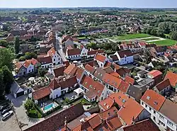 View of Lissewege | |
 Coat of arms | |
Location of Lissewege | |
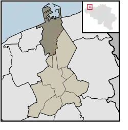 Location of Lissewege in Bruges | |
 Lissewege  Lissewege | |
| Coordinates: 51°17′39″N 3°11′56″E / 51.29417°N 3.19889°E | |
| Country | |
| Community | |
| Region | |
| Province | |
| Arrondissement | Bruges |
| Municipality | Bruges |
| Area | |
• Total | 26.80 km2 (10.35 sq mi) |
| Population (2014-12-31) | |
• Total | 7,412 |
| • Density | 280/km2 (720/sq mi) |
| Postal codes | 8380 |
| Area codes | 050 |
Lissewege (Dutch pronunciation: [ˈlɪsəˌʋeːɣə]) is a sub-municipality of the city of Bruges located in the province of West Flanders, Flemish Region, Belgium. It was a separate municipality until 1971. On 1 January 1971, it was merged into Bruges.[1] Lissewege also includes Zeebrugge and Zwankendamme.
Gallery
-
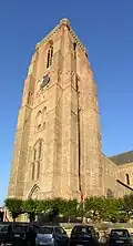 Bell tower of Our Lady's Church (13th century)
 -

-
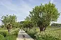 The Oude Pastoriestraat ("Old Presbytery street")
 -
.jpg) The RV Belgica (A962) in the Boudewijnkanaal near Lissewege
The RV Belgica (A962) in the Boudewijnkanaal near Lissewege
References
Wikimedia Commons has media related to Lissewege.
Populated places in Bruges | ||
|---|---|---|
| Sub-municipalities | ||
| Neighbourhoods, villages and hamlets | ||