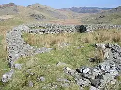
List of hillforts in Wales
This is a list of hillforts in Wales.
Anglesey
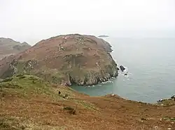
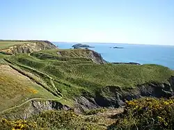
- Din Sylwy (Bwrdd Arthur) (53°18′39″N 4°07′22″W / 53.3108°N 4.1229°W), contour fort[1]
- Caer Idris Hillfort (53°11′15″N 4°15′17″W / 53.1874°N 4.2546°W), promontory fort[2]
- Caer y Twr (53°18′51″N 4°40′27″W / 53.3141°N 4.6742°W), partial contour fort[3]
- Dinas Gynfor (53°25′39″N 4°25′25″W / 53.4274°N 4.4236°W), promontory fort[4]
- Dinas Porth Ruffydd (53°16′55″N 4°40′02″W / 53.2819°N 4.6673°W), promontory fort[5]
- Mynydd Llwydiarth (53°17′00″N 4°11′42″W / 53.2832°N 4.1949°W), promontory fort[6]
- Parciau hill fort (53°20′15″N 4°15′46″W / 53.3374°N 4.2627°W), promontory fort[7]
- Tan-y-graig, Llanffinan (53°16′06″N 4°14′38″W / 53.2684°N 4.2439°W), contour fort[8]
- Twyn-y-Parc (53°09′24″N 4°26′29″W / 53.1568°N 4.4414°W), promontory fort[9]
- Y Werthyr hillfort (53°16′33″N 4°26′21″W / 53.2758°N 4.4391°W), marsh fort[10]
- Y Werthyr, Llanddeusant (53°19′49″N 4°27′34″W / 53.3303°N 4.4594°W), contour fort[11]
- Ynys-y-Fydlyn (53°23′42″N 4°34′14″W / 53.3949°N 4.5705°W), promontory fort[12]
Bridgend County Borough
- Cae Summerhouse Camp (51°29′22″N 3°38′15″W / 51.4894°N 3.6375°W), partial contour fort[13]
- Chapel Hill Camp, Merthyr Mawr House (51°29′26″N 3°36′06″W / 51.4906°N 3.6018°W), contour fort[14]
- Coed-y-Mwstwr (51°31′04″N 3°31′27″W / 51.5179°N 3.5242°W), contour fort[15]
- Cwm Llwyd (51°33′23″N 3°31′04″W / 51.5565°N 3.5178°W), partial contour fort[16]
- Mynydd Twmpathyddaer (51°30′37″N 3°40′20″W / 51.5103°N 3.6722°W), contour fort[17]
- Mynydd y Gaer (51°33′16″N 3°28′55″W / 51.5544°N 3.482°W), partial contour fort[18]
- Pen y Castell, Kenfig Hill (51°31′52″N 3°40′13″W / 51.5312°N 3.6704°W), contour fort[19]
- Y Bwlwarcau (51°35′02″N 3°40′38″W / 51.5839°N 3.6771°W), multiple enclosure hillfort[20]
- Y Bwlwarcau, Eastern Enclosure (51°35′06″N 3°39′32″W / 51.5851°N 3.6589°W), hillslope fort[21]
Caerphilly County Borough
- Ruperra hill fort (51°34′26″N 3°07′21″W / 51.5738°N 3.1226°W), contour fort[22]
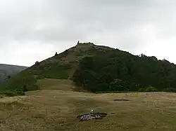
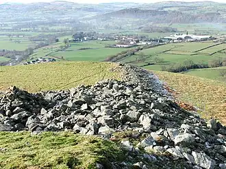
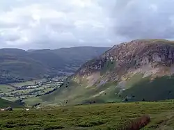
- Mynydd Twmbarlwm (51°37′40″N 3°05′37″W / 51.627654°N 3.093715°W), contour fort, motte and bailey castle Cadw ref MM044[23]
Carmarthenshire
- Allt Abercothi (51°52′00″N 4°10′15″W / 51.8668°N 4.1708°W), promontory fort[24]
- Allt Clog-y-fran (51°48′34″N 4°33′03″W / 51.8094°N 4.5508°W), promontory fort[25]
- Allt y Ferin (51°53′18″N 4°08′57″W / 51.8884°N 4.1491°W), promontory fort[26]
- Allt-y-Cnap (51°50′38″N 4°19′53″W / 51.8438°N 4.3313°W), partial contour fort[27]
- Banc y Rhyfel (51°55′06″N 4°07′23″W / 51.9184°N 4.1231°W), partial contour fort[28]
- Blaen-maes, Pencarreg (52°05′12″N 4°07′43″W / 52.0868°N 4.1287°W), contour fort[29]
- Cae Castell, Llangathen (51°54′24″N 4°02′40″W / 51.9066°N 4.0444°W), promontory fort[30]
- Cae'r Castell, Llanarthney (51°51′26″N 4°09′46″W / 51.8571°N 4.1627°W), promontory fort[31]
- Caer Blaen Minog (51°59′42″N 4°23′10″W / 51.9951°N 4.3861°W), promontory fort[32]
- Caerau Clungwyn (51°53′14″N 4°18′37″W / 51.8871°N 4.3103°W), promontory fort[33]
- Careg Llwyd (51°41′43″N 4°17′08″W / 51.6953°N 4.2856°W), promontory fort[34]
- Carnawllon-Fawr (51°46′02″N 4°11′30″W / 51.7671°N 4.1918°W), promontory fort[35]
- Carreg Cegyn (51°53′29″N 3°55′56″W / 51.8915°N 3.9322°W), contour fort[36]
- Castell Bron Niwl (51°52′42″N 4°28′20″W / 51.8783°N 4.4722°W), hillslope fort[37]
- Castell Elwyn (52°04′22″N 4°05′44″W / 52.0728°N 4.0955°W), hillslope fort[38]
- Castell Gorwyn (51°54′27″N 4°27′35″W / 51.9074°N 4.4598°W), hillslope fort[39]
- Castell Henfryn (52°01′37″N 4°21′21″W / 52.027°N 4.3557°W), partial contour fort[40]
- Castell Mawr, Llanwinio (51°55′00″N 4°33′07″W / 51.9168°N 4.552°W), promontory fort[41]
- Castell Mawr, Trelech-a'r-Bettws (51°55′12″N 4°30′54″W / 51.92°N 4.5151°W), partial contour fort[42]
- Castell Pant y Fen (52°02′18″N 4°14′39″W / 52.0383°N 4.2443°W), level terrain fort[43]
- Castell Pen-y-Coed (51°47′10″N 4°32′44″W / 51.7861°N 4.5456°W), promontory fort[44]
- Castell Pyr, Llanllwni (52°02′14″N 4°14′02″W / 52.0372°N 4.2339°W), promontory fort[45]
- Castell y Waun (51°50′05″N 4°26′54″W / 51.8348°N 4.4484°W), contour fort[46]
- Castell-y-Gaer, Newchurch (51°50′59″N 4°24′19″W / 51.8497°N 4.4054°W), contour fort[47]
- Castell, Pencader (52°00′14″N 4°15′41″W / 52.0038°N 4.2614°W), promontory fort[48]
- Castle Lloyd Camp (51°45′19″N 4°32′58″W / 51.7552°N 4.5495°W), promontory fort[49]
- Cefn Crug (52°00′17″N 3°46′12″W / 52.0046°N 3.77°W), promontory fort[50]
- Cefn Gaer (51°58′37″N 3°53′43″W / 51.9769°N 3.8953°W), contour fort[51]
- Cefnbenydd (51°58′38″N 3°52′12″W / 51.9773°N 3.87°W), contour fort[52]
- Cencoed (51°42′16″N 4°12′14″W / 51.7045°N 4.204°W), promontory fort[53]
- Cilcrug (51°53′32″N 4°22′13″W / 51.8921°N 4.3702°W), partial contour fort[54]
- Clog-y-Fran (51°48′49″N 4°32′44″W / 51.8137°N 4.5455°W), partial contour fort[55]
- Court Wood (51°41′44″N 4°16′54″W / 51.6955°N 4.2817°W), contour fort[56]
- Coygan Camp (51°45′17″N 4°29′14″W / 51.7546°N 4.4873°W), contour fort[57]
- Craig Gwrtheyrn (52°02′19″N 4°17′09″W / 52.0386°N 4.2858°W), hillfort[58]
- Croes Arthur (51°54′36″N 4°13′53″W / 51.91°N 4.2315°W), level terrain fort[59]
- Cwm-Felin Boeth (51°50′28″N 4°37′50″W / 51.8411°N 4.6305°W), partial contour fort[60]
- Dan Lan y Castell (51°49′28″N 4°22′31″W / 51.8244°N 4.3753°W), contour fort[61]
- Danycerrig (51°54′19″N 4°17′22″W / 51.9053°N 4.2894°W), contour fort[62]
- Dinas Fawr, Llangeler (52°01′22″N 4°24′48″W / 52.0228°N 4.4132°W), hillslope fort[63]
- Dinefwr Castle (51°52′36″N 4°01′03″W / 51.8768°N 4.0175°W), contour fort[64]
- Dryslwyn Castle (51°51′48″N 4°06′03″W / 51.8632°N 4.1007°W), contour fort[65]
- Gaer Fawr, Manordeilo (51°56′17″N 3°59′25″W / 51.938°N 3.9904°W), contour fort[66]
- Gelli Diogyn (51°51′44″N 4°37′03″W / 51.8623°N 4.6176°W), partial contour fort[67]
- Gilman Point and Napps Circle (51°44′21″N 4°34′03″W / 51.7392°N 4.5676°W), promontory fort[68]
- Glan-y-Mor Fort, Laugharne (51°46′25″N 4°27′23″W / 51.7736°N 4.4563°W), hillslope fort[69]
- Grongaer, Llangathen (51°52′29″N 4°04′24″W / 51.8747°N 4.0734°W), contour fort[70]
- Hafod Camp (51°52′22″N 4°35′24″W / 51.8729°N 4.5899°W), promontory fort[71]
- Llansteffan Castle (51°45′56″N 4°23′27″W / 51.7655°N 4.3908°W), promontory fort[72]
- Llwyndu Camp (51°54′11″N 3°55′17″W / 51.9031°N 3.9215°W), contour fort[73]
- Maes Ifan (51°56′45″N 4°04′33″W / 51.9457°N 4.0758°W), promontory fort[74]
- Maes y Castell (51°55′59″N 3°59′31″W / 51.9331°N 3.992°W), partial contour fort[75]
- Mandinam (51°56′13″N 3°50′13″W / 51.9369°N 3.8369°W), contour fort[76]
- Merlin's Hill (51°52′15″N 4°14′46″W / 51.8707°N 4.246°W), contour fort[77]
- Moat Farm Camp (51°43′27″N 4°15′50″W / 51.7241°N 4.264°W), promontory fort[78]
- Parc Cynog Farm (51°45′35″N 4°31′50″W / 51.7596°N 4.5305°W), level terrain fort[79]
- Parc y Gaer, Carmarthen (51°52′33″N 4°18′19″W / 51.8758°N 4.3054°W), hillslope fort[80]
- Parc-Castell, Llangeler (52°00′09″N 4°18′32″W / 52.0025°N 4.3088°W), promontory fort[81]
- Parc-y-Gaer, Abergwili (51°54′09″N 4°13′19″W / 51.9025°N 4.22198°W), promontory fort[82]
- Parc-y-Gaer, Colston (51°45′49″N 4°31′29″W / 51.7637°N 4.5246°W), promontory fort[83]
- Pen y Gaer Fawr, Penlan (51°51′32″N 4°31′42″W / 51.8589°N 4.5282°W), contour fort[84]
- Pen y Gaer, Llanybydder (52°04′10″N 4°09′18″W / 52.0695°N 4.155°W), contour fort[85]
- Pen y Gaer, Sarnau (51°51′43″N 4°27′21″W / 51.862°N 4.4557°W), promontory fort[86]
- Pen-y-Gaer, Abernant (51°52′58″N 4°23′24″W / 51.8827°N 4.3901°W), promontory fort[87]
- Pen-y-Gaer, Meidrim (51°50′46″N 4°27′34″W / 51.8462°N 4.4594°W), partial contour fort[88]
- Pen-y-Gar, Llanpumsaint (51°55′27″N 4°20′12″W / 51.9243°N 4.3368°W), promontory fort[89]
- Pen-y-Garn (51°51′05″N 4°04′06″W / 51.8513°N 4.0684°W), partial contour fort[90]
- Pencaerau-bach (51°53′09″N 4°26′18″W / 51.8858°N 4.4384°W), promontory fort[91]
- Pencastell, Llanwinio (51°55′54″N 4°32′11″W / 51.9317°N 4.5365°W), promontory fort[92]
- Sugar Loaf (52°04′16″N 3°42′05″W / 52.0711°N 3.7014°W), contour fort[93]
- Tal-y-Fan, Llandeilofawr (51°55′04″N 3°58′22″W / 51.9179°N 3.9728°W), hillslope fort[94]
- Top Castle (51°44′20″N 4°36′58″W / 51.739°N 4.6162°W), partial contour fort[95]
- Waun-y-Castell (51°51′14″N 4°00′21″W / 51.854°N 4.0057°W), contour fort[96]
- Woodreefe Castle (51°44′45″N 4°37′53″W / 51.7459°N 4.6314°W), promontory fort[97]
- Y Fan (51°57′56″N 3°55′49″W / 51.9655°N 3.9303°W), contour fort[98]
- Y Gaer Fach (51°54′05″N 3°54′43″W / 51.9013°N 3.9119°W), contour fort[99]
- Y Gaer Wen (52°00′09″N 4°20′21″W / 52.0024°N 4.3391°W), contour fort[100]
- Y Gaer, Pencarreg (52°04′43″N 4°03′35″W / 52.0785°N 4.0598°W), contour fort[101]
- Y Garn Goch (51°54′07″N 3°54′13″W / 51.902°N 3.9037°W), contour fort[102]
- Yr Hen Castell, Llanfihangel-ar-arth (52°02′43″N 4°18′15″W / 52.0452°N 4.3042°W), partial contour fort[103]
Ceredigion

- Alltfadog South (52°24′59″N 3°58′30″W / 52.4165°N 3.975°W), contour fort[104]
- Bronfre-ganol (52°12′21″N 4°12′35″W / 52.2058°N 4.2097°W), contour fort[105]
- Bryn Maen Caerau, Cellan (52°06′57″N 4°03′01″W / 52.1157°N 4.0504°W), marsh fort[106]
- Caer Allt-goch (52°28′35″N 4°00′08″W / 52.4763°N 4.0023°W), contour fort[107]
- Caer Argoed (52°19′11″N 4°01′56″W / 52.3197°N 4.0321°W), partial contour fort[108]
- Caer Cadwgan, Cellan (52°06′45″N 4°00′48″W / 52.1125°N 4.0132°W), contour fort[109]
- Caer Lletty-llwyd (52°28′31″N 3°59′16″W / 52.4753°N 3.9877°W), partial contour fort[110]
- Caer Llifry (52°11′12″N 4°10′23″W / 52.1866°N 4.173°W), contour fort[111]
- Caer Pwll-Glas (52°27′39″N 4°00′45″W / 52.4607°N 4.0125°W), partial contour fort[112]
- Caerau, Henllan (52°02′09″N 4°23′43″W / 52.0359°N 4.3954°W), promontory fort[113]
- Capel Bangor Camp (52°24′30″N 3°58′27″W / 52.4084°N 3.9743°W), contour fort[114]
- Castell Allt-goch (52°07′53″N 4°03′22″W / 52.1314°N 4.0562°W), hillfort[115]
- Castell Bach, Cwm Tydi (52°11′48″N 4°24′01″W / 52.1967°N 4.4003°W), promontory fort[116]
- Castell Bach, Llanrhystyd (52°17′55″N 4°08′42″W / 52.29871°N 4.1449°W), contour fort[117]
- Castell Bach, Penbryn (52°09′14″N 4°28′57″W / 52.154°N 4.4826°W), promontory fort[118]
- Castell Blaen-Igau (52°07′44″N 4°25′27″W / 52.129°N 4.4242°W), promontory fort[119]
- Castell Bwa-drain Camp (52°23′53″N 3°53′35″W / 52.398°N 3.893°W), contour fort[120]
- Castell Cadwaladr (52°18′18″N 4°07′30″W / 52.305°N 4.125°W), contour fort[121]
- Castell Crugiau (52°08′58″N 4°24′26″W / 52.1494°N 4.4073°W), contour fort[122]
- Castell Cwmere (52°10′07″N 4°08′47″W / 52.1687°N 4.1463°W), promontory fort[123]
- Castell Disgwylfa (52°20′43″N 3°55′42″W / 52.3453°N 3.9282°W), contour fort[124]
- Castell Flemish hillfort (52°15′02″N 3°58′22″W / 52.2505°N 3.97281°W), contour fort[125]
- Castell Goetre (52°08′21″N 4°02′33″W / 52.1392°N 4.0426°W), contour fort[126]
- Castell Goginan Fach (52°25′08″N 3°55′13″W / 52.419°N 3.9204°W), promontory fort[127]
- Castell Grogwynion (52°20′08″N 3°52′42″W / 52.3356°N 3.8782°W), partial contour fort[128]
- Castell Gwynionydd (52°03′16″N 4°18′00″W / 52.0544°N 4.3001°W), partial contour fort[129]
- Castell Mawr (52°17′47″N 4°08′45″W / 52.2965°N 4.1458°W), contour fort[130]
- Castell Moeddyn (52°08′42″N 4°12′57″W / 52.145°N 4.2157°W), contour fort[131]
- Castell Moeddyn Fach (52°08′24″N 4°13′48″W / 52.1399°N 4.2299°W), promontory fort[132]
- Castell Nadolig (52°07′33″N 4°29′12″W / 52.1257°N 4.4868°W), contour fort[133]
- Castell Nantperchellan (52°03′30″N 4°39′58″W / 52.0582°N 4.6661°W), promontory fort[134]
- Castell Olwen (52°07′24″N 4°04′32″W / 52.1233°N 4.0755°W), contour fort[135]
- Castell Perthi-mawr (52°12′33″N 4°09′19″W / 52.2093°N 4.1553°W), multiple enclosure hillfort[136]
- Castell Rhyfel (52°13′21″N 3°51′28″W / 52.2224°N 3.8577°W), contour fort[137]
- Castell Tregaron (52°13′27″N 3°55′26″W / 52.2241°N 3.9238°W), promontory fort[138]
- Castell-Careg-Wen (52°21′25″N 3°55′39″W / 52.357°N 3.9275°W), promontory fort[139]
- Cefn Blewog Camp (52°20′05″N 3°54′49″W / 52.3348°N 3.9137°W), partial contour fort[140]
- Clyn-yr-Ynys (52°07′31″N 4°40′26″W / 52.1252°N 4.6738°W), hillslope fort[141]
- Cnwc y Bugail (52°20′54″N 3°55′43″W / 52.3483°N 3.9285°W), contour fort[142]
- Coed Allt-fedw Camp (52°20′17″N 3°58′02″W / 52.338°N 3.9673°W), contour fort[143]
- Coed Ty'n-y-Cwm (52°20′46″N 3°55′24″W / 52.34615°N 3.92322°W), partial contour fort[144]
- Coed-Parc Gaer (52°08′36″N 4°03′51″W / 52.1433°N 4.0641°W), hillslope fort[145]
- Cribyn Clotas (52°08′31″N 4°08′25″W / 52.142°N 4.1404°W), hillfort[146]
- Cribyn Gaer (52°08′10″N 4°09′50″W / 52.1361°N 4.1638°W), contour fort[147]
- Crug-y-balog (52°04′50″N 4°25′17″W / 52.0806°N 4.4213°W), contour fort[148]
- Crugllwyn Camp (52°06′17″N 4°37′36″W / 52.1046°N 4.6268°W), promontory fort[149]
- Cwm Castell (52°10′33″N 4°14′23″W / 52.1758°N 4.2398°W), contour fort[150]
- Dinas Cerdin (52°05′51″N 4°21′29″W / 52.0975°N 4.358°W), contour fort[151]
- Dinas, Melindwr (52°26′00″N 3°51′04″W / 52.4333°N 3.851°W), contour fort[152]
- Esgair Nant-yr-arian (52°25′02″N 3°53′54″W / 52.4171°N 3.8982°W), promontory fort[153]
- Foel y Mwnt (52°08′14″N 4°38′30″W / 52.1371°N 4.6418°W), promontory fort[154]
- Gaer Fawr (52°19′42″N 3°59′04″W / 52.3284°N 3.9844°W), contour fort[155]
- Gaer Lwyd (52°08′37″N 4°29′02″W / 52.1437°N 4.4838°W), partial contour fort[156]
- Gaer Pwntan (52°06′58″N 4°29′47″W / 52.116°N 4.4965°W), contour fort[157]
- Gaer Rhydlydan (52°08′54″N 4°17′46″W / 52.1484°N 4.296°W), contour fort[158]
- Gaer Wen, Pen-y-graig (52°05′55″N 4°20′34″W / 52.0987°N 4.3427°W), promontory fort[159]
- Gaer-Wen, Llangranog (52°10′48″N 4°25′13″W / 52.1801°N 4.4202°W), partial contour fort[160]
- Gaer, Brongwyn (52°03′26″N 4°29′39″W / 52.0572°N 4.4941°W), contour fort[161]
- Gaer, Llandygwydd (52°03′36″N 4°33′37″W / 52.06°N 4.5602°W), level terrain fort[162]
- Gilfach-Hafel Camp (52°18′35″N 4°06′54″W / 52.3097°N 4.115°W), contour fort[163]
- Graig y Gwbert (52°07′10″N 4°41′28″W / 52.1195°N 4.691°W), promontory fort[164]
- Hen Gaer, Bow Street (52°26′25″N 4°00′46″W / 52.4403°N 4.0127°W), contour fort[165]
- Llangranog (52°09′27″N 4°28′14″W / 52.1576°N 4.4705°W), promontory fort[166]
- Lletty-evan-hen (52°26′44″N 3°55′47″W / 52.4455°N 3.9297°W), hillfort[167]
- Mynachlog-Uchaf (52°08′41″N 4°19′42″W / 52.1446°N 4.3282°W), hillslope fort[168]
- New Cross Camp (52°22′30″N 4°00′58″W / 52.3749°N 4.0162°W), contour fort[169]
- Old Warren Hill (52°23′20″N 4°02′11″W / 52.3889°N 4.0363°W), promontory fort[170]
- Pant y Bula (52°04′19″N 4°27′28″W / 52.0719°N 4.4577°W), promontory fort[171]
- Pen Clawdd-mawr (52°10′37″N 4°06′53″W / 52.177°N 4.1147°W), promontory fort[172]
- Pen Coed-foel Camp (52°03′40″N 4°17′56″W / 52.061°N 4.299°W), contour fort[173]
- Pen Dinas (52°24′11″N 4°04′57″W / 52.403°N 4.0825°W), contour fort[174]
- Pen Dinas, Elerch (52°28′16″N 3°56′56″W / 52.4712°N 3.9489°W), contour fort[175]
- Pen-y-Bannau (52°17′08″N 3°50′46″W / 52.2855°N 3.846°W), partial contour fort[176]
- Pen-y-Darren (52°25′44″N 3°56′41″W / 52.429°N 3.9447°W), contour fort[177]
- Pen-y-Felin Wynt Hillfort (52°23′12″N 3°56′20″W / 52.3867°N 3.9389°W), promontory fort[178]
- Pen-y-Frwydd Llwyd Camp, Craig Ystradmeurig (52°18′07″N 3°53′39″W / 52.3019°N 3.8943°W), contour fort[179]
- Pen-y-Gaer, Llanbadarn (52°13′44″N 3°59′34″W / 52.2288°N 3.9928°W), contour fort[180]
- Pen-y-Gaer, Nantcwnlle (52°12′17″N 4°05′00″W / 52.2048°N 4.0832°W), partial contour fort[181]
- Pendinas Lochtyn (52°09′58″N 4°27′51″W / 52.1662°N 4.4641°W), contour fort[182]
- Penrhyn Coch Camp (52°26′15″N 3°58′31″W / 52.4376°N 3.9753°W), partial contour fort[183]
- Tan-y-ffordd (52°24′02″N 3°55′23″W / 52.4005°N 3.923°W), partial contour fort[184]
- Tre-Coll (52°14′30″N 3°59′29″W / 52.2416°N 3.9913°W), promontory fort[185]
- Trwyn Crou (52°10′26″N 4°26′26″W / 52.1738°N 4.4405°W), promontory fort[186]
- Y Gaer, Caron-uwch-clawdd (52°16′49″N 3°52′30″W / 52.2802°N 3.8751°W), contour fort[187]
- Y Gaer, Ciliau Aeron (52°12′16″N 4°11′50″W / 52.2044°N 4.1972°W), hillslope fort[188]
- Ynys Lochtyn (52°10′15″N 4°28′00″W / 52.1708°N 4.4668°W), promontory fort[189]
City and County of Cardiff
- Caerau Hillfort (51°28′05″N 3°14′46″W / 51.46811°N 3.24612°W), contour fort[190]
- Castle Field Camp, Graig-llwyn (51°32′58″N 3°08′55″W / 51.5494°N 3.1486°W), partial contour fort[191]
- Llwynda'-ddu (51°31′15″N 3°17′10″W / 51.5209°N 3.2861°W), contour fort[192]
- Wenallt Camp (51°32′14″N 3°13′26″W / 51.5373°N 3.2239°W), hillslope fort[193]
City and County of Swansea
- Berry Wood (51°34′27″N 4°12′21″W / 51.5742°N 4.2058°W), hillslope fort[194]
- Bishopston Valley Camp (51°34′15″N 4°03′57″W / 51.5709°N 4.0659°W), promontory fort[195]
- Burry Holms (51°36′34″N 4°18′49″W / 51.6094°N 4.3135°W), promontory fort[196]
- Carn Nicholas (51°37′56″N 3°54′54″W / 51.6322°N 3.9151°W), hillslope fort[197]
- Cilifor Top (51°36′35″N 4°09′34″W / 51.6098°N 4.1594°W), contour fort[198]
- Crawley Rocks, Nicholston Burrows (51°34′16″N 4°08′19″W / 51.571°N 4.1387°W), promontory fort[199]
- Deborah's Hole Camp (51°33′16″N 4°15′48″W / 51.5545°N 4.2633°W), promontory fort[200]
- Fforestnewydd (51°41′46″N 3°58′28″W / 51.6961°N 3.9745°W), level terrain fort[201]
- Graig Fawr, Pontardulais (51°44′36″N 4°00′10″W / 51.7433°N 4.0027°W), contour fort[202]
- Gron Gaer (51°37′58″N 4°05′46″W / 51.6329°N 4.096°W), partial contour fort[203]
- Harding's Down West Camp (51°35′38″N 4°15′41″W / 51.59399°N 4.2615°W), contour fort[204]
- Harding's Down, East Camp (51°35′34″N 4°15′28″W / 51.5929°N 4.2577°W), partial contour fort[205]
- Harding's Down, North Camp (51°35′40″N 4°15′31″W / 51.5945°N 4.25854°W), hillslope fort[206]
- Hen Gastell, Pen-Clawdd (51°38′32″N 4°05′26″W / 51.6422°N 4.0906°W), hillslope fort[207]
- High Pennard (51°33′37″N 4°04′03″W / 51.5603°N 4.0674°W), promontory fort[208]
- Horse Cliff Camp (51°33′05″N 4°15′31″W / 51.5515°N 4.2586°W), promontory fort[209]
- Lewes Castle Promontory Fort, Rhossili (51°33′45″N 4°17′20″W / 51.5625°N 4.2888°W), promontory fort[210]
- Llanddewi, Port Eynon (51°34′36″N 4°13′47″W / 51.5767°N 4.2298°W), level terrain fort[211]
- Llwynheiernin (51°38′08″N 3°55′03″W / 51.6356°N 3.9176°W), hillslope fort[212]
- Maiden Castle, Oxwich (51°32′55″N 4°09′05″W / 51.5485°N 4.1515°W), promontory fort[213]
- Old Castle Promontory Fort, Rhossili (51°34′06″N 4°17′48″W / 51.5684°N 4.2966°W), promontory fort[214]
- Pen-y-gaer, Pen-clawdd (51°38′22″N 4°06′59″W / 51.6394°N 4.1163°W), partial contour fort[215]
- Redley Cliff Camp (51°34′09″N 4°02′19″W / 51.5692°N 4.0387°W), promontory fort[216]
- Reynoldston Camp (51°35′15″N 4°11′26″W / 51.5876°N 4.1905°W), hillslope fort[217]
- Stembridge Hillfort (51°36′04″N 4°12′39″W / 51.6011°N 4.2108°W), promontory fort[218]
- The Bulwark, Llanmadoc Hill (51°36′43″N 4°15′00″W / 51.612°N 4.2499°W), hillslope fort[219]
- Thurba Head (51°33′37″N 4°16′42″W / 51.5603°N 4.2783°W), promontory fort[220]
- Tor-Gro (51°37′11″N 4°13′28″W / 51.6197°N 4.2245°W), level terrain fort[221]
- Willoxton Cwm (51°34′59″N 4°05′45″W / 51.583°N 4.0959°W), hillslope fort[222]
- Worm's Head (51°33′50″N 4°19′09″W / 51.564°N 4.3193°W), promontory fort[223]
- Yellow Top, Paviland (51°33′03″N 4°15′20″W / 51.5509°N 4.2555°W), promontory fort[224]
Conwy County Borough
- Braich-y-Ddinas (53°15′31″N 3°56′56″W / 53.2587°N 3.9488°W), partial contour fort[225]
- Bryn Euryn (53°18′08″N 3°45′16″W / 53.3021°N 3.7544°W), partial contour fort[226]
- Bryngaer Dinas (53°14′44″N 3°56′57″W / 53.2456°N 3.9493°W), contour fort[227]
- Caer Bach (53°14′20″N 3°52′59″W / 53.2389°N 3.8831°W), partial contour fort[228]
- Caer Caradog (53°01′07″N 3°32′22″W / 53.0186°N 3.5395°W), partial contour fort[229]
- Caer Ddunod (53°03′21″N 3°30′57″W / 53.0559°N 3.5157°W), partial contour fort[230]
- Castell Caer Seion (53°16′57″N 3°51′42″W / 53.2826°N 3.8617°W), contour fort[231]
- Cerrig-y-ddinas, Llangelynin (53°14′52″N 3°52′07″W / 53.2479°N 3.8686°W), partial contour fort[232]
- Dinas Allt Wen, Dwygyfylchi (53°16′41″N 3°52′58″W / 53.2781°N 3.8829°W), contour fort[233]
- Dinorben (53°16′06″N 3°32′56″W / 53.2682°N 3.5488°W), contour fort[234]
- Erw Goch Camp (53°14′35″N 3°46′18″W / 53.2431°N 3.7717°W), level terrain fort[235]
- Mynydd y Gaer (53°14′00″N 3°32′25″W / 53.2332°N 3.5404°W), contour fort[236]
- Pen y corddyn Mawr (53°16′24″N 3°37′43″W / 53.2734°N 3.6285°W), partial contour fort[237]
- Pen y Dinas (53°19′47″N 3°50′05″W / 53.3296°N 3.8348°W), promontory fort[238]
- Pen y Gaer (53°12′22″N 3°52′23″W / 53.206°N 3.873°W), contour fort[239]
- Pen-y-Castell, Maenan (53°10′55″N 3°48′27″W / 53.1819°N 3.8076°W), hillslope fort[240]
- Tan-y-Gopa (53°16′36″N 3°35′50″W / 53.2768°N 3.5971°W), contour fort[241]
Denbighshire
- Bedd-y-Cawr, St Asaph (53°14′11″N 3°28′47″W / 53.2365°N 3.4798°W), promontory fort[242]
- Caer Drewyn (52°59′21″N 3°21′36″W / 52.9892°N 3.3601°W), partial contour fort[243]
- Castell Dinas Bran (52°58′46″N 3°09′31″W / 52.9794°N 3.1587°W), contour fort[244]
- Craig Adwy Wynt (53°04′45″N 3°18′46″W / 53.0793°N 3.3129°W), partial contour fort[245]
- Craig yr Ychain (52°55′04″N 3°27′08″W / 52.9179°N 3.4523°W), partial contour fort[246]
- Dinas Melin-y-Wig (53°01′52″N 3°25′09″W / 53.0312°N 3.4193°W), contour fort[247]
- Foel Fenlli (53°07′53″N 3°15′08″W / 53.1314°N 3.2523°W), partial contour fort[248]
- Gwernheylod Banks (52°59′02″N 2°56′30″W / 52.9838°N 2.9416°W), promontory fort[249]
- Moel Fodig (53°00′03″N 3°20′54″W / 53.0007°N 3.3482°W), contour fort[250]
- Moel Hiraddug (53°17′41″N 3°24′25″W / 53.2947°N 3.407°W), contour fort[251]
- Moel y Gaer, Bodfari (53°13′35″N 3°21′24″W / 53.2265°N 3.3568°W), partial contour fort[252]
- Moel y Gaer, Llanbedr (53°08′46″N 3°16′27″W / 53.146°N 3.2742°W), contour fort[253]
- Moel y Gaer, Llantysilio (53°00′29″N 3°14′34″W / 53.0081°N 3.2428°W), contour fort[254]
- Mynydd Rhyd ddu (53°01′07″N 3°24′37″W / 53.0187°N 3.4104°W), contour fort[255]
- Pen y Gaer, Efenechtyd (53°05′00″N 3°20′11″W / 53.0832°N 3.3364°W), contour fort[256]
- Pen y Gaer, Trefor (52°58′35″N 3°07′06″W / 52.9764°N 3.1184°W), level terrain fort[257]
- Penycloddiau (53°11′55″N 3°18′20″W / 53.1987°N 3.3055°W), partial contour fort[258]
- Pwll-y-Clai (53°07′02″N 3°22′31″W / 53.1172°N 3.3753°W), contour fort[259]
- Tan-y-Llan (53°04′50″N 3°22′13″W / 53.0806°N 3.3703°W), hillslope fort[260]
- Vivod (52°58′32″N 3°12′44″W / 52.9755°N 3.2122°W), level terrain fort[261]
Flintshire
- Caer Estyn (53°06′36″N 3°01′34″W / 53.1101°N 3.0262°W), contour fort[262]
- Glol Camp (53°17′34″N 3°19′18″W / 53.2929°N 3.3218°W), contour fort[263]
- Moel Arthur (53°11′04″N 3°16′50″W / 53.1845°N 3.2806°W), contour fort[264]
- Moel Ffagnallt (53°13′12″N 3°12′53″W / 53.22°N 3.2146°W), contour fort[265]
- Moel y Gaer, Rhosesmor (53°12′45″N 3°10′57″W / 53.2124°N 3.1826°W), contour fort[266]
Gwynedd
- Bryn Castell, Uwch Mynydd (52°45′52″N 4°00′04″W / 52.7645°N 4.0011°W), contour fort[267]
- Bryn Rhydd (52°55′06″N 4°34′55″W / 52.9183°N 4.582°W), partial contour fort[268]
- Bryn-y-Castell (52°58′08″N 3°53′43″W / 52.9689°N 3.8953°W), contour fort[269]
- Bwlch Ffordd Isa (52°55′50″N 4°22′44″W / 52.9306°N 4.3788°W), partial contour fort[270]
- Bwlch, Llangelynin (52°37′45″N 4°06′51″W / 52.6293°N 4.1143°W), partial contour fort[271]
- Byrllysg fort (52°47′46″N 4°05′02″W / 52.7962°N 4.0839°W), hillslope fort[272]
- Caer Carreg-y-Fran, Cwm Glo (53°08′31″N 4°10′24″W / 53.1419°N 4.1734°W), contour fort[273]
- Caer Euni (52°57′35″N 3°29′21″W / 52.9597°N 3.4893°W), partial contour fort[274]
- Caer Pencraig, Ty'n y Caeau (53°11′03″N 4°06′23″W / 53.1843°N 4.1065°W), contour fort[275]
- Caer, Glascoed (53°09′24″N 4°10′25″W / 53.1567°N 4.1737°W), contour fort[276]
- Careg-y-Llam, Pistyll (52°57′51″N 4°28′55″W / 52.9643°N 4.482°W), promontory fort[277]
- Carn Fadryn castle and hillfort (52°53′09″N 4°33′22″W / 52.88592°N 4.55615°W), contour fort[278]
- Carn Pentyrch, Llangybi (52°57′01″N 4°20′48″W / 52.9502°N 4.3467°W), contour fort[279]
- Castell Caerau Camp, Gyrn Goch (52°58′18″N 4°13′18″W / 52.9718°N 4.2218°W), contour fort[280]
- Castell Mawr, Rhoslefain (52°37′21″N 4°05′55″W / 52.6224°N 4.0986°W), partial contour fort[281]
- Castell Odo, Aberdaron (52°49′24″N 4°41′31″W / 52.8232°N 4.692°W), contour fort[282]
- Castell Pared Mawr (52°47′34″N 4°31′01″W / 52.7929°N 4.517°W), level terrain fort[283]
- Castell-y-Gaer, Llangelynin (52°39′38″N 4°05′00″W / 52.6606°N 4.0832°W), contour fort[284]
- Castell, Llanengan (52°48′39″N 4°31′53″W / 52.8108°N 4.5313°W), partial contour fort[285]
- Cefn Ddwysarn Camp (52°55′52″N 3°32′18″W / 52.9312°N 3.5383°W), partial contour fort[286]
- Clogwyn Arllef (52°50′14″N 4°05′11″W / 52.8372°N 4.0865°W), contour fort[287]
- Conion (52°49′24″N 4°37′42″W / 52.8232°N 4.6283°W), level terrain fort[288]
- Craig y Castell I, Brithdir (52°43′26″N 3°56′06″W / 52.724°N 3.9349°W), contour fort[289]
- Craig y Castell II, Brithdir (52°44′16″N 3°56′18″W / 52.7377°N 3.9383°W), contour fort[290]
- Craig y Ddinas, Llanddwywe-is-y-Gaer (52°47′13″N 4°02′29″W / 52.787°N 4.0414°W), contour fort[291]
- Craig yr Aderyn (52°38′31″N 4°00′20″W / 52.6419°N 4.0055°W), contour fort[292]
- Craig-y-Dinas, Pontllyfni (53°02′33″N 4°18′58″W / 53.0426°N 4.3162°W), contour fort[293]
- Craig-y-Tyddyn Camp (52°57′40″N 4°13′35″W / 52.9611°N 4.2263°W), partial contour fort[294]
- Creigiau Gwineu (52°48′56″N 4°37′51″W / 52.8155°N 4.6308°W), contour fort[295]
- Dinas Camp, Y Felinheli (53°10′51″N 4°13′04″W / 53.1807°N 4.2177°W), promontory fort[296]
- Dinas Dinlle hillfort (53°04′54″N 4°20′05″W / 53.0816°N 4.3347°W), contour fort[297]
- Dinas Dinorwig (53°09′54″N 4°10′15″W / 53.1651°N 4.1707°W), contour fort[298]
- Dinas Emrys (53°01′19″N 4°04′44″W / 53.0219°N 4.0789°W), contour fort[299]
- Dinas Oleu (52°43′19″N 4°02′56″W / 52.7219°N 4.049°W), contour fort[300]
- Dinas, Beddgelert (53°01′06″N 4°06′02″W / 53.0183°N 4.1006°W), contour fort[301]
- Dinas, Ty-du (53°07′00″N 4°08′36″W / 53.1166°N 4.1432°W), contour fort[302]
- Ffridd Fechan Fort (52°44′26″N 4°03′09″W / 52.7405°N 4.0526°W), hillslope fort[303]
- Foel Caethle, Tywyn (52°34′05″N 4°03′27″W / 52.568°N 4.0575°W), contour fort[304]
- Garn Boduan (52°55′28″N 4°30′52″W / 52.9245°N 4.5145°W), contour fort[305]
- Garn Saethon (52°52′27″N 4°31′49″W / 52.8741°N 4.5304°W), contour fort[306]
- Llechlwyd Tonfanau, Tywyn (52°36′27″N 4°06′35″W / 52.6074°N 4.1098°W), promontory fort[307]
- Maes-y-Gaer Camp, Aber (53°13′58″N 4°00′13″W / 53.2328°N 4.0037°W), contour fort[308]
- Maesoglan Farm (52°54′42″N 4°32′02″W / 52.9116°N 4.534°W), hillslope fort[309]
- Moel Dinas, Garreg (52°57′37″N 4°02′51″W / 52.9604°N 4.0475°W), contour fort[310]
- Moel Faner (52°46′00″N 3°52′47″W / 52.7667°N 3.8797°W), contour fort[311]
- Moel Goedog Camp (52°52′20″N 4°03′40″W / 52.8721°N 4.0612°W), partial contour fort[312]
- Moel Offrwm (52°46′19″N 3°51′17″W / 52.7719°N 3.8548°W), contour fort[313]
- Moel Offrwm Lower Camp (52°46′07″N 3°51′26″W / 52.7686°N 3.8573°W), hillfort[314]
- Moel y Gest (52°55′40″N 4°09′36″W / 52.9278°N 4.16°W), contour fort[315]
- Mynydd Mynyllod (52°56′50″N 3°29′11″W / 52.9471°N 3.4863°W), partial contour fort[316]
- Mynydd Mynytho (52°51′01″N 4°31′26″W / 52.8504°N 4.5239°W), partial contour fort[317]
- Nant-y-Castell, Llanbedrog (52°51′15″N 4°29′39″W / 52.8543°N 4.4941°W), contour fort[318]
- Nantlle, Llanllyfni (53°03′32″N 4°12′04″W / 53.0589°N 4.201°W), contour fort[319]
- Pared y Cefn hir (52°43′01″N 3°58′42″W / 52.717°N 3.9784°W), contour fort[320]
- Pen Dinas Camp, Llandygai (53°11′28″N 4°04′55″W / 53.191°N 4.0819°W), partial contour fort[321]
- Pen y Dinas (52°46′02″N 4°04′01″W / 52.7673°N 4.0669°W), partial contour fort[322]
- Pen y Gaer, Cilfodan, Bethesda (53°11′05″N 4°03′16″W / 53.1846°N 4.0544°W), contour fort[323]
- Pen y Gaer, Llanaelhaearn (52°59′02″N 4°20′31″W / 52.9838°N 4.3419°W), contour fort[324]
- Pen-y-Bryn, Cymer (52°45′28″N 3°53′13″W / 52.7577°N 3.8869°W), promontory fort[325]
- Pen-y-Gaer Camp, Aberglaslyn (52°59′25″N 4°06′26″W / 52.9904°N 4.1073°W), contour fort[326]
- Pen-y-Gaer, Afon Soch (52°49′29″N 4°31′36″W / 52.8247°N 4.5266°W), contour fort[327]
- Pen-y-Gaer, Llanbedrog (52°51′16″N 4°29′29″W / 52.8545°N 4.4913°W), promontory fort[328]
- Pen-y-Garreg, Clynnog (53°01′18″N 4°20′49″W / 53.0216°N 4.3469°W), partial contour fort[329]
- Pier Camp, Bangor (53°14′01″N 4°07′40″W / 53.2337°N 4.1277°W), contour fort[330]
- Polish Home, Rhyd-y-Clafdy (52°52′52″N 4°28′54″W / 52.8811°N 4.4817°W), contour fort[331]
- Porth Oer (52°50′15″N 4°43′19″W / 52.8376°N 4.722°W), promontory fort[332]
- Tal-y-Gareg, Tonfanau Quarry, Towyn (52°36′41″N 4°06′26″W / 52.6113°N 4.1073°W), contour fort[333]
- Tre'r Ceiri (52°58′29″N 4°25′26″W / 52.9747°N 4.4238°W), contour fort[334]
- Trwyn Porth Dinllaen (52°56′38″N 4°34′07″W / 52.944°N 4.5687°W), promontory fort[335]
- Tyddyn Bychan, Rhyd y Clafdy (52°52′58″N 4°29′48″W / 52.8829°N 4.4967°W), promontory fort[336]
- Wyddgrug (52°54′01″N 4°32′59″W / 52.9003°N 4.5497°W), contour fort[337]
- Y Foel, Pontllynfi (53°01′51″N 4°18′44″W / 53.0309°N 4.3123°W), contour fort[338]
- Y Gaer, Ystum Gwadnaeth (52°46′51″N 3°49′09″W / 52.7807°N 3.8193°W), contour fort[339]
- Ynys For (52°57′50″N 4°05′13″W / 52.9638°N 4.0869°W), partial contour fort[340]
Merthyr Tydfil County Borough
- Castell Morlais (51°46′36″N 3°22′44″W / 51.7768°N 3.3789°W), contour fort[341]
Monmouthshire
- Blackfield Wood Camp (51°41′16″N 2°40′58″W / 51.6878°N 2.6827°W), promontory fort[342]
- Cae Camp (51°38′23″N 2°55′40″W / 51.6398°N 2.9278°W), contour fort[343]
- Caerau Camp, Ponthir (51°38′09″N 2°58′11″W / 51.6357°N 2.9698°W), partial contour fort[344]
- Coed y Bwnydd Camp (51°45′23″N 2°55′17″W / 51.7563°N 2.9214°W), contour fort[345]
- Gaer Fawr Camp, Llangwm (51°41′07″N 2°48′35″W / 51.6853°N 2.8096°W), contour fort[346]
- Gaer Hill Camp, Penterry (51°40′40″N 2°42′01″W / 51.6779°N 2.7002°W), contour fort[347]
- Gaer hill fort, Trellech (51°43′49″N 2°44′08″W / 51.7303°N 2.7356°W), multiple enclosure hillfort[348]
- Great House Camp (51°43′34″N 2°49′23″W / 51.7261°N 2.8231°W), contour fort[349]
- Llancayo Camp (51°43′46″N 2°54′07″W / 51.7294°N 2.902°W), promontory fort[350]
- Llanmelin Wood Camp and Llanmelin Outpost, Caerwent (51°37′45″N 2°46′46″W / 51.6291°N 2.7794°W), contour fort[351]
- Mitchel-troy enclosure (51°47′33″N 2°44′24″W / 51.7924°N 2.7399°W), hillslope fort[352]
- Pen Twyn, Llanfihangel Crucorney (51°54′04″N 2°59′15″W / 51.9011°N 2.9874°W), contour fort[353]
- Piercefield Great Camp (51°39′37″N 2°40′20″W / 51.6604°N 2.6721°W), partial contour fort[354]
- Piercefield Little Camp (51°39′30″N 2°40′38″W / 51.6583°N 2.6772°W), level terrain fort[355]
- Sudbrook Camp (51°34′57″N 2°42′55″W / 51.5826°N 2.7154°W), promontory fort[356]
- The Bulwarks, Chepstow (51°37′52″N 2°40′08″W / 51.6312°N 2.6689°W), promontory fort[357]
- The Larches Camp (51°36′21″N 2°49′13″W / 51.6058°N 2.8202°W), contour fort[358]
- Twyn y Gaer, Llanfihangel Crucorney (51°53′30″N 3°01′38″W / 51.8916°N 3.0273°W), contour fort[359]
- Ysgyryd (Skirrid) Fawr (51°51′32″N 2°58′22″W / 51.859°N 2.9727°W), contour fort[360]
Neath Port Talbot County Borough
- Buarth y Gaer (51°37′39″N 3°47′06″W / 51.6276°N 3.7849°W), contour fort[361]
- Caer Blaen-y-cwm, Margam (51°34′44″N 3°41′06″W / 51.579°N 3.6851°W), hillslope fort[362]
- Carn Caca (51°41′30″N 3°41′29″W / 51.6918°N 3.6914°W), partial contour fort[363]
- Cefn yr Argoed (51°37′59″N 3°41′20″W / 51.6331°N 3.6888°W), hillslope fort[364]
- Craig Ty-Isaf (51°37′31″N 3°47′52″W / 51.6254°N 3.7979°W), partial contour fort[365]
- Gaer Fawr Lower Camp, Mynydd y Gaer (51°37′59″N 3°47′06″W / 51.6331°N 3.785°W), partial contour fort[366]
- Glyn-Neath (51°44′57″N 3°37′00″W / 51.7492°N 3.6166°W), contour fort[367]
- Half Moon Camp, Margam (51°34′00″N 3°44′00″W / 51.5666°N 3.7332°W), contour fort[368]
- Mynydd-y-Castell Camp, Margam (51°33′55″N 3°43′25″W / 51.5653°N 3.7237°W), contour fort[369]
- Pen y Castell, Cwmafan (51°36′41″N 3°45′03″W / 51.6115°N 3.7509°W), contour fort[370]
- Warren Hill, Briton Ferry (51°37′53″N 3°49′37″W / 51.6315°N 3.8269°W), contour fort[371]
Newport
- Castell Prin (51°37′38″N 2°51′14″W / 51.6272°N 2.854°W), contour fort[372]
- Coed-y-Caerau enclosure complex (51°37′08″N 2°53′58″W / 51.619°N 2.8995°W), contour fort[373]
- Graig-y-Saeson (51°34′12″N 3°03′00″W / 51.5701°N 3.0499°W), partial contour fort[374]
- Lodge Wood Camp (51°36′59″N 2°58′45″W / 51.6164°N 2.9792°W), contour fort[375]
- Rhiwderin Camp (51°35′01″N 3°03′49″W / 51.5836°N 3.0636°W), contour fort[376]
- St Julian's Wood Camp, Christchurch (51°35′49″N 2°57′15″W / 51.5969°N 2.9541°W), hillslope fort[377]
- The Mount, Pen-y-Lan (51°33′28″N 3°04′16″W / 51.5579°N 3.071°W), contour fort[378]
- Tredegar Fort (51°34′33″N 3°01′36″W / 51.5759°N 3.0267°W), contour fort[379]
- Wilcrick Hill Camp (51°35′09″N 2°51′04″W / 51.5859°N 2.8512°W), contour fort[380]
Pembrokeshire
- Allt Fawr (51°53′58″N 4°47′35″W / 51.8994°N 4.7931°W), promontory fort[381]
- Arnold's Hill (51°48′10″N 4°53′06″W / 51.8027°N 4.885°W), partial contour fort[382]
- Berry Hill (52°01′13″N 4°48′58″W / 52.0204°N 4.816°W), promontory fort[383]
- Berry Slade (51°37′48″N 5°03′37″W / 51.6301°N 5.0602°W), promontory fort[384]
- Black Point Rath (51°47′43″N 5°06′18″W / 51.7952°N 5.105°W), promontory fort[385]
- Blaen Gywddno (51°46′45″N 4°40′51″W / 51.7793°N 4.6807°W), promontory fort[386]
- Borough Head (51°46′16″N 5°08′07″W / 51.771°N 5.1354°W), promontory fort[387]
- Bowett Wood Camp (51°40′05″N 4°56′06″W / 51.6681°N 4.935°W), promontory fort[388]
- Brawdy Castle (51°52′24″N 5°06′22″W / 51.8732°N 5.1061°W), promontory fort[389]
- Broadmoor Rath (51°46′06″N 5°09′55″W / 51.7682°N 5.1653°W), promontory fort[390]
- Buckspool Down Camp (51°36′08″N 4°57′19″W / 51.6023°N 4.9553°W), promontory fort[391]
- Bulliber Camp (51°37′45″N 5°01′54″W / 51.6293°N 5.0316°W), partial contour fort[392]
- Bush Inn Camp, Robeston Wathen (51°48′19″N 4°47′30″W / 51.8053°N 4.7916°W), promontory fort[393]
- Caer Aber Pwll, Caerau (51°55′52″N 5°13′06″W / 51.9311°N 5.2184°W), promontory fort[394]
- Caerau Gaer, Llandewi Velfrey (51°48′45″N 4°42′00″W / 51.8125°N 4.6999°W), partial contour fort[395]
- Canaston Wood Camp (51°47′34″N 4°46′22″W / 51.7927°N 4.7729°W), promontory fort[396]
- Capeston Rath (51°44′37″N 5°05′24″W / 51.7435°N 5.0901°W), promontory fort[397]
- Carn Alw (51°58′15″N 4°42′40″W / 51.9707°N 4.7112°W), partial contour fort[398]
- Carn Ffoi (52°00′20″N 4°50′41″W / 52.0055°N 4.8447°W), contour fort[399]
- Carningli Hillfort (52°00′00″N 4°49′22″W / 52°N 4.8227°W), partial contour fort[400]
- Carreg Golchfa (51°58′29″N 5°05′02″W / 51.9747°N 5.084°W), promontory fort[401]
- Castell Caerwen (51°58′14″N 4°53′16″W / 51.9705°N 4.8877°W), promontory fort[402]
- Castell Coch, Penmorfa (51°58′13″N 5°05′56″W / 51.9702°N 5.0989°W), promontory fort[403]
- Castell Coch, Tremynydd (51°55′38″N 5°14′12″W / 51.9272°N 5.2368°W), promontory fort[404]
- Castell Coch, Trevine (51°57′39″N 5°08′42″W / 51.9607°N 5.145°W), promontory fort[405]
- Castell Cynon (51°58′30″N 4°50′11″W / 51.975°N 4.8365°W), promontory fort[406]
- Castell Felinganol (52°02′54″N 4°40′44″W / 52.0482°N 4.679°W), promontory fort[407]
- Castell Forlan (51°54′18″N 4°46′30″W / 51.905°N 4.775°W), promontory fort[408]
- Castell Gilfach Gam (51°58′17″N 4°29′20″W / 51.9715°N 4.4888°W), promontory fort[409]
- Castell Gwyn II (51°51′41″N 4°45′05″W / 51.8613°N 4.7515°W), promontory fort[410]
- Castell Gwyn, Llandissilio (51°51′44″N 4°44′46″W / 51.8621°N 4.746°W), multiple enclosure hillfort[411]
- Castell Gwyndy (51°49′23″N 4°40′32″W / 51.823°N 4.6755°W), promontory fort[412]
- Castell Heinif (51°52′27″N 5°18′30″W / 51.8742°N 5.3082°W), promontory fort[413]
- Castell Hendre Wen (51°57′46″N 5°01′40″W / 51.9628°N 5.0278°W), partial contour fort[414]
- Castell Henllys (52°01′04″N 4°44′43″W / 52.0178°N 4.7453°W), partial contour fort[415]
- Castell Llwyd, Meline (52°00′18″N 4°45′04″W / 52.0049°N 4.751°W), promontory fort[416]
- Castell Mael, Puncheston (51°55′50″N 4°53′47″W / 51.9306°N 4.8963°W), promontory fort[417]
- Castell Mawr Hillfort (52°00′23″N 4°44′33″W / 52.0064°N 4.7424°W), contour fort[418]
- Castell Meherin East (51°46′26″N 4°41′12″W / 51.7738°N 4.6867°W), contour fort[419]
- Castell Meherin West (51°46′26″N 4°41′18″W / 51.774°N 4.6883°W), partial contour fort[420]
- Castell Nanhyfer, Nevern (52°01′36″N 4°47′49″W / 52.0267°N 4.7969°W), promontory fort[421]
- Castell Pant-y-Phillip (51°57′45″N 4°58′50″W / 51.9625°N 4.9806°W), contour fort[422]
- Castell Pen-yr-Allt, Llantood (52°02′46″N 4°41′16″W / 52.0461°N 4.6877°W), promontory fort[423]
- Castell Pengegin (51°58′24″N 4°51′23″W / 51.9734°N 4.8564°W), promontory fort[424]
- Castell Penpleidiau (51°52′11″N 5°15′04″W / 51.8696°N 5.251°W), promontory fort[425]
- Castell Rhyd-y-Brwyn (51°51′58″N 4°48′33″W / 51.866°N 4.8093°W), partial contour fort[426]
- Castell Tre Ruffydd (52°04′11″N 4°46′22″W / 52.0697°N 4.7727°W), promontory fort[427]
- Castell Trefach, Nevern (52°01′57″N 4°47′26″W / 52.0325°N 4.7905°W), promontory fort[428]
- Castell-y-Fuwch (51°55′32″N 4°52′28″W / 51.9255°N 4.8744°W), hillslope fort[429]
- Castle Head, St. Brides (51°45′21″N 5°11′32″W / 51.7559°N 5.1923°W), promontory fort[430]
- Castle Lake Camp (51°46′48″N 4°52′10″W / 51.78°N 4.8694°W), promontory fort[431]
- Castlemartin Castle (51°38′45″N 5°00′53″W / 51.6457°N 5.0147°W), contour fort[432]
- Castles Bay (51°40′25″N 5°07′04″W / 51.6735°N 5.1179°W), promontory fort[433]
- Clawdd y Milwyr (51°54′11″N 5°18′43″W / 51.903°N 5.312°W), promontory fort[434]
- Clegyr Boia (51°52′43″N 5°17′19″W / 51.8785°N 5.2885°W), contour fort[435]
- Crocksydam Camp (51°36′36″N 4°58′57″W / 51.61°N 4.9825°W), promontory fort[436]
- Crowhill Rath (51°49′02″N 4°58′31″W / 51.8172°N 4.9752°W), promontory fort[437]
- Cwm Gloyn Camp (Eastern enclosure). (52°01′23″N 4°45′54″W / 52.023°N 4.765°W), promontory fort[438]
- Cwm Gloyn II (West enclosure) (52°01′23″N 4°45′59″W / 52.023°N 4.7664°W), promontory fort[439]
- Cwm-Pen-y-Benglog (52°00′08″N 4°44′32″W / 52.0021°N 4.7421°W), promontory fort[440]
- Dale Point (51°42′12″N 5°09′17″W / 51.7032°N 5.1546°W), promontory fort[441]
- Denant (51°46′39″N 5°00′48″W / 51.7775°N 5.0132°W), promontory fort[442]
- Dinas Fach, Solva (51°51′44″N 5°09′33″W / 51.8621°N 5.1592°W), promontory fort[443]
- Dinas Island Castle (East) (52°01′28″N 4°53′49″W / 52.0245°N 4.8969°W), partial contour fort[444]
- Dinas Mawr, Llanwnda, Pen-caer (52°00′23″N 5°04′42″W / 52.0064°N 5.0782°W), promontory fort[445]
- Faenor Gaer (51°49′12″N 4°45′59″W / 51.82°N 4.7665°W), partial contour fort[446]
- Ffynone Wood (52°00′59″N 4°33′33″W / 52.0165°N 4.5591°W), promontory fort[447]
- Fishpond Camp (51°36′57″N 4°55′53″W / 51.6157°N 4.9315°W), promontory fort[448]
- Flimston Bay Camp, Castlemartin (51°36′45″N 4°59′28″W / 51.6126°N 4.991°W), promontory fort[449]
- Foel Drygarn (51°58′13″N 4°41′00″W / 51.9703°N 4.6833°W), contour fort[450]
- Freshwater East Camp (51°38′55″N 4°51′31″W / 51.6485°N 4.8586°W), promontory fort[451]
- Gaer Cwmffryd (52°02′12″N 4°41′01″W / 52.0367°N 4.6837°W), promontory fort[452]
- Garn Fawr (52°00′29″N 5°04′03″W / 52.008°N 5.0676°W), contour fort[453]
- Garn Fechan, Llanwnda (52°00′32″N 5°03′38″W / 52.009°N 5.0605°W), contour fort[454]
- Glandwr Isaf Camp (52°04′09″N 4°44′10″W / 52.0692°N 4.7361°W), promontory fort[455]
- Great Castle Head, Dale (51°42′24″N 5°11′11″W / 51.7066°N 5.1865°W), promontory fort[456]
- Great Castle Head, St Ishmael's (51°42′42″N 5°06′58″W / 51.7116°N 5.116°W), promontory fort[457]
- Great Treffgarne Rocks Camp (51°53′12″N 4°58′14″W / 51.8867°N 4.9705°W), contour fort[458]
- Greenala Camp (51°37′57″N 4°52′54″W / 51.6325°N 4.8818°W), promontory fort[459]
- Gribin Promontory Fort, Solva (51°52′13″N 5°11′38″W / 51.8703°N 5.194°W), contour fort[460]
- Gribin Ridge Fort, Solva (51°52′23″N 5°11′17″W / 51.8731°N 5.1881°W), partial contour fort[461]
- Hazel Grove Camp South (51°52′21″N 4°57′30″W / 51.8726°N 4.9582°W), promontory fort[462]
- Holgan (51°49′44″N 4°47′50″W / 51.829°N 4.7972°W), promontory fort[463]
- Howney Stone Rath (51°46′16″N 5°09′39″W / 51.7711°N 5.1609°W), promontory fort[464]
- Keeston Castle (51°50′07″N 5°03′07″W / 51.8353°N 5.0519°W), partial contour fort[465]
- Lambeeth (51°40′25″N 4°59′06″W / 51.6735°N 4.9849°W), promontory fort[466]
- Lamborough Camp (51°50′32″N 4°51′50″W / 51.8421°N 4.8639°W), promontory fort[467]
- Linney Head Camp, Castlemartin (51°37′13″N 5°03′06″W / 51.6204°N 5.0517°W), promontory fort[468]
- Little Aber Pwll, Caerau (51°55′55″N 5°12′58″W / 51.932°N 5.2162°W), promontory fort[469]
- Little Castle Head, St Ishmael's (51°42′58″N 5°06′26″W / 51.7161°N 5.1071°W), promontory fort[470]
- Little Castle Point, Dale (51°41′26″N 5°11′14″W / 51.6905°N 5.1872°W), promontory fort[471]
- Llanddewi Gaer (51°48′45″N 4°41′36″W / 51.8124°N 4.6932°W), promontory fort[472]
- Marloes Sound Rath (51°43′33″N 5°13′55″W / 51.7259°N 5.2319°W), level terrain fort[473]
- Martin's Haven (51°41′18″N 5°00′32″W / 51.6882°N 5.009°W), promontory fort[474]
- Merrion Camp (51°38′21″N 4°58′42″W / 51.6391°N 4.9783°W), partial contour fort[475]
- Molleston Back Camp (51°46′57″N 4°46′27″W / 51.7826°N 4.7741°W), hillslope fort[476]
- Mullock Bridge West (51°43′49″N 5°10′43″W / 51.7303°N 5.1787°W), promontory fort[477]
- Old Castle Camp, Manorbier (51°38′09″N 4°46′56″W / 51.6359°N 4.7821°W), promontory fort[478]
- Old Castle, Milford (51°42′34″N 5°01′25″W / 51.7095°N 5.0236°W), promontory fort[479]
- Pant-y-Cadno (51°52′13″N 4°44′34″W / 51.8703°N 4.7428°W), contour fort[480]
- Parc Castell, Castlebythe (51°56′06″N 4°53′04″W / 51.9349°N 4.8844°W), promontory fort[481]
- Parc Castell, Pont Cwm-bach (51°59′25″N 4°59′57″W / 51.9903°N 4.9991°W), promontory fort[482]
- Pen-Castell, St Dogmael's (52°04′46″N 4°45′32″W / 52.0795°N 4.7589°W), promontory fort[483]
- Penrhyn Erw-goch (52°00′41″N 4°55′40″W / 52.01145°N 4.9279°W), promontory fort[484]
- Poll Carn (51°52′53″N 4°58′36″W / 51.8814°N 4.9766°W), partial contour fort[485]
- Porth Y Bwch (51°51′57″N 5°10′45″W / 51.8658°N 5.1792°W), promontory fort[486]
- Porth y Rhaw Camp (51°52′20″N 5°13′03″W / 51.8723°N 5.2176°W), promontory fort[487]
- Porth-Egr (51°56′43″N 5°12′04″W / 51.9453°N 5.2011°W), promontory fort[488]
- Posty Draw, Bletherston (51°52′28″N 4°47′56″W / 51.8744°N 4.7989°W), promontory fort[489]
- Quoit's Wood (51°40′11″N 4°56′16″W / 51.6696°N 4.9378°W), promontory fort[490]
- Romans Castle (51°45′15″N 5°03′04″W / 51.7543°N 5.051°W), partial contour fort[491]
- Rudbaxton Rath (51°49′55″N 4°55′31″W / 51.8319°N 4.9254°W), contour fort[492]
- Skomar Camp, Lydstep (51°38′39″N 4°46′09″W / 51.6443°N 4.7691°W), promontory fort[493]
- Solva (51°52′28″N 5°11′06″W / 51.8745°N 5.185°W), partial contour fort[494]
- South Castle, Skomer (51°43′59″N 5°16′48″W / 51.7331°N 5.2801°W), promontory fort[495]
- South Hook Camp (51°42′53″N 5°05′25″W / 51.7146°N 5.0903°W), promontory fort[496]
- St Lawrence Camp (51°54′35″N 5°00′28″W / 51.9096°N 5.0077°W), promontory fort[497]
- Stackpole (51°37′28″N 4°54′01″W / 51.6245°N 4.9002°W), promontory fort[498]
- Stackpole, Cheriton (51°37′57″N 4°54′37″W / 51.6326°N 4.9104°W), contour fort[499]
- Sunnyside (51°48′26″N 4°47′10″W / 51.8072°N 4.7861°W), contour fort[500]
- Syke Rath (51°45′02″N 5°05′02″W / 51.7506°N 5.0839°W), promontory fort[501]
- Thornton Rath (51°43′50″N 5°02′06″W / 51.7305°N 5.0351°W), promontory fort[502]
- Tower Point, St. Brides (51°45′08″N 5°12′11″W / 51.7523°N 5.203°W), promontory fort[503]
- Trwyn-y-Castell (51°56′18″N 5°12′39″W / 51.9382°N 5.2107°W), promontory fort[504]
- Tyganol Fort, Nevern (51°59′47″N 4°46′56″W / 51.9964°N 4.7822°W), promontory fort[505]
- Walwyn's Castle (51°45′28″N 5°05′02″W / 51.7579°N 5.0838°W), promontory fort[506]
- Warman's Hill (51°37′43″N 5°01′32″W / 51.6285°N 5.0256°W), hillslope fort[507]
- West Angle Bay (51°41′22″N 5°06′39″W / 51.6895°N 5.1108°W), promontory fort[508]
- West Pennar Rath (51°41′16″N 4°59′27″W / 51.6879°N 4.9908°W), partial contour fort[509]
- West Pickard Camp (51°40′02″N 5°05′32″W / 51.6673°N 5.0923°W), promontory fort[510]
- West Popton Camp (51°41′38″N 5°01′47″W / 51.69381°N 5.0298°W), promontory fort[511]
- Wooltack Point (51°44′08″N 5°14′54″W / 51.7355°N 5.2484°W), promontory fort[512]
- Y Castell, Bridell (52°01′45″N 4°40′12″W / 52.0293°N 4.67°W), promontory fort[513]
- Y Gaer, Bridell (52°03′03″N 4°40′03″W / 52.0509°N 4.6674°W), promontory fort[514]
- Y-Castell, Henre Ruffydd, Solva (51°53′03″N 5°11′33″W / 51.8843°N 5.1925°W), promontory fort[515]
- Ynys-y-Castell, Abercastle (51°57′44″N 5°07′44″W / 51.9621°N 5.129°W), promontory fort[516]
Powys

- Aberllynfi Gaer (52°01′51″N 3°12′14″W / 52.0308°N 3.2038°W), partial contour fort[517]
- Afon Tarell (51°54′40″N 3°27′55″W / 51.911°N 3.4654°W), promontory fort[518]
- Allt yr Esgair (51°54′39″N 3°16′18″W / 51.9108°N 3.2718°W), contour fort[519]
- Bausley Hill (52°43′27″N 3°00′19″W / 52.7243°N 3.0054°W), partial contour fort[520]
- Beacon Ring (52°38′42″N 3°05′16″W / 52.6449°N 3.0878°W), contour fort[521]
- Black Bank (52°39′40″N 3°05′24″W / 52.6611°N 3.0901°W), partial contour fort[522]
- Breidden hillfort (52°43′22″N 3°02′39″W / 52.7227°N 3.0442°W), contour fort[523]
- Bryn Mawr (52°45′50″N 3°06′41″W / 52.764°N 3.1113°W), contour fort[524]
- Bryn-y-Saethau (52°41′18″N 3°17′59″W / 52.6883°N 3.2998°W), contour fort[525]
- Bryngwyn Wood Camp (52°45′06″N 3°12′39″W / 52.7518°N 3.2109°W), contour fort[526]
- Burfa Castle (52°14′34″N 3°03′00″W / 52.2429°N 3.0499°W), contour fort[527]
- Bwlch-y-Cibau (52°44′52″N 3°13′17″W / 52.7477°N 3.2215°W), contour fort[528]
- Caer Din (52°30′03″N 3°04′19″W / 52.5009°N 3.072°W), contour fort[529]
- Caer Einon (52°10′04″N 3°22′13″W / 52.1677°N 3.3703°W), promontory fort[530]
- Caer Fawr, Llanelwedd (52°10′03″N 3°22′44″W / 52.1675°N 3.379°W), promontory fort[531]
- Careg-wiber Bank (52°13′34″N 3°20′33″W / 52.2261°N 3.3425°W), level terrain fort[532]
- Castell Carno (52°33′09″N 3°33′05″W / 52.5526°N 3.5515°W), partial contour fort[533]
- Castell Dinas, Talgarth (51°57′47″N 3°11′47″W / 51.9631°N 3.1965°W), contour fort[534]
- Castell-y-Blaidd (52°24′33″N 3°17′17″W / 52.4092°N 3.2881°W), contour fort[535]
- Castell-y-Dail (52°29′52″N 3°20′08″W / 52.4978°N 3.3356°W), partial contour fort[536]
- Castle Bank, Glascwm (52°11′43″N 3°20′14″W / 52.1954°N 3.3373°W), contour fort[537]
- Castle Ring, Old Churchstoke (52°32′48″N 3°03′00″W / 52.5468°N 3.0499°W), hillslope fort[538]
- Castle Ring, Pen Offa (52°15′57″N 3°04′34″W / 52.2657°N 3.0762°W), partial contour fort[539]
- Cefn Carnedd (52°29′56″N 3°26′57″W / 52.499°N 3.4492°W), contour fort[540]
- Cefn Cyfronydd (52°39′59″N 3°16′05″W / 52.6664°N 3.268°W), contour fort[541]
- Cefn Llan (52°32′42″N 3°10′21″W / 52.545°N 3.1726°W), contour fort[542]
- Cefn-Du Camp (52°40′33″N 3°15′29″W / 52.6757°N 3.258°W), partial contour fort[543]
- Cefn-y-Castell (52°42′48″N 3°01′46″W / 52.7134°N 3.0294°W), contour fort[544]
- Cefn-y-Coed (52°31′56″N 3°10′33″W / 52.5323°N 3.1758°W), hillslope fort[545]
- Cefn-yr-Allt (52°36′33″N 3°11′33″W / 52.6092°N 3.1925°W), partial contour fort[546]
- Cefnllys Castle (52°14′38″N 3°20′07″W / 52.2438°N 3.3354°W), contour fort[547]
- Clawdd Wood (52°41′20″N 3°14′36″W / 52.6889°N 3.2434°W), contour fort[548]
- Coed Fennifach (51°57′17″N 3°26′11″W / 51.9547°N 3.4363°W), contour fort[549]
- Coed Mawr Gaer (52°28′45″N 3°27′03″W / 52.4792°N 3.4507°W), contour fort[550]
- Coed Pentwyn (51°50′20″N 3°10′18″W / 51.8388°N 3.1717°W), partial contour fort[551]
- Coed Swydd (52°16′24″N 3°15′59″W / 52.2734°N 3.2665°W), hillslope fort[552]
- Coed y Caerau (51°54′24″N 3°21′15″W / 51.9066°N 3.3543°W), hillslope fort[553]
- Coed-y-Gaer, Llanfihangel Cwmdu (51°54′32″N 3°11′56″W / 51.9088°N 3.199°W), partial contour fort[554]
- Corn y Fan (52°00′28″N 3°28′48″W / 52.0079°N 3.4801°W), contour fort[555]
- Craig Rhiwarth (52°49′56″N 3°24′19″W / 52.8321°N 3.4052°W), contour fort[556]
- Craig y Ddinas (51°45′38″N 3°34′25″W / 51.76065°N 3.5735°W), promontory fort[557]
- Cross Oak (51°54′12″N 3°17′39″W / 51.9034°N 3.2943°W), contour fort[558]
- Crowther's Camp (52°41′38″N 3°06′53″W / 52.6939°N 3.1147°W), partial contour fort[559]
- Crug Hywel (51°52′45″N 3°07′35″W / 51.8792°N 3.1264°W), partial contour fort[560]
- Cwm Aran (52°19′20″N 3°15′15″W / 52.3223°N 3.2542°W), contour fort[561]
- Cwm Berwyn (52°11′03″N 3°21′28″W / 52.1841°N 3.3578°W), promontory fort[562]
- Cwm Cefn-y-Gaer (52°19′14″N 3°17′26″W / 52.3206°N 3.2905°W), partial contour fort[563]
- Cwm Golog, Kerry (52°29′05″N 3°12′57″W / 52.4847°N 3.2157°W), hillslope fort[564]
- Dinas, Trefeglwys (52°29′16″N 3°36′49″W / 52.4878°N 3.6135°W), partial contour fort[565]
- Dol-y-Gaer (51°49′25″N 3°21′58″W / 51.8237°N 3.3662°W), promontory fort[566]
- Drostre Bank (51°58′23″N 3°18′34″W / 51.9731°N 3.3095°W), partial contour fort[567]
- Ffinant Isaf, Aberysgir (51°58′36″N 3°29′01″W / 51.9767°N 3.4836°W), hillslope fort[568]
- Ffridd Faldwyn, Montgomery (52°33′53″N 3°09′24″W / 52.5647°N 3.1568°W), contour fort[569]
- Ffridd Mathrafal (52°41′36″N 3°18′18″W / 52.6934°N 3.305°W), contour fort[570]
- Fron Goch (52°35′50″N 3°44′25″W / 52.5973°N 3.7403°W), contour fort[571]
- Fron Goth II (52°20′35″N 3°09′11″W / 52.3431°N 3.1531°W), contour fort[572]
- Fron Haul (52°35′18″N 3°23′30″W / 52.5882°N 3.3917°W), promontory fort[573]
- Fronderw Wood Camp (52°29′31″N 3°13′17″W / 52.4919°N 3.2215°W), hillslope fort[574]
- Gaer Fach, Merthyr Cynog (52°01′09″N 3°26′43″W / 52.0193°N 3.4452°W), contour fort[575]
- Gaer Fawr, Alltarnog (52°01′55″N 3°25′44″W / 52.0319°N 3.429°W), contour fort[576]
- Gaer Fawr, Guilsfield (52°42′33″N 3°09′00″W / 52.7093°N 3.15°W), contour fort[577]
- Gaer, Glascwm (52°11′03″N 3°20′21″W / 52.1841°N 3.3392°W), contour fort[578]
- Gallt-y-Gog (52°35′41″N 3°50′38″W / 52.5946°N 3.844°W), contour fort[579]
- Gardden Camp (52°40′00″N 3°25′50″W / 52.6666°N 3.4305°W), contour fort[580]
- Garth Hill enclosure, Nantmel (52°08′41″N 3°23′08″W / 52.1446°N 3.3856°W), contour fort[581]
- Garth, Nantmel (52°17′42″N 3°24′46″W / 52.2951°N 3.4127°W), partial contour fort[582]
- Gelli-nedd (51°48′50″N 3°34′18″W / 51.8139°N 3.5718°W), partial contour fort[583]
- Giant's Bank (52°31′19″N 3°15′05″W / 52.522°N 3.2513°W), contour fort[584]
- Glan Frogan (52°45′14″N 3°12′25″W / 52.754°N 3.2069°W), contour fort[585]
- Glog Hill Camp (52°18′48″N 3°07′38″W / 52.3132°N 3.1272°W), partial contour fort[586]
- Gogerddan Camp (52°41′48″N 3°29′29″W / 52.6967°N 3.4913°W), contour fort[587]
- Graig Fawr Camp, Hundred House (52°13′02″N 3°16′22″W / 52.2171°N 3.2729°W), contour fort[588]
- Great Cloddiau (52°30′35″N 3°14′27″W / 52.5097°N 3.2409°W), partial contour fort[589]
- Gwern Ddu Wood (52°41′15″N 3°16′20″W / 52.6875°N 3.2723°W), hillslope fort[590]
- Hillis Camp (51°59′09″N 3°17′30″W / 51.9859°N 3.2916°W), contour fort[591]
- Knucklas Castle (52°21′49″N 3°06′10″W / 52.3635°N 3.1028°W), contour fort[592]
- Lawn Farm (52°23′01″N 3°10′12″W / 52.3837°N 3.17°W), partial contour fort[593]
- Llandegley Rocks (East enclosure) (52°14′54″N 3°16′07″W / 52.2483°N 3.2686°W), contour fort[594]
- Llandegley Rocks (West enclosure) (52°14′47″N 3°16′26″W / 52.2465°N 3.2738°W), contour fort[595]
- Llanerch Farm enclosure (52°13′12″N 3°14′07″W / 52.2201°N 3.2352°W), contour fort[596]
- Llangenny Camp (51°51′38″N 3°07′20″W / 51.8606°N 3.1222°W), contour fort[597]
- Llanymynech Hill (52°47′30″N 3°05′30″W / 52.7918°N 3.0917°W), contour fort[598]
- Llethrau Camp (52°26′28″N 3°15′51″W / 52.441°N 3.2641°W), hillslope fort[599]
- Llwyn Bryn Dinas (52°48′49″N 3°13′46″W / 52.8135°N 3.2294°W), hillfort[600]
- Llwyn Celyn (52°05′20″N 3°10′19″W / 52.0888°N 3.172°W), partial contour fort[601]
- Llwyn Llwyd (52°02′16″N 3°27′36″W / 52.03764°N 3.4599°W), hillslope fort[602]
- Llys-y-Cawr (Giant's Hall) (52°42′35″N 3°23′11″W / 52.7096°N 3.3865°W), partial contour fort[603]
- Llysin Hill (52°18′27″N 3°13′20″W / 52.3074°N 3.2221°W), contour fort[604]
- Lower House Camp (52°37′23″N 3°13′39″W / 52.623°N 3.2276°W), hillslope fort[605]
- Lower Ucheldre Camp (52°34′43″N 3°16′10″W / 52.5785°N 3.2695°W), contour fort[606]
- Moel Bentyrch (52°40′30″N 3°23′55″W / 52.6749°N 3.3986°W), contour fort[607]
- Moel Dolwen Camp (52°39′32″N 3°29′46″W / 52.6589°N 3.4962°W), contour fort[608]
- Mynydd Llangorse (51°56′31″N 3°13′22″W / 51.9419°N 3.2229°W), promontory fort[609]
- Nant Tarthwynni East (51°51′50″N 3°19′32″W / 51.8639°N 3.3256°W), hillslope fort[610]
- Nant Tarthwynni West (51°51′58″N 3°19′25″W / 51.8661°N 3.3236°W), hillslope fort[611]
- New Pieces (52°43′09″N 3°02′29″W / 52.7191°N 3.0413°W), partial contour fort[612]
- Pant Mawr (52°41′45″N 3°13′41″W / 52.6959°N 3.2281°W), contour fort[613]
- Pant-y-ffridd (52°37′01″N 3°14′44″W / 52.617°N 3.2455°W), promontory fort[614]
- Pen Ffawyddog Gaer (51°51′31″N 3°10′09″W / 51.8587°N 3.1692°W), hillslope fort[615]
- Pen Rhiw Wen (52°01′58″N 3°16′24″W / 52.0327°N 3.2732°W), partial contour fort[616]
- Pen y Gaer, Dwyriw (52°35′28″N 3°22′47″W / 52.591°N 3.3798°W), contour fort[617]
- Pen y Gaer, Llanidloes (52°28′08″N 3°36′30″W / 52.469°N 3.6084°W), partial contour fort[618]
- Pen-Llys (52°43′32″N 3°19′35″W / 52.7255°N 3.3263°W), partial contour fort[619]
- Pen-y-Castell II (52°28′50″N 3°33′13″W / 52.4805°N 3.5537°W), partial contour fort[620]
- Pen-y-Castell, Kerry (52°28′44″N 3°16′35″W / 52.479°N 3.2765°W), contour fort[621]
- Pen-y-Clun (52°28′29″N 3°34′58″W / 52.4746°N 3.5828°W), contour fort[622]
- Pen-y-Coed (52°39′14″N 3°16′26″W / 52.6538°N 3.274°W), hillslope fort[623]
- Pen-y-crug (51°57′48″N 3°24′51″W / 51.9632°N 3.4142°W), contour fort[624]
- Pen-y-Foel (52°38′41″N 3°12′56″W / 52.6448°N 3.2155°W), contour fort[625]
- Pen-y-Gaer, Bettws-Cedewain (52°34′11″N 3°16′15″W / 52.5697°N 3.2707°W), contour fort[626]
- Pen-yr-allt (51°59′07″N 3°17′47″W / 51.9854°N 3.2963°W), level terrain fort[627]
- Pen'r-Allt, Llanidloes (52°27′37″N 3°32′49″W / 52.4603°N 3.547°W), contour fort[628]
- Pendre, Talgarth (51°59′09″N 3°13′50″W / 51.9858°N 3.2306°W), promontory fort[629]
- Penmyarth Camp (51°52′43″N 3°12′15″W / 51.8787°N 3.2042°W), contour fort[630]
- Pentre Camp, Llangyniew (52°40′36″N 3°18′24″W / 52.6766°N 3.3068°W), contour fort[631]
- Pentre Wood (52°30′58″N 3°03′37″W / 52.5162°N 3.0604°W), contour fort[632]
- Perwlwyn Coppice (52°46′22″N 3°15′39″W / 52.7728°N 3.2607°W), partial contour fort[633]
- Plas-y-Gaer (51°54′43″N 3°24′27″W / 51.9119°N 3.4074°W), hillslope fort[634]
- Pwll-y-Rhyd (51°48′38″N 3°34′35″W / 51.8106°N 3.5764°W), hillslope fort[635]
- Rhyd Uchaf II (51°50′57″N 3°28′17″W / 51.8493°N 3.4714°W), promontory fort[636]
- Roundton Hill (52°32′53″N 3°02′34″W / 52.5481°N 3.0427°W), contour fort[637]
- Sibwll Wood Camp (52°29′51″N 3°12′33″W / 52.4976°N 3.2091°W), hillslope fort[638]
- Slwch Tump (51°56′46″N 3°22′28″W / 51.94619°N 3.3745°W), contour fort[639]
- Soldier's Mount, Foel (52°46′38″N 3°09′58″W / 52.7773°N 3.1662°W), contour fort[640]
- Soldiers Ring, Broniarth Hill (52°41′51″N 3°14′33″W / 52.6974°N 3.2426°W), contour fort[641]
- Tan-y-Clawdd Camp (52°39′45″N 3°12′01″W / 52.6626°N 3.2002°W), contour fort[642]
- The Whimble (52°15′22″N 3°09′58″W / 52.2562°N 3.166°W), contour fort[643]
- Tinboeth Castle (52°22′10″N 3°20′14″W / 52.3694°N 3.3371°W), contour fort[644]
- Tre Durn Wood (52°00′13″N 3°18′10″W / 52.0037°N 3.3027°W), partial contour fort[645]
- Trefnanney Gaer (52°43′53″N 3°10′51″W / 52.7315°N 3.1809°W), partial contour fort[646]
- Twyn Llechfaen (51°57′10″N 3°20′13″W / 51.9529°N 3.3369°W), contour fort[647]
- Twyn-y-Gaer (51°55′29″N 3°34′06″W / 51.9248°N 3.5682°W), contour fort[648]
- Twyn-y-Gaer, Garthbrengy (52°00′28″N 3°22′44″W / 52.0077°N 3.3788°W), contour fort[649]
- Twyn-y-Gaer, Trallwng (51°57′52″N 3°30′04″W / 51.9644°N 3.5011°W), partial contour fort[650]
- Ty'n y Cwm Camp (52°26′33″N 3°14′49″W / 52.4426°N 3.247°W), partial contour fort[651]
- Tyle Clydach (51°53′14″N 3°18′46″W / 51.8871°N 3.3129°W), hillslope fort[652]
- Welfield Camp (52°09′54″N 3°24′42″W / 52.165°N 3.411612°W), contour fort[653]
- Wern Camp (52°10′28″N 3°13′33″W / 52.1745°N 3.2259°W), contour fort[654]
- Wyle Cop Camp, Caersws (52°32′24″N 3°26′29″W / 52.54°N 3.4413°W), hillslope fort[655]
- Y Gaer, Cefn Cloddiau (52°29′59″N 3°35′39″W / 52.4996°N 3.5942°W), partial contour fort[656]
- Y Gaer, Llandewi Ystradenni (52°19′09″N 3°18′01″W / 52.3193°N 3.3004°W), multiple enclosure hillfort[657]
- Y Gaer, Pen-pont (51°56′30″N 3°28′15″W / 51.9417°N 3.4707°W), contour fort[658]
- Y Golfa Camp (52°39′12″N 3°12′59″W / 52.6534°N 3.2163°W), promontory fort[659]
- Yr Allt, Llangedwyn (52°48′31″N 3°11′26″W / 52.8086°N 3.1906°W), hillslope fort[660]
- Ystrad Faelog Hillort (52°31′30″N 3°29′30″W / 52.525°N 3.4916°W), promontory fort[661]
Rhondda Cynon Taf
- Caerau, Llantrisant (51°32′23″N 3°21′00″W / 51.5397°N 3.3501°W), contour fort[662]
- Craig-y-Dinas, Hirwaun (51°45′40″N 3°34′25″W / 51.761°N 3.5735°W), promontory fort[663]
- Gwersyll (51°43′36″N 3°24′37″W / 51.7266°N 3.4102°W), contour fort[664]
- Lle'r Gaer (51°34′27″N 3°22′20″W / 51.5741°N 3.3721°W), contour fort[665]
- Maendy Camp (51°38′55″N 3°30′31″W / 51.6486°N 3.5086°W), contour fort[666]
Vale of Glamorgan
- Bonvilston Gaer (51°27′50″N 3°20′59″W / 51.4638°N 3.3496°W), partial contour fort[667]
- Caer Dynnaf (51°27′29″N 3°27′51″W / 51.4581°N 3.4641°W), contour fort[668]
- Castell Moel, Bonvilston (51°27′08″N 3°21′45″W / 51.4521°N 3.3624°W), partial contour fort[669]
- Castle Ditches, Llancarfan (51°25′17″N 3°21′17″W / 51.4214°N 3.3546°W), partial contour fort[670]
- Craig Tan-y-Lan (51°30′19″N 3°30′07″W / 51.5052°N 3.502°W), promontory fort[671]
- Cwm Bach, Wick (51°25′53″N 3°35′10″W / 51.4314°N 3.586°W), promontory fort[672]
- Dinas Powys hillfort (51°26′15″N 3°13′14″W / 51.4375°N 3.2206°W), promontory fort[673]
- Llanfythin Camp (51°26′19″N 3°21′41″W / 51.4385°N 3.3613°W), promontory fort[674]
- Llangian Wood Hillfort (51°27′39″N 3°24′35″W / 51.4607°N 3.4096°W), hillslope fort[675]
- Llantrithyd Camp (51°26′58″N 3°23′06″W / 51.4494°N 3.3849°W), hillslope fort[676]
- Mynydd Ruthin (51°30′21″N 3°29′03″W / 51.5058°N 3.4842°W), hillslope fort[677]
- Mynydd-y-Fforest (51°29′43″N 3°25′52″W / 51.4953°N 3.4312°W), hillslope fort[678]
- Nash Point Camp (51°24′18″N 3°33′39″W / 51.4049°N 3.5609°W), promontory fort[679]
- St Mary Hill Down (51°30′03″N 3°29′21″W / 51.5009°N 3.4893°W), hillslope fort[680]
- Sully Island (51°23′45″N 3°11′47″W / 51.3957°N 3.1965°W), promontory fort[681]
- The Bulwarks, Porthkerry (51°23′19″N 3°19′15″W / 51.3887°N 3.3208°W), promontory fort[682]
- Westwood Corner (51°23′38″N 3°18′24″W / 51.3938°N 3.3066°W), promontory fort[683]
Wrexham County Borough
- Bryn Alun Camp (53°04′34″N 2°59′57″W / 53.0761°N 2.9993°W), promontory fort[684]
- Bryn-y-Gaer, Broughton (53°04′20″N 3°02′18″W / 53.0722°N 3.0382°W), contour fort[685]
- Cerrig Gwynion (52°53′50″N 3°15′44″W / 52.8971°N 3.2622°W), partial contour fort[686]
- Roft Promontory Fort (also known as The Rofft) (53°05′46″N 2°57′36″W / 53.096°N 2.9599°W), promontory fort[687]
- Y Gardden, Ruabon (52°59′45″N 3°02′56″W / 52.9958°N 3.0488°W), contour fort[688]
See also
References
- ^ 1756. Atlas of Hillforts of Britain and Ireland.
- ^ 1732. Atlas of Hillforts of Britain and Ireland.
- ^ 1738. Atlas of Hillforts of Britain and Ireland.
- ^ 1763. Atlas of Hillforts of Britain and Ireland.
- ^ 1694. Atlas of Hillforts of Britain and Ireland.
- ^ 1674. Atlas of Hillforts of Britain and Ireland.
- ^ 1744. Atlas of Hillforts of Britain and Ireland.
- ^ 2566. Atlas of Hillforts of Britain and Ireland.
- ^ 1762. Atlas of Hillforts of Britain and Ireland.
- ^ 1766. Atlas of Hillforts of Britain and Ireland.
- ^ 1743. Atlas of Hillforts of Britain and Ireland.
- ^ 1749. Atlas of Hillforts of Britain and Ireland.
- ^ 1602. Atlas of Hillforts of Britain and Ireland.
- ^ 1604. Atlas of Hillforts of Britain and Ireland.
- ^ 1636. Atlas of Hillforts of Britain and Ireland.
- ^ 1621. Atlas of Hillforts of Britain and Ireland.
- ^ 1550. Atlas of Hillforts of Britain and Ireland.
- ^ 1637. Atlas of Hillforts of Britain and Ireland.
- ^ 1553. Atlas of Hillforts of Britain and Ireland.
- ^ 1546. Atlas of Hillforts of Britain and Ireland.
- ^ 1547. Atlas of Hillforts of Britain and Ireland.
- ^ 2434. Atlas of Hillforts of Britain and Ireland.
- ^ "Home". twmbarlwm.co.uk.
- ^ 2271. Atlas of Hillforts of Britain and Ireland.
- ^ 2255. Atlas of Hillforts of Britain and Ireland.
- ^ 2123. Atlas of Hillforts of Britain and Ireland.
- ^ 2202. Atlas of Hillforts of Britain and Ireland.
- ^ 2122. Atlas of Hillforts of Britain and Ireland.
- ^ 2258. Atlas of Hillforts of Britain and Ireland.
- ^ 2246. Atlas of Hillforts of Britain and Ireland.
- ^ 1815. Atlas of Hillforts of Britain and Ireland.
- ^ 2224. Atlas of Hillforts of Britain and Ireland.
- ^ 2187. Atlas of Hillforts of Britain and Ireland.
- ^ 2147. Atlas of Hillforts of Britain and Ireland.
- ^ 2249. Atlas of Hillforts of Britain and Ireland.
- ^ 2141. Atlas of Hillforts of Britain and Ireland.
- ^ 2242. Atlas of Hillforts of Britain and Ireland.
- ^ 2130. Atlas of Hillforts of Britain and Ireland.
- ^ 2207. Atlas of Hillforts of Britain and Ireland.
- ^ 2218. Atlas of Hillforts of Britain and Ireland.
- ^ 2248. Atlas of Hillforts of Britain and Ireland.
- ^ 2238. Atlas of Hillforts of Britain and Ireland.
- ^ 2194. Atlas of Hillforts of Britain and Ireland.
- ^ 2234. Atlas of Hillforts of Britain and Ireland.
- ^ 2195. Atlas of Hillforts of Britain and Ireland.
- ^ 2270. Atlas of Hillforts of Britain and Ireland.
- ^ 2201. Atlas of Hillforts of Britain and Ireland.
- ^ 2191. Atlas of Hillforts of Britain and Ireland.
- ^ 2232. Atlas of Hillforts of Britain and Ireland.
- ^ 2260. Atlas of Hillforts of Britain and Ireland.
- ^ 2250. Atlas of Hillforts of Britain and Ireland.
- ^ 2275. Atlas of Hillforts of Britain and Ireland.
- ^ 2149. Atlas of Hillforts of Britain and Ireland.
- ^ 2215. Atlas of Hillforts of Britain and Ireland.
- ^ 2233. Atlas of Hillforts of Britain and Ireland.
- ^ 2254. Atlas of Hillforts of Britain and Ireland.
- ^ 2253. Atlas of Hillforts of Britain and Ireland.
- ^ 2192. Atlas of Hillforts of Britain and Ireland.
- ^ 2150. Atlas of Hillforts of Britain and Ireland.
- ^ 2231. Atlas of Hillforts of Britain and Ireland.
- ^ 2251. Atlas of Hillforts of Britain and Ireland.
- ^ 2259. Atlas of Hillforts of Britain and Ireland.
- ^ 2216. Atlas of Hillforts of Britain and Ireland.
- ^ 2135. Atlas of Hillforts of Britain and Ireland.
- ^ 2124. Atlas of Hillforts of Britain and Ireland.
- ^ 2133. Atlas of Hillforts of Britain and Ireland.
- ^ 2142. Atlas of Hillforts of Britain and Ireland.
- ^ 2276. Atlas of Hillforts of Britain and Ireland.
- ^ 2229. Atlas of Hillforts of Britain and Ireland.
- ^ 2126. Atlas of Hillforts of Britain and Ireland.
- ^ 2240. Atlas of Hillforts of Britain and Ireland.
- ^ 2205. Atlas of Hillforts of Britain and Ireland.
- ^ 2138. Atlas of Hillforts of Britain and Ireland.
- ^ 2277. Atlas of Hillforts of Britain and Ireland.
- ^ 2132. Atlas of Hillforts of Britain and Ireland.
- ^ 2272. Atlas of Hillforts of Britain and Ireland.
- ^ 2188. Atlas of Hillforts of Britain and Ireland.
- ^ 2146. Atlas of Hillforts of Britain and Ireland.
- ^ 2204. Atlas of Hillforts of Britain and Ireland.
- ^ 2257. Atlas of Hillforts of Britain and Ireland.
- ^ 2190. Atlas of Hillforts of Britain and Ireland.
- ^ 2189. Atlas of Hillforts of Britain and Ireland.
- ^ 2237. Atlas of Hillforts of Britain and Ireland.
- ^ 2241. Atlas of Hillforts of Britain and Ireland.
- ^ 2127. Atlas of Hillforts of Britain and Ireland.
- ^ 2211. Atlas of Hillforts of Britain and Ireland.
- ^ 2214. Atlas of Hillforts of Britain and Ireland.
- ^ 2199. Atlas of Hillforts of Britain and Ireland.
- ^ 2208. Atlas of Hillforts of Britain and Ireland.
- ^ 2119. Atlas of Hillforts of Britain and Ireland.
- ^ 2212. Atlas of Hillforts of Britain and Ireland.
- ^ 2239. Atlas of Hillforts of Britain and Ireland.
- ^ 2273. Atlas of Hillforts of Britain and Ireland.
- ^ 2134. Atlas of Hillforts of Britain and Ireland.
- ^ 2228. Atlas of Hillforts of Britain and Ireland.
- ^ 2131. Atlas of Hillforts of Britain and Ireland.
- ^ 2230. Atlas of Hillforts of Britain and Ireland.
- ^ 2198. Atlas of Hillforts of Britain and Ireland.
- ^ 2140. Atlas of Hillforts of Britain and Ireland.
- ^ 2217. Atlas of Hillforts of Britain and Ireland.
- ^ 2129. Atlas of Hillforts of Britain and Ireland.
- ^ 2136. Atlas of Hillforts of Britain and Ireland.
- ^ 2193. Atlas of Hillforts of Britain and Ireland.
- ^ 2387. Atlas of Hillforts of Britain and Ireland.
- ^ 2381. Atlas of Hillforts of Britain and Ireland.
- ^ 4344. Atlas of Hillforts of Britain and Ireland.
- ^ 2331. Atlas of Hillforts of Britain and Ireland.
- ^ 2322. Atlas of Hillforts of Britain and Ireland.
- ^ 2309. Atlas of Hillforts of Britain and Ireland.
- ^ 2332. Atlas of Hillforts of Britain and Ireland.
- ^ 2377. Atlas of Hillforts of Britain and Ireland.
- ^ 2330. Atlas of Hillforts of Britain and Ireland.
- ^ 2359. Atlas of Hillforts of Britain and Ireland.
- ^ 2333. Atlas of Hillforts of Britain and Ireland.
- ^ 2366. Atlas of Hillforts of Britain and Ireland.
- ^ 2307. Atlas of Hillforts of Britain and Ireland.
- ^ 2279. Atlas of Hillforts of Britain and Ireland.
- ^ 2308. Atlas of Hillforts of Britain and Ireland.
- ^ 2299. Atlas of Hillforts of Britain and Ireland.
- ^ 2345. Atlas of Hillforts of Britain and Ireland.
- ^ 2297. Atlas of Hillforts of Britain and Ireland.
- ^ 2799. Atlas of Hillforts of Britain and Ireland.
- ^ 2349. Atlas of Hillforts of Britain and Ireland.
- ^ 2327. Atlas of Hillforts of Britain and Ireland.
- ^ 2354. Atlas of Hillforts of Britain and Ireland.
- ^ 2310. Atlas of Hillforts of Britain and Ireland.
- ^ 2338. Atlas of Hillforts of Britain and Ireland.
- ^ 2337. Atlas of Hillforts of Britain and Ireland.
- ^ 2303. Atlas of Hillforts of Britain and Ireland.
- ^ 2280. Atlas of Hillforts of Britain and Ireland.
- ^ 2315. Atlas of Hillforts of Britain and Ireland.
- ^ 2316. Atlas of Hillforts of Britain and Ireland.
- ^ 2342. Atlas of Hillforts of Britain and Ireland.
- ^ 2296. Atlas of Hillforts of Britain and Ireland.
- ^ 2285. Atlas of Hillforts of Britain and Ireland.
- ^ 2362. Atlas of Hillforts of Britain and Ireland.
- ^ 2339. Atlas of Hillforts of Britain and Ireland.
- ^ 2355. Atlas of Hillforts of Britain and Ireland.
- ^ 2329. Atlas of Hillforts of Britain and Ireland.
- ^ 2324. Atlas of Hillforts of Britain and Ireland.
- ^ 2372. Atlas of Hillforts of Britain and Ireland.
- ^ 2326. Atlas of Hillforts of Britain and Ireland.
- ^ 2325. Atlas of Hillforts of Britain and Ireland.
- ^ 2812. Atlas of Hillforts of Britain and Ireland.
- ^ 2367. Atlas of Hillforts of Britain and Ireland.
- ^ 2348. Atlas of Hillforts of Britain and Ireland.
- ^ 2365. Atlas of Hillforts of Britain and Ireland.
- ^ 2346. Atlas of Hillforts of Britain and Ireland.
- ^ 2369. Atlas of Hillforts of Britain and Ireland.
- ^ 2304. Atlas of Hillforts of Britain and Ireland.
- ^ 2347. Atlas of Hillforts of Britain and Ireland.
- ^ 2374. Atlas of Hillforts of Britain and Ireland.
- ^ 2361. Atlas of Hillforts of Britain and Ireland.
- ^ 2289. Atlas of Hillforts of Britain and Ireland.
- ^ 2323. Atlas of Hillforts of Britain and Ireland.
- ^ 2301. Atlas of Hillforts of Britain and Ireland.
- ^ 2370. Atlas of Hillforts of Britain and Ireland.
- ^ 2382. Atlas of Hillforts of Britain and Ireland.
- ^ 2288. Atlas of Hillforts of Britain and Ireland.
- ^ 2286. Atlas of Hillforts of Britain and Ireland.
- ^ 2380. Atlas of Hillforts of Britain and Ireland.
- ^ 2358. Atlas of Hillforts of Britain and Ireland.
- ^ 1814. Atlas of Hillforts of Britain and Ireland.
- ^ 2375. Atlas of Hillforts of Britain and Ireland.
- ^ 2352. Atlas of Hillforts of Britain and Ireland.
- ^ 2300. Atlas of Hillforts of Britain and Ireland.
- ^ 2336. Atlas of Hillforts of Britain and Ireland.
- ^ 2311. Atlas of Hillforts of Britain and Ireland.
- ^ 2318. Atlas of Hillforts of Britain and Ireland.
- ^ 2319. Atlas of Hillforts of Britain and Ireland.
- ^ 2357. Atlas of Hillforts of Britain and Ireland.
- ^ 2363. Atlas of Hillforts of Britain and Ireland.
- ^ 2302. Atlas of Hillforts of Britain and Ireland.
- ^ 2360. Atlas of Hillforts of Britain and Ireland.
- ^ 2351. Atlas of Hillforts of Britain and Ireland.
- ^ 2341. Atlas of Hillforts of Britain and Ireland.
- ^ 2335. Atlas of Hillforts of Britain and Ireland.
- ^ 2320. Atlas of Hillforts of Britain and Ireland.
- ^ 2340. Atlas of Hillforts of Britain and Ireland.
- ^ 2395. Atlas of Hillforts of Britain and Ireland.
- ^ 2393. Atlas of Hillforts of Britain and Ireland.
- ^ 2298. Atlas of Hillforts of Britain and Ireland.
- ^ 2334. Atlas of Hillforts of Britain and Ireland.
- ^ 2368. Atlas of Hillforts of Britain and Ireland.
- ^ 2356. Atlas of Hillforts of Britain and Ireland.
- ^ 2800. Atlas of Hillforts of Britain and Ireland.
- ^ 2353. Atlas of Hillforts of Britain and Ireland.
- ^ 2314. Atlas of Hillforts of Britain and Ireland.
- ^ 2295. Atlas of Hillforts of Britain and Ireland.
- ^ 1518. Atlas of Hillforts of Britain and Ireland.
- ^ 2398. Atlas of Hillforts of Britain and Ireland.
- ^ 2405. Atlas of Hillforts of Britain and Ireland.
- ^ 1801. Atlas of Hillforts of Britain and Ireland.
- ^ 1551. Atlas of Hillforts of Britain and Ireland.
- ^ 1607. Atlas of Hillforts of Britain and Ireland.
- ^ 1498. Atlas of Hillforts of Britain and Ireland.
- ^ 1653. Atlas of Hillforts of Britain and Ireland.
- ^ 1600. Atlas of Hillforts of Britain and Ireland.
- ^ 1605. Atlas of Hillforts of Britain and Ireland.
- ^ 2457. Atlas of Hillforts of Britain and Ireland.
- ^ 1630. Atlas of Hillforts of Britain and Ireland.
- ^ 1622. Atlas of Hillforts of Britain and Ireland.
- ^ 1601. Atlas of Hillforts of Britain and Ireland.
- ^ 1499. Atlas of Hillforts of Britain and Ireland.
- ^ 1501. Atlas of Hillforts of Britain and Ireland.
- ^ 1500. Atlas of Hillforts of Britain and Ireland.
- ^ 1599. Atlas of Hillforts of Britain and Ireland.
- ^ 1608. Atlas of Hillforts of Britain and Ireland.
- ^ 2462. Atlas of Hillforts of Britain and Ireland.
- ^ 1549. Atlas of Hillforts of Britain and Ireland.
- ^ 1552. Atlas of Hillforts of Britain and Ireland.
- ^ 1652. Atlas of Hillforts of Britain and Ireland.
- ^ 2459. Atlas of Hillforts of Britain and Ireland.
- ^ 1548. Atlas of Hillforts of Britain and Ireland.
- ^ 1575. Atlas of Hillforts of Britain and Ireland.
- ^ 1612. Atlas of Hillforts of Britain and Ireland.
- ^ 1554. Atlas of Hillforts of Britain and Ireland.
- ^ 1516. Atlas of Hillforts of Britain and Ireland.
- ^ 1503. Atlas of Hillforts of Britain and Ireland.
- ^ 2460. Atlas of Hillforts of Britain and Ireland.
- ^ 1515. Atlas of Hillforts of Britain and Ireland.
- ^ 1606. Atlas of Hillforts of Britain and Ireland.
- ^ 1543. Atlas of Hillforts of Britain and Ireland.
- ^ 2458. Atlas of Hillforts of Britain and Ireland.
- ^ 1690. Atlas of Hillforts of Britain and Ireland.
- ^ 1219. Atlas of Hillforts of Britain and Ireland.
- ^ 1673. Atlas of Hillforts of Britain and Ireland.
- ^ 1682. Atlas of Hillforts of Britain and Ireland.
- ^ 1174. Atlas of Hillforts of Britain and Ireland.
- ^ 1173. Atlas of Hillforts of Britain and Ireland.
- ^ 2621. Atlas of Hillforts of Britain and Ireland.
- ^ 1687. Atlas of Hillforts of Britain and Ireland.
- ^ 1691. Atlas of Hillforts of Britain and Ireland.
- ^ 1168. Atlas of Hillforts of Britain and Ireland.
- ^ 1759. Atlas of Hillforts of Britain and Ireland.
- ^ 1221. Atlas of Hillforts of Britain and Ireland.
- ^ 1167. Atlas of Hillforts of Britain and Ireland.
- ^ 1686. Atlas of Hillforts of Britain and Ireland.
- ^ 1688. Atlas of Hillforts of Britain and Ireland.
- ^ 1689. Atlas of Hillforts of Britain and Ireland.
- ^ 1169. Atlas of Hillforts of Britain and Ireland.
- ^ 1528. Atlas of Hillforts of Britain and Ireland.
- ^ 1179. Atlas of Hillforts of Britain and Ireland.
- ^ 1159. Atlas of Hillforts of Britain and Ireland.
- ^ 1184. Atlas of Hillforts of Britain and Ireland.
- ^ 1182. Atlas of Hillforts of Britain and Ireland.
- ^ 1177. Atlas of Hillforts of Britain and Ireland.
- ^ 2954. Atlas of Hillforts of Britain and Ireland.
- ^ 1560. Atlas of Hillforts of Britain and Ireland.
- ^ 1178. Atlas of Hillforts of Britain and Ireland.
- ^ 1154. Atlas of Hillforts of Britain and Ireland.
- ^ 1217. Atlas of Hillforts of Britain and Ireland.
- ^ 1171. Atlas of Hillforts of Britain and Ireland.
- ^ 1478. Atlas of Hillforts of Britain and Ireland.
- ^ 1441. Atlas of Hillforts of Britain and Ireland.
- ^ 1183. Atlas of Hillforts of Britain and Ireland.
- ^ 1160. Atlas of Hillforts of Britain and Ireland.
- ^ 1155. Atlas of Hillforts of Britain and Ireland.
- ^ 1175. Atlas of Hillforts of Britain and Ireland.
- ^ 1537. Atlas of Hillforts of Britain and Ireland.
- ^ 1296. Atlas of Hillforts of Britain and Ireland.
- ^ 1162. Atlas of Hillforts of Britain and Ireland.
- ^ 1437. Atlas of Hillforts of Britain and Ireland.
- ^ 1156. Atlas of Hillforts of Britain and Ireland.
- ^ 1164. Atlas of Hillforts of Britain and Ireland.
- ^ 1165. Atlas of Hillforts of Britain and Ireland.
- ^ 1706. Atlas of Hillforts of Britain and Ireland.
- ^ 1775. Atlas of Hillforts of Britain and Ireland.
- ^ 1731. Atlas of Hillforts of Britain and Ireland.
- ^ 1788. Atlas of Hillforts of Britain and Ireland.
- ^ 1784. Atlas of Hillforts of Britain and Ireland.
- ^ 1698. Atlas of Hillforts of Britain and Ireland.
- ^ 1769. Atlas of Hillforts of Britain and Ireland.
- ^ 1734. Atlas of Hillforts of Britain and Ireland.
- ^ 2610. Atlas of Hillforts of Britain and Ireland.
- ^ 1768. Atlas of Hillforts of Britain and Ireland.
- ^ 1724. Atlas of Hillforts of Britain and Ireland.
- ^ 1678. Atlas of Hillforts of Britain and Ireland.
- ^ 1726. Atlas of Hillforts of Britain and Ireland.
- ^ 1658. Atlas of Hillforts of Britain and Ireland.
- ^ 1735. Atlas of Hillforts of Britain and Ireland.
- ^ 1693. Atlas of Hillforts of Britain and Ireland.
- ^ 1712. Atlas of Hillforts of Britain and Ireland.
- ^ 1783. Atlas of Hillforts of Britain and Ireland.
- ^ 1714. Atlas of Hillforts of Britain and Ireland.
- ^ 1764. Atlas of Hillforts of Britain and Ireland.
- ^ 1697. Atlas of Hillforts of Britain and Ireland.
- ^ 1711. Atlas of Hillforts of Britain and Ireland.
- ^ 1695. Atlas of Hillforts of Britain and Ireland.
- ^ 1742. Atlas of Hillforts of Britain and Ireland.
- ^ 1705. Atlas of Hillforts of Britain and Ireland.
- ^ 1761. Atlas of Hillforts of Britain and Ireland.
- ^ 1727. Atlas of Hillforts of Britain and Ireland.
- ^ 1659. Atlas of Hillforts of Britain and Ireland.
- ^ 1710. Atlas of Hillforts of Britain and Ireland.
- ^ 1767. Atlas of Hillforts of Britain and Ireland.
- ^ 1733. Atlas of Hillforts of Britain and Ireland.
- ^ 1656. Atlas of Hillforts of Britain and Ireland.
- ^ 1729. Atlas of Hillforts of Britain and Ireland.
- ^ 1708. Atlas of Hillforts of Britain and Ireland.
- ^ 2622. Atlas of Hillforts of Britain and Ireland.
- ^ 1772. Atlas of Hillforts of Britain and Ireland.
- ^ 1707. Atlas of Hillforts of Britain and Ireland.
- ^ 1785. Atlas of Hillforts of Britain and Ireland.
- ^ 1681. Atlas of Hillforts of Britain and Ireland.
- ^ 1676. Atlas of Hillforts of Britain and Ireland.
- ^ 1740. Atlas of Hillforts of Britain and Ireland.
- ^ 1664. Atlas of Hillforts of Britain and Ireland.
- ^ 1789. Atlas of Hillforts of Britain and Ireland.
- ^ 1730. Atlas of Hillforts of Britain and Ireland.
- ^ 1782. Atlas of Hillforts of Britain and Ireland.
- ^ 1696. Atlas of Hillforts of Britain and Ireland.
- ^ 1780. Atlas of Hillforts of Britain and Ireland.
- ^ 1781. Atlas of Hillforts of Britain and Ireland.
- ^ 1725. Atlas of Hillforts of Britain and Ireland.
- ^ 1736. Atlas of Hillforts of Britain and Ireland.
- ^ 1786. Atlas of Hillforts of Britain and Ireland.
- ^ 1679. Atlas of Hillforts of Britain and Ireland.
- ^ 1747. Atlas of Hillforts of Britain and Ireland.
- ^ 1774. Atlas of Hillforts of Britain and Ireland.
- ^ 1662. Atlas of Hillforts of Britain and Ireland.
- ^ 1699. Atlas of Hillforts of Britain and Ireland.
- ^ 1665. Atlas of Hillforts of Britain and Ireland.
- ^ 1728. Atlas of Hillforts of Britain and Ireland.
- ^ 1773. Atlas of Hillforts of Britain and Ireland.
- ^ 1765. Atlas of Hillforts of Britain and Ireland.
- ^ 1713. Atlas of Hillforts of Britain and Ireland.
- ^ 1680. Atlas of Hillforts of Britain and Ireland.
- ^ 1657. Atlas of Hillforts of Britain and Ireland.
- ^ 1745. Atlas of Hillforts of Britain and Ireland.
- ^ 2600. Atlas of Hillforts of Britain and Ireland.
- ^ 2589. Atlas of Hillforts of Britain and Ireland.
- ^ 4346. Atlas of Hillforts of Britain and Ireland.
- ^ 1685. Atlas of Hillforts of Britain and Ireland.
- ^ 2598. Atlas of Hillforts of Britain and Ireland.
- ^ 2599. Atlas of Hillforts of Britain and Ireland.
- ^ 1677. Atlas of Hillforts of Britain and Ireland.
- ^ 1663. Atlas of Hillforts of Britain and Ireland.
- ^ 1777. Atlas of Hillforts of Britain and Ireland.
- ^ 1748. Atlas of Hillforts of Britain and Ireland.
- ^ 2422. Atlas of Hillforts of Britain and Ireland.
- ^ 2408. Atlas of Hillforts of Britain and Ireland.
- ^ 1645. Atlas of Hillforts of Britain and Ireland.
- ^ 2399. Atlas of Hillforts of Britain and Ireland.
- ^ 2438. Atlas of Hillforts of Britain and Ireland.
- ^ 2428. Atlas of Hillforts of Britain and Ireland.
- ^ 2406. Atlas of Hillforts of Britain and Ireland.
- ^ 2424. Atlas of Hillforts of Britain and Ireland.
- ^ 2423. Atlas of Hillforts of Britain and Ireland.
- ^ 2437. Atlas of Hillforts of Britain and Ireland.
- ^ 2426. Atlas of Hillforts of Britain and Ireland.
- ^ 2439. Atlas of Hillforts of Britain and Ireland.
- ^ 2433. Atlas of Hillforts of Britain and Ireland.
- ^ 2412. Atlas of Hillforts of Britain and Ireland.
- ^ 2417. Atlas of Hillforts of Britain and Ireland.
- ^ 2429. Atlas of Hillforts of Britain and Ireland.
- ^ 2430. Atlas of Hillforts of Britain and Ireland.
- ^ 1792. Atlas of Hillforts of Britain and Ireland.
- ^ 2435. Atlas of Hillforts of Britain and Ireland.
- ^ 2432. Atlas of Hillforts of Britain and Ireland.
- ^ 2403. Atlas of Hillforts of Britain and Ireland.
- ^ 2411. Atlas of Hillforts of Britain and Ireland.
- ^ 1796. Atlas of Hillforts of Britain and Ireland.
- ^ 2404. Atlas of Hillforts of Britain and Ireland.
- ^ 2401. Atlas of Hillforts of Britain and Ireland.
- ^ 2400. Atlas of Hillforts of Britain and Ireland.
- ^ 1795. Atlas of Hillforts of Britain and Ireland.
- ^ 2407. Atlas of Hillforts of Britain and Ireland.
- ^ 2409. Atlas of Hillforts of Britain and Ireland.
- ^ 2402. Atlas of Hillforts of Britain and Ireland.
- ^ 2421. Atlas of Hillforts of Britain and Ireland.
- ^ 2425. Atlas of Hillforts of Britain and Ireland.
- ^ 4353. Atlas of Hillforts of Britain and Ireland.
- ^ 1509. Atlas of Hillforts of Britain and Ireland.
- ^ 1800. Atlas of Hillforts of Britain and Ireland.
- ^ 1505. Atlas of Hillforts of Britain and Ireland.
- ^ 1598. Atlas of Hillforts of Britain and Ireland.
- ^ 1497. Atlas of Hillforts of Britain and Ireland.
- ^ 1507. Atlas of Hillforts of Britain and Ireland.
- ^ 1556. Atlas of Hillforts of Britain and Ireland.
- ^ 4085. Atlas of Hillforts of Britain and Ireland.
- ^ 2099. Atlas of Hillforts of Britain and Ireland.
- ^ 2100. Atlas of Hillforts of Britain and Ireland.
- ^ 2102. Atlas of Hillforts of Britain and Ireland.
- ^ 2007. Atlas of Hillforts of Britain and Ireland.
- ^ 2084. Atlas of Hillforts of Britain and Ireland.
- ^ 4090. Atlas of Hillforts of Britain and Ireland.
- ^ 2052. Atlas of Hillforts of Britain and Ireland.
- ^ 1985. Atlas of Hillforts of Britain and Ireland.
- ^ 2008. Atlas of Hillforts of Britain and Ireland.
- ^ 1883. Atlas of Hillforts of Britain and Ireland.
- ^ 1813. Atlas of Hillforts of Britain and Ireland.
- ^ 2077. Atlas of Hillforts of Britain and Ireland.
- ^ 1973. Atlas of Hillforts of Britain and Ireland.
- ^ 2092. Atlas of Hillforts of Britain and Ireland.
- ^ 2079. Atlas of Hillforts of Britain and Ireland.
- ^ 2004. Atlas of Hillforts of Britain and Ireland.
- ^ 1896. Atlas of Hillforts of Britain and Ireland.
- ^ 1920. Atlas of Hillforts of Britain and Ireland.
- ^ 1923. Atlas of Hillforts of Britain and Ireland.
- ^ 1989. Atlas of Hillforts of Britain and Ireland.
- ^ 1927. Atlas of Hillforts of Britain and Ireland.
- ^ 1992. Atlas of Hillforts of Britain and Ireland.
- ^ 1968. Atlas of Hillforts of Britain and Ireland.
- ^ 1991. Atlas of Hillforts of Britain and Ireland.
- ^ 1935. Atlas of Hillforts of Britain and Ireland.
- ^ 1904. Atlas of Hillforts of Britain and Ireland.
- ^ 1915. Atlas of Hillforts of Britain and Ireland.
- ^ 1897. Atlas of Hillforts of Britain and Ireland.
- ^ 2101. Atlas of Hillforts of Britain and Ireland.
- ^ 1885. Atlas of Hillforts of Britain and Ireland.
- ^ 2093. Atlas of Hillforts of Britain and Ireland.
- ^ 1964. Atlas of Hillforts of Britain and Ireland.
- ^ 2109. Atlas of Hillforts of Britain and Ireland.
- ^ 1888. Atlas of Hillforts of Britain and Ireland.
- ^ 1892. Atlas of Hillforts of Britain and Ireland.
- ^ 1910. Atlas of Hillforts of Britain and Ireland.
- ^ 1893. Atlas of Hillforts of Britain and Ireland.
- ^ 2083. Atlas of Hillforts of Britain and Ireland.
- ^ 2082. Atlas of Hillforts of Britain and Ireland.
- ^ 1939. Atlas of Hillforts of Britain and Ireland.
- ^ 1955. Atlas of Hillforts of Britain and Ireland.
- ^ 1905. Atlas of Hillforts of Britain and Ireland.
- ^ 1926. Atlas of Hillforts of Britain and Ireland.
- ^ 1966. Atlas of Hillforts of Britain and Ireland.
- ^ 1918. Atlas of Hillforts of Britain and Ireland.
- ^ 1902. Atlas of Hillforts of Britain and Ireland.
- ^ 1938. Atlas of Hillforts of Britain and Ireland.
- ^ 1925. Atlas of Hillforts of Britain and Ireland.
- ^ 1959. Atlas of Hillforts of Britain and Ireland.
- ^ 2078. Atlas of Hillforts of Britain and Ireland.
- ^ 1873. Atlas of Hillforts of Britain and Ireland.
- ^ 2005. Atlas of Hillforts of Britain and Ireland.
- ^ 1940. Atlas of Hillforts of Britain and Ireland.
- ^ 1961. Atlas of Hillforts of Britain and Ireland.
- ^ 1881. Atlas of Hillforts of Britain and Ireland.
- ^ 2091. Atlas of Hillforts of Britain and Ireland.
- ^ 1889. Atlas of Hillforts of Britain and Ireland.
- ^ 1890. Atlas of Hillforts of Britain and Ireland.
- ^ 1894. Atlas of Hillforts of Britain and Ireland.
- ^ 2002. Atlas of Hillforts of Britain and Ireland.
- ^ 2095. Atlas of Hillforts of Britain and Ireland.
- ^ 1978. Atlas of Hillforts of Britain and Ireland.
- ^ 1936. Atlas of Hillforts of Britain and Ireland.
- ^ 1987. Atlas of Hillforts of Britain and Ireland.
- ^ 2075. Atlas of Hillforts of Britain and Ireland.
- ^ 1899. Atlas of Hillforts of Britain and Ireland.
- ^ 1884. Atlas of Hillforts of Britain and Ireland.
- ^ 1880. Atlas of Hillforts of Britain and Ireland.
- ^ 1895. Atlas of Hillforts of Britain and Ireland.
- ^ 2086. Atlas of Hillforts of Britain and Ireland.
- ^ 1907. Atlas of Hillforts of Britain and Ireland.
- ^ 1988. Atlas of Hillforts of Britain and Ireland.
- ^ 1952. Atlas of Hillforts of Britain and Ireland.
- ^ 1903. Atlas of Hillforts of Britain and Ireland.
- ^ 1998. Atlas of Hillforts of Britain and Ireland.
- ^ 2003. Atlas of Hillforts of Britain and Ireland.
- ^ 1942. Atlas of Hillforts of Britain and Ireland.
- ^ 2087. Atlas of Hillforts of Britain and Ireland.
- ^ 1976. Atlas of Hillforts of Britain and Ireland.
- ^ 2953. Atlas of Hillforts of Britain and Ireland.
- ^ 1951. Atlas of Hillforts of Britain and Ireland.
- ^ 2074. Atlas of Hillforts of Britain and Ireland.
- ^ 2009. Atlas of Hillforts of Britain and Ireland.
- ^ 2110. Atlas of Hillforts of Britain and Ireland.
- ^ 2050. Atlas of Hillforts of Britain and Ireland.
- ^ 2058. Atlas of Hillforts of Britain and Ireland.
- ^ 1810. Atlas of Hillforts of Britain and Ireland.
- ^ 1994. Atlas of Hillforts of Britain and Ireland.
- ^ 2000. Atlas of Hillforts of Britain and Ireland.
- ^ 1999. Atlas of Hillforts of Britain and Ireland.
- ^ 2081. Atlas of Hillforts of Britain and Ireland.
- ^ 1996. Atlas of Hillforts of Britain and Ireland.
- ^ 2020. Atlas of Hillforts of Britain and Ireland.
- ^ 1875. Atlas of Hillforts of Britain and Ireland.
- ^ 2113. Atlas of Hillforts of Britain and Ireland.
- ^ 4089. Atlas of Hillforts of Britain and Ireland.
- ^ 2089. Atlas of Hillforts of Britain and Ireland.
- ^ 2017. Atlas of Hillforts of Britain and Ireland.
- ^ 1886. Atlas of Hillforts of Britain and Ireland.
- ^ 1924. Atlas of Hillforts of Britain and Ireland.
- ^ 1953. Atlas of Hillforts of Britain and Ireland.
- ^ 1898. Atlas of Hillforts of Britain and Ireland.
- ^ 1760. Atlas of Hillforts of Britain and Ireland.
- ^ 1950. Atlas of Hillforts of Britain and Ireland.
- ^ 1983. Atlas of Hillforts of Britain and Ireland.
- ^ 1965. Atlas of Hillforts of Britain and Ireland.
- ^ 1990. Atlas of Hillforts of Britain and Ireland.
- ^ 1917. Atlas of Hillforts of Britain and Ireland.
- ^ 2051. Atlas of Hillforts of Britain and Ireland.
- ^ 2111. Atlas of Hillforts of Britain and Ireland.
- ^ 2055. Atlas of Hillforts of Britain and Ireland.
- ^ 2088. Atlas of Hillforts of Britain and Ireland.
- ^ 1984. Atlas of Hillforts of Britain and Ireland.
- ^ 1995. Atlas of Hillforts of Britain and Ireland.
- ^ 2001. Atlas of Hillforts of Britain and Ireland.
- ^ 1941. Atlas of Hillforts of Britain and Ireland.
- ^ 2105. Atlas of Hillforts of Britain and Ireland.
- ^ 1876. Atlas of Hillforts of Britain and Ireland.
- ^ 2076. Atlas of Hillforts of Britain and Ireland.
- ^ 2011. Atlas of Hillforts of Britain and Ireland.
- ^ 2018. Atlas of Hillforts of Britain and Ireland.
- ^ 1958. Atlas of Hillforts of Britain and Ireland.
- ^ 1967. Atlas of Hillforts of Britain and Ireland.
- ^ 1921. Atlas of Hillforts of Britain and Ireland.
- ^ 2942. Atlas of Hillforts of Britain and Ireland.
- ^ 1811. Atlas of Hillforts of Britain and Ireland.
- ^ 2103. Atlas of Hillforts of Britain and Ireland.
- ^ 2049. Atlas of Hillforts of Britain and Ireland.
- ^ 2006. Atlas of Hillforts of Britain and Ireland.
- ^ 2019. Atlas of Hillforts of Britain and Ireland.
- ^ 1997. Atlas of Hillforts of Britain and Ireland.
- ^ 1908. Atlas of Hillforts of Britain and Ireland.
- ^ 1909. Atlas of Hillforts of Britain and Ireland.
- ^ 1974. Atlas of Hillforts of Britain and Ireland.
- ^ 1993. Atlas of Hillforts of Britain and Ireland.
- ^ 1278. Atlas of Hillforts of Britain and Ireland.
- ^ 1529. Atlas of Hillforts of Britain and Ireland.
- ^ 1300. Atlas of Hillforts of Britain and Ireland.
- ^ 1197. Atlas of Hillforts of Britain and Ireland.
- ^ 1367. Atlas of Hillforts of Britain and Ireland.
- ^ 1360. Atlas of Hillforts of Britain and Ireland.
- ^ 1276. Atlas of Hillforts of Britain and Ireland.
- ^ 1402. Atlas of Hillforts of Britain and Ireland.
- ^ 1424. Atlas of Hillforts of Britain and Ireland.
- ^ 1421. Atlas of Hillforts of Britain and Ireland.
- ^ 1383. Atlas of Hillforts of Britain and Ireland.
- ^ 1423. Atlas of Hillforts of Britain and Ireland.
- ^ 1376. Atlas of Hillforts of Britain and Ireland.
- ^ 1414. Atlas of Hillforts of Britain and Ireland.
- ^ 1532. Atlas of Hillforts of Britain and Ireland.
- ^ 1393. Atlas of Hillforts of Britain and Ireland.
- ^ 1410. Atlas of Hillforts of Britain and Ireland.
- ^ 1280. Atlas of Hillforts of Britain and Ireland.
- ^ 1396. Atlas of Hillforts of Britain and Ireland.
- ^ 1449. Atlas of Hillforts of Britain and Ireland.
- ^ 1395. Atlas of Hillforts of Britain and Ireland.
- ^ 1373. Atlas of Hillforts of Britain and Ireland.
- ^ 1382. Atlas of Hillforts of Britain and Ireland.
- ^ 1448. Atlas of Hillforts of Britain and Ireland.
- ^ 1409. Atlas of Hillforts of Britain and Ireland.
- ^ 1370. Atlas of Hillforts of Britain and Ireland.
- ^ 1268. Atlas of Hillforts of Britain and Ireland.
- ^ 1198. Atlas of Hillforts of Britain and Ireland.
- ^ 1371. Atlas of Hillforts of Britain and Ireland.
- ^ 1361. Atlas of Hillforts of Britain and Ireland.
- ^ 1269. Atlas of Hillforts of Britain and Ireland.
- ^ 1345. Atlas of Hillforts of Britain and Ireland.
- ^ 1253. Atlas of Hillforts of Britain and Ireland.
- ^ 1203. Atlas of Hillforts of Britain and Ireland.
- ^ 1211. Atlas of Hillforts of Britain and Ireland.
- ^ 1379. Atlas of Hillforts of Britain and Ireland.
- ^ 1446. Atlas of Hillforts of Britain and Ireland.
- ^ 1332. Atlas of Hillforts of Britain and Ireland.
- ^ 1225. Atlas of Hillforts of Britain and Ireland.
- ^ 1412. Atlas of Hillforts of Britain and Ireland.
- ^ 1218. Atlas of Hillforts of Britain and Ireland.
- ^ 1212. Atlas of Hillforts of Britain and Ireland.
- ^ 1348. Atlas of Hillforts of Britain and Ireland.
- ^ 1474. Atlas of Hillforts of Britain and Ireland.
- ^ 1397. Atlas of Hillforts of Britain and Ireland.
- ^ 1533. Atlas of Hillforts of Britain and Ireland.
- ^ 1377. Atlas of Hillforts of Britain and Ireland.
- ^ 1207. Atlas of Hillforts of Britain and Ireland.
- ^ 1442. Atlas of Hillforts of Britain and Ireland.
- ^ 1443. Atlas of Hillforts of Britain and Ireland.
- ^ 1318. Atlas of Hillforts of Britain and Ireland.
- ^ 1306. Atlas of Hillforts of Britain and Ireland.
- ^ 1438. Atlas of Hillforts of Britain and Ireland.
- ^ 1427. Atlas of Hillforts of Britain and Ireland.
- ^ 1224. Atlas of Hillforts of Britain and Ireland.
- ^ 1190. Atlas of Hillforts of Britain and Ireland.
- ^ 1257. Atlas of Hillforts of Britain and Ireland.
- ^ 1206. Atlas of Hillforts of Britain and Ireland.
- ^ 1308. Atlas of Hillforts of Britain and Ireland.
- ^ 1307. Atlas of Hillforts of Britain and Ireland.
- ^ 1347. Atlas of Hillforts of Britain and Ireland.
- ^ 1415. Atlas of Hillforts of Britain and Ireland.
- ^ 1223. Atlas of Hillforts of Britain and Ireland.
- ^ 1404. Atlas of Hillforts of Britain and Ireland.
- ^ 1195. Atlas of Hillforts of Britain and Ireland.
- ^ 1399. Atlas of Hillforts of Britain and Ireland.
- ^ 1210. Atlas of Hillforts of Britain and Ireland.
- ^ 1473. Atlas of Hillforts of Britain and Ireland.
- ^ 3566. Atlas of Hillforts of Britain and Ireland.
- ^ 1381. Atlas of Hillforts of Britain and Ireland.
- ^ 1314. Atlas of Hillforts of Britain and Ireland.
- ^ 1384. Atlas of Hillforts of Britain and Ireland.
- ^ 1475. Atlas of Hillforts of Britain and Ireland.
- ^ 1425. Atlas of Hillforts of Britain and Ireland.
- ^ 1316. Atlas of Hillforts of Britain and Ireland.
- ^ 1267. Atlas of Hillforts of Britain and Ireland.
- ^ 1189. Atlas of Hillforts of Britain and Ireland.
- ^ 1380. Atlas of Hillforts of Britain and Ireland.
- ^ 2774. Atlas of Hillforts of Britain and Ireland.
- ^ 1451. Atlas of Hillforts of Britain and Ireland.
- ^ 1222. Atlas of Hillforts of Britain and Ireland.
- ^ 0071. Atlas of Hillforts of Britain and Ireland.
- ^ 1454. Atlas of Hillforts of Britain and Ireland.
- ^ 1157. Atlas of Hillforts of Britain and Ireland.
- ^ 1540. Atlas of Hillforts of Britain and Ireland.
- ^ 1196. Atlas of Hillforts of Britain and Ireland.
- ^ 1400. Atlas of Hillforts of Britain and Ireland.
- ^ 1452. Atlas of Hillforts of Britain and Ireland.
- ^ 1352. Atlas of Hillforts of Britain and Ireland.
- ^ 1456. Atlas of Hillforts of Britain and Ireland.
- ^ 1405. Atlas of Hillforts of Britain and Ireland.
- ^ 1403. Atlas of Hillforts of Britain and Ireland.
- ^ 1192. Atlas of Hillforts of Britain and Ireland.
- ^ 1336. Atlas of Hillforts of Britain and Ireland.
- ^ 1194. Atlas of Hillforts of Britain and Ireland.
- ^ 1536. Atlas of Hillforts of Britain and Ireland.
- ^ 1340. Atlas of Hillforts of Britain and Ireland.
- ^ 1188. Atlas of Hillforts of Britain and Ireland.
- ^ 1450. Atlas of Hillforts of Britain and Ireland.
- ^ 1315. Atlas of Hillforts of Britain and Ireland.
- ^ 1408. Atlas of Hillforts of Britain and Ireland.
- ^ 1202. Atlas of Hillforts of Britain and Ireland.
- ^ 1420. Atlas of Hillforts of Britain and Ireland.
- ^ 1199. Atlas of Hillforts of Britain and Ireland.
- ^ 1453. Atlas of Hillforts of Britain and Ireland.
- ^ 1200. Atlas of Hillforts of Britain and Ireland.
- ^ 1187. Atlas of Hillforts of Britain and Ireland.
- ^ 1311. Atlas of Hillforts of Britain and Ireland.
- ^ 1351. Atlas of Hillforts of Britain and Ireland.
- ^ 1476. Atlas of Hillforts of Britain and Ireland.
- ^ 1317. Atlas of Hillforts of Britain and Ireland.
- ^ 1523. Atlas of Hillforts of Britain and Ireland.
- ^ 1320. Atlas of Hillforts of Britain and Ireland.
- ^ 1333. Atlas of Hillforts of Britain and Ireland.
- ^ 1486. Atlas of Hillforts of Britain and Ireland.
- ^ 1374. Atlas of Hillforts of Britain and Ireland.
- ^ 1193. Atlas of Hillforts of Britain and Ireland.
- ^ 1444. Atlas of Hillforts of Britain and Ireland.
- ^ 4087. Atlas of Hillforts of Britain and Ireland.
- ^ 1209. Atlas of Hillforts of Britain and Ireland.
- ^ 1372. Atlas of Hillforts of Britain and Ireland.
- ^ 1204. Atlas of Hillforts of Britain and Ireland.
- ^ 1324. Atlas of Hillforts of Britain and Ireland.
- ^ 1416. Atlas of Hillforts of Britain and Ireland.
- ^ 1344. Atlas of Hillforts of Britain and Ireland.
- ^ 1349. Atlas of Hillforts of Britain and Ireland.
- ^ 2775. Atlas of Hillforts of Britain and Ireland.
- ^ 1284. Atlas of Hillforts of Britain and Ireland.
- ^ 1313. Atlas of Hillforts of Britain and Ireland.
- ^ 1346. Atlas of Hillforts of Britain and Ireland.
- ^ 1326. Atlas of Hillforts of Britain and Ireland.
- ^ 1321. Atlas of Hillforts of Britain and Ireland.
- ^ 1309. Atlas of Hillforts of Britain and Ireland.
- ^ 1302. Atlas of Hillforts of Britain and Ireland.
- ^ 1455. Atlas of Hillforts of Britain and Ireland.
- ^ 1328. Atlas of Hillforts of Britain and Ireland.
- ^ 1413. Atlas of Hillforts of Britain and Ireland.
- ^ 1385. Atlas of Hillforts of Britain and Ireland.
- ^ 1265. Atlas of Hillforts of Britain and Ireland.
- ^ 1411. Atlas of Hillforts of Britain and Ireland.
- ^ 1378. Atlas of Hillforts of Britain and Ireland.
- ^ 1322. Atlas of Hillforts of Britain and Ireland.
- ^ 1350. Atlas of Hillforts of Britain and Ireland.
- ^ 1526. Atlas of Hillforts of Britain and Ireland.
- ^ 1530. Atlas of Hillforts of Britain and Ireland.
- ^ 1804. Atlas of Hillforts of Britain and Ireland.
- ^ 2427. Atlas of Hillforts of Britain and Ireland.
- ^ 1793. Atlas of Hillforts of Britain and Ireland.
- ^ 1798. Atlas of Hillforts of Britain and Ireland.
- ^ 1508. Atlas of Hillforts of Britain and Ireland.
- ^ 1626. Atlas of Hillforts of Britain and Ireland.
- ^ 1603. Atlas of Hillforts of Britain and Ireland.
- ^ 1629. Atlas of Hillforts of Britain and Ireland.
- ^ 1638. Atlas of Hillforts of Britain and Ireland.
- ^ 1572. Atlas of Hillforts of Britain and Ireland.
- ^ 1617. Atlas of Hillforts of Britain and Ireland.
- ^ 4339. Atlas of Hillforts of Britain and Ireland.
- ^ 1646. Atlas of Hillforts of Britain and Ireland.
- ^ 1615. Atlas of Hillforts of Britain and Ireland.
- ^ 1624. Atlas of Hillforts of Britain and Ireland.
- ^ 1574. Atlas of Hillforts of Britain and Ireland.
- ^ 1613. Atlas of Hillforts of Britain and Ireland.
- ^ 1647. Atlas of Hillforts of Britain and Ireland.
- ^ 1573. Atlas of Hillforts of Britain and Ireland.
- ^ 1797. Atlas of Hillforts of Britain and Ireland.
- ^ 1794. Atlas of Hillforts of Britain and Ireland.
- ^ 2436. Atlas of Hillforts of Britain and Ireland.
- ^ 1525. Atlas of Hillforts of Britain and Ireland.
- ^ 1166. Atlas of Hillforts of Britain and Ireland.
- ^ 1185. Atlas of Hillforts of Britain and Ireland.
- ^ 1527. Atlas of Hillforts of Britain and Ireland.
- ^ 1161. Atlas of Hillforts of Britain and Ireland.
Further reading
- Forde-Johnston, J. (1976), Hillforts of the Iron Age in England and Wales: a survey of the surface evidence, Liverpool: Liverpool University Press, ISBN 0-85323-381-0
External links
- Hill forts in the Penllyn area
- Royal Commission on the Ancient and Historic Monuments of Wales' website
- Hillforts Atlas Project – a crowd-sourced project to map the hillforts of Britain and Ireland
| Styles | |
|---|---|
| Buildings and structures | |
| Other | |
| |