The summit of Gunnbjørn Fjeld is the highest point on the Island of Greenland , Kalaallit Nunaat , the Kingdom of Denmark , and the entire Arctic . This article comprises three sortable tables of major mountain peaks [ 1] Greenland (Kalaallit Nunaat ). Kalaallit Nunaat includes the Island of Greenland and surrounding islands.
The summit of a mountain or hill may be measured in three principal ways:
The topographic elevation of a summit measures the height of the summit above a geodetic sea level .[ 2] first table below ranks the 40 highest major summits of Greenland by elevation.
The topographic prominence of a summit is a measure of how high the summit rises above its surroundings.[ 2] [ 3] second table below ranks the 40 most prominent summits of Greenland.
The topographic isolation (or radius of dominance) of a summit measures how far the summit lies from its nearest point of equal elevation.[ 4] third table below ranks the 40 most isolated major summits of Greenland.
Highest major summits
Of the highest major summits of Greenland, four peaks exceed 3000 meters (9843 feet) elevation and 24 peaks equal or exceed 2000 meters (6562 feet) elevation. 29, or about three-quarters, of these peaks are on Greenland's main island, while 11 peaks are on smaller islands off the main island's coast.
The 40 highest summits of Greenland with at least 500 meters of topographic prominence
Rank
Mountain peak
Island
Elevation
Prominence
Isolation
Location
1
Gunnbjørn Fjeld [ 5] [ 6] [ a] [ b] Island of Greenland
68°55′06″N 29°53′57″W / 68.9184°N 29.8991°W / 68.9184; -29.8991 (Gunnbjørn Fjeld )
2
Mont Forel [ 7] [ c] Island of Greenland
66°56′07″N 36°47′14″W / 66.9354°N 36.7873°W / 66.9354; -36.7873 (Mont Forel )
3
Ejnar Mikkelsen Fjeld [ 8] [ d] Island of Greenland
68°53′45″N 28°37′40″W / 68.8957°N 28.6279°W / 68.8957; -28.6279 (Ejnar Mikkelsen Fjeld )
4
Greenland Ice Sheet high point [ 9] [ e] Island of Greenland
72°28′00″N 37°06′00″W / 72.4667°N 37.1000°W / 72.4667; -37.1000 (Greenland Ice Sheet high point )
5
Petermann Bjerg [ 10] [ f] Island of Greenland
73°05′26″N 28°37′07″W / 73.0905°N 28.6187°W / 73.0905; -28.6187 (Petermann Bjerg )
6
Dansketinden [ 11] [ g] Island of Greenland
72°07′34″N 24°57′04″W / 72.1262°N 24.9512°W / 72.1262; -24.9512 (Dansketinden )
7
Patuersoq [ 12] [ h] Island of Greenland
60°50′00″N 44°14′00″W / 60.8333°N 44.2333°W / 60.8333; -44.2333 (Patuersoq )
8
Avannaarsua high point [ 13] [ i] Island of Greenland
77°30′00″N 47°37′00″W / 77.5000°N 47.6167°W / 77.5000; -47.6167 (Avannaarsua high point )
9
Sukkertoppen [ 14] [ j] Island of Greenland
66°12′00″N 52°21′00″W / 66.2000°N 52.3500°W / 66.2000; -52.3500 (Sukkertoppen )
10
Klosterbjerge [ 15] Island of Greenland
72°15′00″N 25°57′00″W / 72.2500°N 25.9500°W / 72.2500; -25.9500 (Klosterbjerge )
11
Margaretatopp [ 16] Island of Greenland
73°22′00″N 26°18′00″W / 73.3667°N 26.3000°W / 73.3667; -26.3000 (Margaretatopp )
12
Reval Toppen [ 17] Queen Louise Land
76°39′38″N 25°42′24″W / 76.6606°N 25.7067°W / 76.6606; -25.7067 (Reval Toppen )
Payers Tinde [ 18] Island of Greenland
73°08′00″N 26°22′00″W / 73.1333°N 26.3667°W / 73.1333; -26.3667 (Payers Tinde )
14
Perserajoq[ 19]
Island of Greenland
71°24′00″N 51°58′00″W / 71.4000°N 51.9667°W / 71.4000; -51.9667 (Perserajoq )
15
Renland high point [ 20] Island of Greenland
71°20′00″N 26°20′00″W / 71.3333°N 26.3333°W / 71.3333; -26.3333 (Renland high point )
16
Kloftbjerge[ 21]
Island of Greenland
71°20′00″N 25°45′00″W / 71.3333°N 25.7500°W / 71.3333; -25.7500 (Kloftbjerge )
17
Nuussuaq high point [ 22] [ k] Island of Greenland
70°41′48″N 52°58′22″W / 70.6966°N 52.9728°W / 70.6966; -52.9728 (Nuussuaq high point )
18
Agssaussat[ 23]
Island of Greenland
65°53′00″N 52°07′00″W / 65.8833°N 52.1167°W / 65.8833; -52.1167 (Agssaussat )
19
Palup Qaqa high point[ 24]
Island of Upernivik
71°20′00″N 52°49′00″W / 71.3333°N 52.8167°W / 71.3333; -52.8167 (Palup Qaqa high point )
20
Gaaseland high point[ 25]
Island of Greenland
70°12′00″N 27°40′00″W / 70.2000°N 27.6667°W / 70.2000; -27.6667 (Gaaseland high point )
21
Milne Land high point [ 26] Island of Milne Land
70°49′10″N 26°35′44″W / 70.8194°N 26.5956°W / 70.8194; -26.5956 (Milne Land high point )
22
Paatuut[ 27]
Island of Greenland
70°17′48″N 52°42′06″W / 70.2966°N 52.7017°W / 70.2966; -52.7017 (Paatuut )
23
Favres Bjerg [ 28] [ l] Island of Greenland
73°57′00″N 23°12′00″W / 73.9500°N 23.2000°W / 73.9500; -23.2000 (Favres Bjerg )
Johnstrup Bjerge[ 29]
Island of Greenland
73°00′00″N 25°32′00″W / 73.0000°N 25.5333°W / 73.0000; -25.5333 (Johnstrup Bjerge )
25
Peary Land high point [ 30] [ m] Island of Greenland
83°19′00″N 35°20′00″W / 83.3167°N 35.3333°W / 83.3167; -35.3333 (Peary Land high point )
26
Pyramiden [ 31] [ n] [ o] Disko Island
70°07′10″N 53°23′20″W / 70.1195°N 53.3890°W / 70.1195; -53.3890 (Pyramiden )
27
Angelin Bjerg[ 32] [ p]
Ymer Island
73°10′00″N 24°19′00″W / 73.1667°N 24.3167°W / 73.1667; -24.3167 (Angelin Bjerg )
28
Traill Island high point [ 33] Traill Island
72°43′00″N 24°04′00″W / 72.7167°N 24.0667°W / 72.7167; -24.0667 (Traill Island high point )
29
Parnaqussuit Qavaat high point[ 34]
Island of Greenland
66°26′00″N 52°55′00″W / 66.4333°N 52.9167°W / 66.4333; -52.9167 (Parnaqussuit Qavaat high point )
30
Berzelius Bjerg[ 35]
Island of Greenland
72°28′00″N 25°04′00″W / 72.4667°N 25.0667°W / 72.4667; -25.0667 (Berzelius Bjerg )
31
Qingagssat Qaqit[ 36] [ q]
Island of Greenland
60°33′55″N 44°41′42″W / 60.5654°N 44.6949°W / 60.5654; -44.6949 (Qingagssat Qaqit )
32
Storo high point [ 37] Island of Storo
70°50′00″N 27°29′00″W / 70.8333°N 27.4833°W / 70.8333; -27.4833 (Storo high point )
33
Snehaetten[ 38] [ r]
Qeqertaq Island
71°39′15″N 53°09′51″W / 71.6542°N 53.1641°W / 71.6542; -53.1641 (Snehaetten )
34
Agdleruussakasit [ 39] [ s] Island of Greenland
60°08′11″N 44°31′45″W / 60.1364°N 44.5293°W / 60.1364; -44.5293 (Agdleruussakasit )
35
Hahn Land high point [ 40] [ t] Island of Greenland
80°26′00″N 19°50′00″W / 80.4333°N 19.8333°W / 80.4333; -19.8333 (Hahn Land high point )
36
Point 1740[ 41]
Island of Greenland
63°40′00″N 50°13′00″W / 63.6667°N 50.2167°W / 63.6667; -50.2167 (Point 1740 )
37
Azimuthbjerg [ 42] [ u] Island of Skjoldungen
63°27′19″N 41°51′03″W / 63.4552°N 41.8508°W / 63.4552; -41.8508 (Azimuthbjerg )
38
Svedenborg Bjerg[ 43] [ v]
Geographical Society Island
72°56′37″N 24°20′28″W / 72.9436°N 24.3412°W / 72.9436; -24.3412 (Svedenborg Bjerg )
39
Appaalik[ 44] [ w]
Appat Island
70°56′51″N 51°59′30″W / 70.9474°N 51.9918°W / 70.9474; -51.9918 (Appaalik )
40
Hardersbjerg [ 45] Island of Greenland
73°26′00″N 22°50′00″W / 73.4333°N 22.8333°W / 73.4333; -22.8333 (Hardersbjerg )
Most prominent summits
Of the most prominent summits of Greenland, only Gunnbjørn Fjeld exceeds 3000 meters (9843 feet) of topographic prominence. Six peaks exceed 2000 meters (6562 feet) and 38 peaks are ultra-prominent summits with at least 1500 meters (4921 feet) of topographic prominence .
The 40 most topographically prominent summits of Greenland
Rank
Mountain peak
Island
Elevation
Prominence
Isolation
Location
1
Gunnbjørn Fjeld [ 5] [ 6] [ a] [ b] Island of Greenland
68°55′06″N 29°53′57″W / 68.9184°N 29.8991°W / 68.9184; -29.8991 (Gunnbjørn Fjeld )
2
Dansketinden [ 11] [ g] Island of Greenland
72°07′34″N 24°57′04″W / 72.1262°N 24.9512°W / 72.1262; -24.9512 (Dansketinden )
3
Palup Qaqa high point[ 24]
Island of Palup Qaqa
71°20′00″N 52°49′00″W / 71.3333°N 52.8167°W / 71.3333; -52.8167 (Palup Qaqa high point )
4
Milne Land high point [ 26] Island of Milne Land
70°49′10″N 26°35′44″W / 70.8194°N 26.5956°W / 70.8194; -26.5956 (Milne Land high point )
5
Payers Tinde [ 18] Island of Greenland
73°08′00″N 26°22′00″W / 73.1333°N 26.3667°W / 73.1333; -26.3667 (Payers Tinde )
6
Perserajoq[ 19]
Island of Greenland
71°24′00″N 51°58′00″W / 71.4000°N 51.9667°W / 71.4000; -51.9667 (Perserajoq )
7
Renland high point [ 20] Island of Greenland
71°20′00″N 26°20′00″W / 71.3333°N 26.3333°W / 71.3333; -26.3333 (Renland high point )
8
Pyramiden [ 31] [ n] [ o] Disko Island
70°07′10″N 53°23′20″W / 70.1195°N 53.3890°W / 70.1195; -53.3890 (Pyramiden )
9
Angelin Bjerg[ 32] [ p]
Ymer Island
73°10′00″N 24°19′00″W / 73.1667°N 24.3167°W / 73.1667; -24.3167 (Angelin Bjerg )
10
Traill Island high point [ 33] Traill Island
72°43′00″N 24°04′00″W / 72.7167°N 24.0667°W / 72.7167; -24.0667 (Traill Island high point )
11
Parnaqussuit Qavaat high point[ 34]
Island of Greenland
66°26′00″N 52°55′00″W / 66.4333°N 52.9167°W / 66.4333; -52.9167 (Parnaqussuit Qavaat high point )
12
Storo high point [ 37] Island of Storo
70°50′00″N 27°29′00″W / 70.8333°N 27.4833°W / 70.8333; -27.4833 (Storo high point )
13
Snehaetten[ 38] [ r]
Qeqertaq Island
71°39′15″N 53°09′51″W / 71.6542°N 53.1641°W / 71.6542; -53.1641 (Snehaetten )
14
Azimuthbjerg [ 42] [ u] Island of Skjoldungen
63°27′19″N 41°51′03″W / 63.4552°N 41.8508°W / 63.4552; -41.8508 (Azimuthbjerg )
15
Svedenborg Bjerg[ 43] [ v]
Geographical Society Island
72°56′37″N 24°20′28″W / 72.9436°N 24.3412°W / 72.9436; -24.3412 (Svedenborg Bjerg )
16
Appaalik[ 44] [ w]
Agpat Island
70°56′51″N 51°59′30″W / 70.9474°N 51.9918°W / 70.9474; -51.9918 (Appaalik )
17
Hahn Land high point [ 40] [ t] Island of Greenland
80°26′00″N 19°50′00″W / 80.4333°N 19.8333°W / 80.4333; -19.8333 (Hahn Land high point )
18
Nuussuaq high point [ 22] [ k] Island of Greenland
70°41′48″N 52°58′22″W / 70.6966°N 52.9728°W / 70.6966; -52.9728 (Nuussuaq high point )
19
Hardersbjerg [ 45] Island of Greenland
73°26′00″N 22°50′00″W / 73.4333°N 22.8333°W / 73.4333; -22.8333 (Hardersbjerg )
20
Klosterbjerge [ 15] Island of Greenland
72°15′00″N 25°57′00″W / 72.2500°N 25.9500°W / 72.2500; -25.9500 (Klosterbjerge )
21
Qingagssat Qaqit[ 36] [ q]
Island of Greenland
60°33′55″N 44°41′42″W / 60.5654°N 44.6949°W / 60.5654; -44.6949 (Qingagssat Qaqit )
22
Ejnar Mikkelsen Fjeld [ 8] [ d] Island of Greenland
68°53′45″N 28°37′40″W / 68.8957°N 28.6279°W / 68.8957; -28.6279 (Ejnar Mikkelsen Fjeld )
23
Agssaussat[ 23]
Island of Greenland
65°53′00″N 52°07′00″W / 65.8833°N 52.1167°W / 65.8833; -52.1167 (Agssaussat )
24
Kloftbjerge[ 21]
Island of Greenland
71°20′00″N 25°45′00″W / 71.3333°N 25.7500°W / 71.3333; -25.7500 (Kloftbjerge )
25
Salliaruseq high point [ 46] Salliaruseq Island
64°23′29″N 51°06′48″W / 64.3913°N 51.1134°W / 64.3913; -51.1134 (Salliaruseq high point )
26
Clavering Island high point [ 47] Clavering Island
74°22′00″N 21°11′00″W / 74.3667°N 21.1833°W / 74.3667; -21.1833 (Clavering Island high point )
27
Schweizerland high point [ 48] Island of Greenland
66°07′13″N 37°26′31″W / 66.1203°N 37.4420°W / 66.1203; -37.4420 (Schweizerland high point )
28
Margaretatopp [ 16] Island of Greenland
73°22′00″N 26°18′00″W / 73.3667°N 26.3000°W / 73.3667; -26.3000 (Margaretatopp )
Paatuut[ 27]
Island of Greenland
70°17′48″N 52°42′06″W / 70.2966°N 52.7017°W / 70.2966; -52.7017 (Paatuut )
Agdleruussakasit [ 39] [ s] Island of Greenland
60°08′11″N 44°31′45″W / 60.1364°N 44.5293°W / 60.1364; -44.5293 (Agdleruussakasit )
31
Mont Forel [ 7] [ c] Island of Greenland
66°56′07″N 36°47′14″W / 66.9354°N 36.7873°W / 66.9354; -36.7873 (Mont Forel )
32
Blaskbjerg[ 49]
Island of Greenland
73°18′00″N 24°02′00″W / 73.3000°N 24.0333°W / 73.3000; -24.0333 (Blaskbjerg )
33
Kinaussak[ 50]
Island of Greenland
64°27′00″N 50°31′00″W / 64.4500°N 50.5167°W / 64.4500; -50.5167 (Kinaussak )
34
Gaaseland high point[ 25]
Island of Greenland
70°12′00″N 27°40′00″W / 70.2000°N 27.6667°W / 70.2000; -27.6667 (Gaaseland high point )
35
Sangmissoq high point [ 51] [ x] Island of Sangmissoq
60°03′01″N 43°54′59″W / 60.0502°N 43.9164°W / 60.0502; -43.9164 (Sangmissoq high point )
36
Favres Bjerg [ 28] [ l] Island of Greenland
73°57′00″N 23°12′00″W / 73.9500°N 23.2000°W / 73.9500; -23.2000 (Favres Bjerg )
37
Johnstrup Bjerge[ 29]
Island of Greenland
73°00′00″N 25°32′00″W / 73.0000°N 25.5333°W / 73.0000; -25.5333 (Johnstrup Bjerge )
38
Berzelius Bjerg[ 35]
Island of Greenland
72°28′00″N 25°04′00″W / 72.4667°N 25.0667°W / 72.4667; -25.0667 (Berzelius Bjerg )
39
Ammassalik Island high point [ 52] Ammassalik Island
65°50′03″N 37°36′42″W / 65.8343°N 37.6118°W / 65.8343; -37.6118 (Ammassalik Island high point )
40
Petermann Bjerg [ 10] [ f] Island of Greenland
73°05′26″N 28°37′07″W / 73.0905°N 28.6187°W / 73.0905; -28.6187 (Petermann Bjerg )
Most isolated major summits
Of the most isolated major summits of Greenland, only Gunnbjørn Fjeld exceeds 3000 kilometers (1864 miles) of topographic isolation. Four peaks exceed 500 kilometers (310.7 miles) of topographic isolation, 13 peaks exceed 200 kilometers (124.3 miles), and 21 peaks exceed 100 kilometers (62.14 miles) of topographic isolation.
The 40 most topographically isolated summits of Greenland with at least 500 meters of topographic prominence
Rank
Mountain peak
Island
Elevation
Prominence
Isolation
Location
1
Gunnbjørn Fjeld [ 5] [ 6] [ a] [ b] Island of Greenland
68°55′06″N 29°53′57″W / 68.9184°N 29.8991°W / 68.9184; -29.8991 (Gunnbjørn Fjeld )
2
Avannaarsua high point [ 13] [ i] Island of Greenland
77°30′00″N 47°37′00″W / 77.5000°N 47.6167°W / 77.5000; -47.6167 (Avannaarsua high point )
3
Perserajoq[ 19]
Island of Greenland
71°24′00″N 51°58′00″W / 71.4000°N 51.9667°W / 71.4000; -51.9667 (Perserajoq )
4
Peary Land high point [ 53] [ y] Island of Greenland
83°19′00″N 35°20′00″W / 83.3167°N 35.3333°W / 83.3167; -35.3333 (Peary Land high point )
5
Greenland Ice Sheet high point [ 9] [ e] Island of Greenland
72°28′00″N 37°06′00″W / 72.4667°N 37.1000°W / 72.4667; -37.1000 (Greenland Ice Sheet high point )
6
Sukkertoppen [ 14] [ j] Island of Greenland
66°12′00″N 52°21′00″W / 66.2000°N 52.3500°W / 66.2000; -52.3500 (Sukkertoppen )
7
Haffner Bjerg [ 54] [ z] Island of Greenland
76°20′33″N 62°20′43″W / 76.3426°N 62.3453°W / 76.3426; -62.3453 (Haffner Bjerg )
8
Reval Toppen [ 17] Island of Greenland
76°39′38″N 25°42′24″W / 76.6606°N 25.7067°W / 76.6606; -25.7067 (Reval Toppen )
9
Mont Forel [ 7] [ c] Island of Greenland
66°56′07″N 36°47′14″W / 66.9354°N 36.7873°W / 66.9354; -36.7873 (Mont Forel )
10
Hahn Land high point [ 40] [ t] Island of Greenland
80°26′00″N 19°50′00″W / 80.4333°N 19.8333°W / 80.4333; -19.8333 (Hahn Land high point )
11
Patuersoq [ 12] [ h] Island of Greenland
60°50′00″N 44°14′00″W / 60.8333°N 44.2333°W / 60.8333; -44.2333 (Patuersoq )
12
Petermann Bjerg [ 10] [ f] Island of Greenland
73°05′26″N 28°37′07″W / 73.0905°N 28.6187°W / 73.0905; -28.6187 (Petermann Bjerg )
13
Point 1740[ 41]
Island of Greenland
63°40′00″N 50°13′00″W / 63.6667°N 50.2167°W / 63.6667; -50.2167 (Point 1740 )
14
Point 813[ 55] [ aa]
Island of Greenland
76°24′13″N 68°43′38″W / 76.4035°N 68.7271°W / 76.4035; -68.7271 (Point 813 )
15
Dansketinden [ 11] [ g] Island of Greenland
72°07′34″N 24°57′04″W / 72.1262°N 24.9512°W / 72.1262; -24.9512 (Dansketinden )
16
Azimuthbjerg [ 42] [ u] Island of Skjoldungen
63°27′19″N 41°51′03″W / 63.4552°N 41.8508°W / 63.4552; -41.8508 (Azimuthbjerg )
17
Gaaseland high point[ 25]
Island of Greenland
70°12′00″N 27°40′00″W / 70.2000°N 27.6667°W / 70.2000; -27.6667 (Gaaseland high point )
18
Point 574[ 56]
Island of Greenland
82°00′00″N 59°10′00″W / 82.0000°N 59.1667°W / 82.0000; -59.1667 (Point 574 )
19
J.A.D. Jensen Nunatakker [ 57] Island of Greenland
62°47′31″N 48°50′54″W / 62.7920°N 48.8483°W / 62.7920; -48.8483 (J.A.D. Jensen Nunatakker )
20
Favres Bjerg [ 28] [ l] Island of Greenland
73°57′00″N 23°12′00″W / 73.9500°N 23.2000°W / 73.9500; -23.2000 (Favres Bjerg )
21
Renland high point [ 20] Island of Greenland
71°20′00″N 26°20′00″W / 71.3333°N 26.3333°W / 71.3333; -26.3333 (Renland high point )
22
Schweizerland high point [ 48] Island of Greenland
66°07′13″N 37°26′31″W / 66.1203°N 37.4420°W / 66.1203; -37.4420 (Schweizerland high point )
23
Kloftbjerge[ 21]
Island of Greenland
71°20′00″N 25°45′00″W / 71.3333°N 25.7500°W / 71.3333; -25.7500 (Kloftbjerge )
24
Kinaussak[ 50]
Island of Greenland
64°27′00″N 50°31′00″W / 64.4500°N 50.5167°W / 64.4500; -50.5167 (Kinaussak )
25
Nuussuaq high point [ 22] [ k] Island of Greenland
70°41′48″N 52°58′22″W / 70.6966°N 52.9728°W / 70.6966; -52.9728 (Nuussuaq high point )
26
Clavering Island high point [ 47] Clavering Island
74°22′00″N 21°11′00″W / 74.3667°N 21.1833°W / 74.3667; -21.1833 (Clavering Island high point )
27
Margaretatopp [ 16] Island of Greenland
73°22′00″N 26°18′00″W / 73.3667°N 26.3000°W / 73.3667; -26.3000 (Margaretatopp )
28
Alabama Nunatak [ 58] Island of Greenland
77°55′58″N 23°52′30″W / 77.9329°N 23.8749°W / 77.9329; -23.8749 (Alabama Nunatak )
29
Milne Land high point [ 26] Island of Milne Land
70°49′10″N 26°35′44″W / 70.8194°N 26.5956°W / 70.8194; -26.5956 (Milne Land high point )
30
Hardersbjerg [ 45] Island of Greenland
73°26′00″N 22°50′00″W / 73.4333°N 22.8333°W / 73.4333; -22.8333 (Hardersbjerg )
31
Traill Island high point [ 33] Traill Island
72°43′00″N 24°04′00″W / 72.7167°N 24.0667°W / 72.7167; -24.0667 (Traill Island high point )
32
Paatuut[ 27]
Island of Greenland
70°17′48″N 52°42′06″W / 70.2966°N 52.7017°W / 70.2966; -52.7017 (Paatuut )
33
Appaalik[ 44] [ w]
Agpat Island
70°56′51″N 51°59′30″W / 70.9474°N 51.9918°W / 70.9474; -51.9918 (Appaalik )
34
Angelin Bjerg[ 32] [ p]
Ymer Island
73°10′00″N 24°19′00″W / 73.1667°N 24.3167°W / 73.1667; -24.3167 (Angelin Bjerg )
35
Klosterbjerge [ 15] Island of Greenland
72°15′00″N 25°57′00″W / 72.2500°N 25.9500°W / 72.2500; -25.9500 (Klosterbjerge )
36
Berzelius Bjerg[ 35]
Island of Greenland
72°28′00″N 25°04′00″W / 72.4667°N 25.0667°W / 72.4667; -25.0667 (Berzelius Bjerg )
37
Mara Mountain [ ab] [ 59] Island of Greenland
83°34′17″N 30°28′42″W / 83.5715°N 30.4784°W / 83.5715; -30.4784 (Mara Mountain )
38
Parnaqussuit Qavaat high point[ 34]
Island of Greenland
66°26′00″N 52°55′00″W / 66.4333°N 52.9167°W / 66.4333; -52.9167 (Parnaqussuit Qavaat high point )
39
Sangmissoq high point [ 51] [ x] Island of Sangmissoq
60°03′01″N 43°54′59″W / 60.0502°N 43.9164°W / 60.0502; -43.9164 (Sangmissoq high point )
40
Snehaetten[ 38] [ r]
Qeqertaq Island
71°39′15″N 53°09′51″W / 71.6542°N 53.1641°W / 71.6542; -53.1641 (Snehaetten )
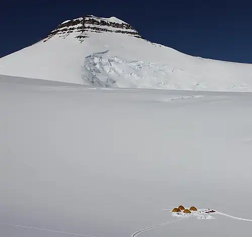
Gallery
See also
Notes
References
External links
Sovereign states Dependencies and
68°55′06″N 29°53′57″W / 68.9184°N 29.8991°W / 68.9184; -29.8991 (Gunnbjørn Fjeld )