Lithaire
Lithaire | |
|---|---|
Part of Montsenelle | |
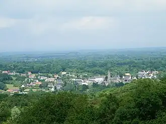 The village seen from Mont Castre | |
Location of Lithaire | |
 Lithaire  Lithaire | |
| Coordinates: 49°18′03″N 1°28′56″W / 49.3008°N 1.4822°W | |
| Country | France |
| Region | Normandy |
| Department | Manche |
| Arrondissement | Coutances |
| Canton | Créances |
| Commune | Montsenelle |
Area 1 | 14.21 km2 (5.49 sq mi) |
| Population (2022)[1] | 599 |
| • Density | 42/km2 (110/sq mi) |
| Time zone | UTC+01:00 (CET) |
| • Summer (DST) | UTC+02:00 (CEST) |
| Postal code | 50250 |
| Elevation | 15–123 m (49–404 ft) (avg. 36 m or 118 ft) |
| 1 French Land Register data, which excludes lakes, ponds, glaciers > 1 km2 (0.386 sq mi or 247 acres) and river estuaries. | |
Lithaire (French pronunciation: [litɛʁ]) is a former commune in the Manche department in Normandy in north-western France. On 1 January 2016, it was merged into the new commune of Montsenelle.[2]
See also
References
- ^ "Populations de référence 2022" [Reference populations 2022] (PDF) (in French). INSEE. December 2024.
- ^ Arrêté préfectoral 20 November 2015 (in French)
Wikimedia Commons has media related to Lithaire.