Little Dixie, Arkansas
Little Dixie, Arkansas | |
|---|---|
 Little Dixie, Arkansas  Little Dixie, Arkansas | |
| Coordinates: 35°00′26″N 91°21′53″W / 35.00722°N 91.36472°W | |
| Country | United States |
| State | Arkansas |
| Counties | Prairie, Woodruff |
| Elevation | 180 ft (50 m) |
| Time zone | UTC-6 (Central (CST)) |
| • Summer (DST) | UTC-5 (CDT) |
| Area code | 870 |
| GNIS feature ID | 58073[1] |
Little Dixie is an unincorporated community in Prairie and Woodruff counties, Arkansas, United States.[1] It is located about 8 miles east-northeast of Des Arc, about 13 miles northwest of Brinkley, and about 19 miles south of Augusta, Arkansas.[2] It sits at the intersection of State Highway 33 and State Highway 38.[2]
Notes
- ^ a b c U.S. Geological Survey Geographic Names Information System: Little Dixie, Arkansas
- ^ a b "Little Dixie, Arkansas". Google Maps. Retrieved July 10, 2024.
Municipalities and communities of Prairie County, Arkansas, United States | ||
|---|---|---|
| Cities | 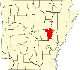 | |
| Towns | ||
| Unincorporated communities | ||
| Footnotes | ‡This populated place also has portions in an adjacent county of counties | |
Municipalities and communities of Woodruff County, Arkansas, United States | ||
|---|---|---|
| Cities |  | |
| Towns | ||
| CDP | ||
| Other unincorporated communities | ||
| Ghost town | ||
| Footnotes | ‡This populated place also has portions in an adjacent county or counties | |