Long Branch Dam
Long Branch Dam is a dam in Macon County in northern Missouri, about 80 miles (130 km) north of Columbia, Missouri.
| Long Branch Dam | |
|---|---|
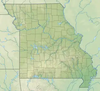 Location of Long Branch Dam  Long Branch Dam (the United States) | |
| Country | United States |
| Location | Macon County Missouri |
| Coordinates | 39°45′09″N 92°30′53″W / 39.75239°N 92.51465°W |
| Purpose | Flood control, Water storage |
| Opening date | 1978 |
| Built by | United States Army Corps of Engineers |
| Dam and spillways | |
| Impounds | East Fork Little Chariton River |
| Height | 71 ft (22 m) |
| Reservoir | |
| Creates | Long Branch Lake |
| Total capacity | 98,000 acre⋅ft (121,000,000 m3) |
| Normal elevation | 790 ft (240 m)[1] |
The dam is a project of the United States Army Corps of Engineers to provide flood control, water storage, wildlife conservation, and recreation. Completed in 1978, the 71-foot (22 m) high earthen dam impounds the water of the East Fork of the Little Chariton River.[2]
Long Branch Lake is the reservoir created by the dam, with about 24 miles (39 km) of shoreline and a flood-control capacity of 98,000 acre-feet (121,000,000 m3). In addition to the adjacent state-run Long Branch State Park with three separate units,[3] the dam has a visitor center at its southern end, and the Atlanta State Wildlife Area at its northern end.
References
- ^ U.S. Geological Survey Geographic Names Information System: Long Branch Dam
- ^ "Long Branch Lake". Archived from the original on 2010-09-21. Retrieved 2014-09-24.
- ^ "Long Branch State Park". 10 December 2010.