Lost River Township, Martin County, Indiana
Lost River Township | |
|---|---|
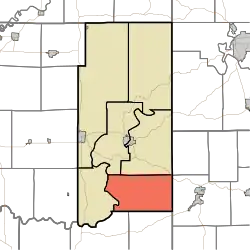 Location in Martin County | |
| Coordinates: 38°33′14″N 86°45′51″W / 38.55389°N 86.76417°W | |
| Country | |
| State | |
| County | Martin |
| Government | |
| • Type | Indiana township |
| Area | |
• Total | 42.75 sq mi (110.7 km2) |
| • Land | 42.29 sq mi (109.5 km2) |
| • Water | 0.46 sq mi (1.2 km2) 1.08% |
| Elevation | 564 ft (172 m) |
| Population (2020) | |
• Total | 513 |
| • Density | 12/sq mi (4.6/km2) |
| Time zone | UTC-5 (Eastern (EST)) |
| • Summer (DST) | UTC-4 (EDT) |
| ZIP codes | 47432, 47527, 47581 |
| Area codes | 812, 930 |
| GNIS feature ID | 453582 |
Lost River Township is one of six townships in Martin County, Indiana, United States. As of the 2020 census, its population was 513 and it contained 250 housing units.[2]
| Census | Pop. | Note | %± |
|---|---|---|---|
| 1890 | 1,448 | — | |
| 1900 | 1,415 | −2.3% | |
| 1910 | 1,283 | −9.3% | |
| 1920 | 1,155 | −10.0% | |
| 1930 | 858 | −25.7% | |
| 1940 | 879 | 2.4% | |
| 1950 | 707 | −19.6% | |
| 1960 | 610 | −13.7% | |
| 1970 | 509 | −16.6% | |
| 1980 | 524 | 2.9% | |
| 1990 | 449 | −14.3% | |
| 2000 | 532 | 18.5% | |
| 2010 | 572 | 7.5% | |
| 2020 | 513 | −10.3% | |
| Source: US Decennial Census[3] | |||
Geography
According to the 2010 census, the township has a total area of 42.75 square miles (110.7 km2), of which 42.29 square miles (109.5 km2) (or 98.92%) is land and 0.46 square miles (1.2 km2) (or 1.08%) is water.[4]
Unincorporated towns
- Rusk at 38°33′26″N 86°45′25″W / 38.557276°N 86.75694°W
- Windom at 38°34′26″N 86°47′52″W / 38.573942°N 86.797775°W
(This list is based on USGS data and may include former settlements.)
Cemeteries
The township contains these seven cemeteries: Anderson, Cornel, Emmons Ridge, Green, Jones, Simmons and Walker.
Major highways
School districts
- Shoals Community School Corporation
Political districts
- Indiana's 8th congressional district
- State House District 62
- State Senate District 48
References
- "Lost River Township, Martin County, Indiana". Geographic Names Information System. United States Geological Survey, United States Department of the Interior. Retrieved September 29, 2009.
- United States Census Bureau 2008 TIGER/Line Shapefiles
- IndianaMap
- ^ "US Board on Geographic Names". United States Geological Survey. October 25, 2007. Retrieved May 9, 2017.
- ^ "Explore Census Data". data.census.gov. Retrieved April 13, 2024.
- ^ "Township Census Counts: STATS Indiana".
- ^ "Population, Housing Units, Area, and Density: 2010 - County -- County Subdivision and Place -- 2010 Census Summary File 1". United States Census. Archived from the original on February 12, 2020. Retrieved May 10, 2013.
External links
- Indiana Township Association
- United Township Association of Indiana
- City-Data.com page for Lost River Township
Places adjacent to Lost River Township, Martin County, Indiana | |
|---|---|
Municipalities and communities of Martin County, Indiana, United States | ||
|---|---|---|
| City | 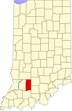 | |
| Towns | ||
| Townships | ||
| CDPs | ||
| Other communities | ||