Luding County
Luding County
泸定县 · ལྕགས་ཟམ་རྫོང་། Chagsam, Jagsam | |
|---|---|
 Luding Bridge crossing the Dadu River | |
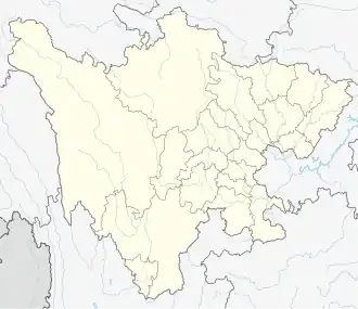
.png) Location of Luding County (red) within Garzê Prefecture (yellow) and Sichuan | |
 Luding Location of the seat in Sichuan 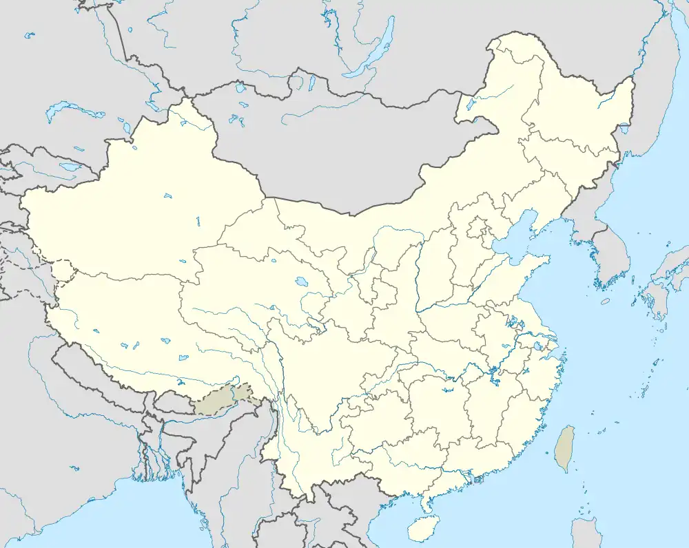 Luding Luding (China) | |
| Coordinates: 29°54′50″N 102°14′02″E / 29.914°N 102.234°E | |
| Country | China |
| Province | Sichuan |
| Prefecture-level city | Garzê |
| County seat | Luqiao |
| Area | |
• Total | 2,165.35 km2 (836.05 sq mi) |
| Population (2022)[1] | |
• Total | 86,234 |
| • Density | 40/km2 (100/sq mi) |
| • Major nationalities | Han - 78.2% Tibetan - 16.0% Yi - 4.8% |
| Time zone | UTC+8 (China Standard) |
| Postal code | 626100 |
| Area code | 0836 |
| Website | www |
| Luding County | |||||||
|---|---|---|---|---|---|---|---|
| Chinese name | |||||||
| Simplified Chinese | 泸定县 | ||||||
| Traditional Chinese | 瀘定縣 | ||||||
| |||||||
| Tibetan name | |||||||
| Tibetan | ལྕགས་ཟམ་རྫོང་། | ||||||
| |||||||
Luding County (simplified Chinese: 泸定县; traditional Chinese: 瀘定縣; pinyin: Lúdìng Xiàn), also known via its Tibetan name as Chagsam or Jagsam (Tibetan: ལྕགས་ཟམ་རྫོང་།, Wylie: lcags zam rdzong, ZYPY: Jagsam Zong), is a county located in the southeast of the Garzê Tibetan Autonomous Prefecture in Sichuan province, China.[1] Luding County covers an area of 2,165.35 km2 (836.05 sq mi), and has a population of 86,234 as of 2022.[1]
History
Geography
Luding County is bordered by Tianquan County, Yingjing County, and Hanyuan County to the east, Shimian County to the south, and Kangding to the west and north.[1]
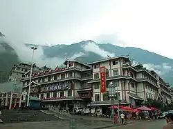
The county is located within the Hengduan Mountains, within the southeastern edge of the Tibetan Plateau.[1] The town of Luqiao, the county seat, sits at an elevation of 1,321 metres (4,334 ft) above sea level.[1] The highest point in the county is Mount Gongga, along the southwestern border with Kangding.[1] Mount Erlang is also located on the county's edge.[1]
Climate
| Climate data for Luding, elevation 1,403 m (4,603 ft), (1991–2020 normals, extremes 1981–2010) | |||||||||||||
|---|---|---|---|---|---|---|---|---|---|---|---|---|---|
| Month | Jan | Feb | Mar | Apr | May | Jun | Jul | Aug | Sep | Oct | Nov | Dec | Year |
| Record high °C (°F) | 23.4 (74.1) |
29.4 (84.9) |
36.3 (97.3) |
35.5 (95.9) |
36.3 (97.3) |
36.3 (97.3) |
37.8 (100.0) |
36.1 (97.0) |
34.9 (94.8) |
30.6 (87.1) |
26.3 (79.3) |
22.0 (71.6) |
37.8 (100.0) |
| Mean daily maximum °C (°F) | 12.2 (54.0) |
15.4 (59.7) |
19.2 (66.6) |
24.0 (75.2) |
25.9 (78.6) |
26.9 (80.4) |
28.7 (83.7) |
28.4 (83.1) |
25.6 (78.1) |
21.5 (70.7) |
18.0 (64.4) |
13.4 (56.1) |
21.6 (70.9) |
| Daily mean °C (°F) | 6.7 (44.1) |
9.4 (48.9) |
12.8 (55.0) |
17.0 (62.6) |
19.5 (67.1) |
21.1 (70.0) |
22.8 (73.0) |
22.5 (72.5) |
20.1 (68.2) |
16.4 (61.5) |
12.5 (54.5) |
7.9 (46.2) |
15.7 (60.3) |
| Mean daily minimum °C (°F) | 2.9 (37.2) |
5.2 (41.4) |
8.4 (47.1) |
12.3 (54.1) |
15.3 (59.5) |
17.3 (63.1) |
19.0 (66.2) |
18.9 (66.0) |
16.8 (62.2) |
13.3 (55.9) |
8.9 (48.0) |
4.2 (39.6) |
11.9 (53.4) |
| Record low °C (°F) | −4.2 (24.4) |
−3.5 (25.7) |
−2.4 (27.7) |
3.4 (38.1) |
6.0 (42.8) |
10.6 (51.1) |
13.2 (55.8) |
11.7 (53.1) |
9.9 (49.8) |
5.3 (41.5) |
0.2 (32.4) |
−3.2 (26.2) |
−4.2 (24.4) |
| Average precipitation mm (inches) | 0.8 (0.03) |
2.9 (0.11) |
17.8 (0.70) |
44.8 (1.76) |
75.8 (2.98) |
123.0 (4.84) |
143.4 (5.65) |
142.3 (5.60) |
86.6 (3.41) |
33.9 (1.33) |
6.3 (0.25) |
1.0 (0.04) |
678.6 (26.7) |
| Average precipitation days (≥ 0.1 mm) | 1.0 | 2.3 | 9.0 | 14.2 | 16.8 | 20.8 | 20.4 | 19.8 | 17.3 | 11.3 | 4.5 | 1.4 | 138.8 |
| Average snowy days | 1.4 | 1.0 | 0.3 | 0 | 0 | 0 | 0 | 0 | 0 | 0 | 0.1 | 0.5 | 3.3 |
| Average relative humidity (%) | 53 | 51 | 55 | 59 | 65 | 74 | 76 | 76 | 76 | 72 | 64 | 58 | 65 |
| Mean monthly sunshine hours | 113.9 | 108.3 | 114.2 | 126.1 | 116.8 | 91.1 | 110.1 | 115.7 | 88.0 | 91.4 | 106.9 | 108.5 | 1,291 |
| Percentage possible sunshine | 35 | 34 | 31 | 33 | 28 | 22 | 26 | 29 | 24 | 26 | 34 | 34 | 30 |
| Source: China Meteorological Administration[2][3] | |||||||||||||
| Climate data for Lan'an Township (1991–2018 normals) | |||||||||||||
|---|---|---|---|---|---|---|---|---|---|---|---|---|---|
| Month | Jan | Feb | Mar | Apr | May | Jun | Jul | Aug | Sep | Oct | Nov | Dec | Year |
| Mean daily maximum °C (°F) | 6.9 (44.4) |
9.4 (48.9) |
13.3 (55.9) |
17.5 (63.5) |
19.8 (67.6) |
20.9 (69.6) |
23.1 (73.6) |
22.8 (73.0) |
19.4 (66.9) |
15.1 (59.2) |
12.0 (53.6) |
8.2 (46.8) |
15.7 (60.3) |
| Daily mean °C (°F) | 1.6 (34.9) |
3.9 (39.0) |
7.6 (45.7) |
11.9 (53.4) |
14.5 (58.1) |
16.4 (61.5) |
18.8 (65.8) |
18.3 (64.9) |
15.2 (59.4) |
10.9 (51.6) |
6.9 (44.4) |
2.9 (37.2) |
10.7 (51.3) |
| Mean daily minimum °C (°F) | −3.7 (25.3) |
−1.5 (29.3) |
2.0 (35.6) |
6.2 (43.2) |
9.1 (48.4) |
12.0 (53.6) |
14.4 (57.9) |
13.8 (56.8) |
11.1 (52.0) |
6.7 (44.1) |
1.7 (35.1) |
−2.3 (27.9) |
5.8 (42.4) |
| Average precipitation mm (inches) | 5.6 (0.22) |
7.9 (0.31) |
18.2 (0.72) |
47.5 (1.87) |
93.4 (3.68) |
171.6 (6.76) |
149.5 (5.89) |
134.5 (5.30) |
126.1 (4.96) |
59.6 (2.35) |
15.0 (0.59) |
6.4 (0.25) |
835.3 (32.9) |
| Source: Baidu[4] | |||||||||||||
Administrative divisions
As of 2022, Luding County contains the following eight towns and one township:[5]
| Name | Simplified Chinese | Hanyu Pinyin | Tibetan | Wylie | Administrative division code | |
|---|---|---|---|---|---|---|
| Towns | ||||||
| Luqiao Town (Jagsam) |
泸桥镇 | Lúqiáo Zhèn | ལྕགས་ཟམ་གྲོང་རྡལ། | lcags zam grong rdal | 513322100 | |
| Linqi Town (Lengqi) |
冷碛镇 | Lěngqì Zhèn | ལིན་ཆིས་གྲོང་རྡལ། | lin chis grong rdal | 513322101 | |
| Xinglong Town (Xinlung) |
兴隆镇 | Xīnglóng Zhèn | ཞིན་ལུང་གྲོང་རྡལ། | zhin lung grong rdal | 513322102 | |
| Boxab Town (Moxi) |
磨西镇 | Móxī Zhèn | འབོ་ཞབས་གྲོང་རྡལ། | 'bo zhabs grong rdal | 513322103 | |
| Kugdalung Town (Kugdalungba, Yanzigou) |
燕子沟镇 | Yànzigōu Zhèn | ཁུག་རྟ་ལུང་གྲོང་རྡལ། | khug rta lung grong rdal | 513322104 | |
| Dêtog Town (Detuo) |
得妥镇 | Détuǒ Zhèn | བདེ་ཐོག་གྲོང་རྡལ། | bde thog grong rdal | 513322105 | |
| Pumba Town (Pingpa, Pengba) |
烹坝镇 | Pēngbà Zhèn | བུམ་པ་གྲོང་རྡལ། | bum pa grong rdal | 513322106 | |
| Dêwê Town (Dewei) |
德威镇 | Déwēi Zhèn | ཏེ་ཝེ་གྲོང་རྡལ། | te we grong rdal | 513322107 | |
| Township | ||||||
| La'ngoi Township (Lan'an) |
岚安乡 | Lán'ān Xiāng | ལ་ངོས་ཤང་། | la ngos shang | 513322200 | |
Demographics
Luding County has a total population of 86,234 as of 2022,[1] up from approximately 80,000 at the end of 2004, and the 77,855 recorded in the 2000 Chinese Census.
Ethnic groups
Luding County has a supermajority Han Chinese population, but is home to a number of ethnic minorities, who constitute about 22% of the county's population.[1] The county's ethnic minorities include Tibetans, Yi, Qiang, Miao, Hui, Mongols, Tujia, Lisu, Manchus, Yao, Kam, Nakhi, Bouyei, Bai, Zhuang, and the Dai.[1]
The following table shows the ethnic composition of Luding County:
| 2000 | 2022[1] | ||||
|---|---|---|---|---|---|
| Ethnic Group | Population | Percentage | Ethnic Group | Population | Percentage |
| Han | 66,066 | 84.86% | Han | ~67,435 | 78.2% |
| Tibetan | 7,834 | 10.06% | Tibetan | ~13,797 | 16.0% |
| Yi | 3,424 | 4.4% | Yi | ~4,139 | 4.8% |
| Mongols | 253 | 0.32% | Mongols | N/A | N/A |
| Others | 278 | 0.36% | Others | 863 | 1.0% |
Transport
References
- ^ a b c d e f g h i j k l 泸定简介 [Luding Introduction]. luding.gov.cn (in Chinese). Luding County People's Government. Archived from the original on 2022-09-05. Retrieved 2022-09-05.
- ^ 中国气象数据网 – WeatherBk Data (in Simplified Chinese). China Meteorological Administration. Retrieved 14 April 2023.
- ^ 中国气象数据网 (in Simplified Chinese). China Meteorological Administration. Retrieved 14 April 2023.
- ^ "泸定县岚安乡历史气候数据(甘孜藏族自治州)月尺度温度和降雨量(1961-2018年) - 百度文库". Baidu Library (in Simplified Chinese). Baidu. Retrieved 27 October 2024.
- ^ 2021年统计用区划代码(泸定县). 2021 Statistical Division Codes (Luding County) (in Chinese). National Bureau of Statistics of China. Archived from the original on 2022-07-14. Retrieved 2022-09-05.
External links
| County-level divisions |  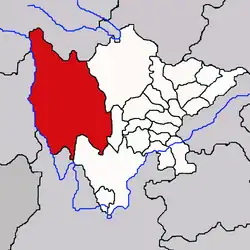 | |
|---|---|---|
| Towns and villages |
| |
| Geography | ||
| Landmarks | ||
| Sciences | ||