Luitré
Luitré
Loezherieg | |
|---|---|
Part of Luitré-Dompierre | |
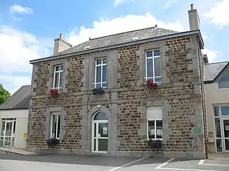 The town hall of Luitré | |
Location of Luitré | |
 Luitré  Luitré | |
| Coordinates: 48°17′03″N 1°07′02″W / 48.2842°N 1.1172°W | |
| Country | France |
| Region | Brittany |
| Department | Ille-et-Vilaine |
| Arrondissement | Fougères-Vitré |
| Canton | Fougères-2 |
| Commune | Luitré-Dompierre |
Area 1 | 29.15 km2 (11.25 sq mi) |
| Population (2022)[1] | 1,289 |
| • Density | 44/km2 (110/sq mi) |
| Time zone | UTC+01:00 (CET) |
| • Summer (DST) | UTC+02:00 (CEST) |
| Postal code | 35133 |
| Elevation | 78–201 m (256–659 ft) |
| 1 French Land Register data, which excludes lakes, ponds, glaciers > 1 km2 (0.386 sq mi or 247 acres) and river estuaries. | |
Luitré (French pronunciation: [lɥitʁe]; Breton: Loezherieg; Gallo: Lutraé) is a former commune in the Ille-et-Vilaine department in Brittany in northwestern France. On 1 January 2019, it was merged into the new commune Luitré-Dompierre.[2]
Amenities: Pharmacy, Doctor, Mairie, small Post Office, carwash, Automat laundry, Technique Controle - repair garage, boulangerie, charcuterie, bar, public toilets, fishing lake
Population
Inhabitants of Luitré are called Luitréens in French.
| Year | Pop. | ±% |
|---|---|---|
| 1962 | 1,134 | — |
| 1968 | 1,154 | +1.8% |
| 1975 | 1,010 | −12.5% |
| 1982 | 1,160 | +14.9% |
| 1990 | 1,258 | +8.4% |
| 1999 | 1,186 | −5.7% |
| 2008 | 1,305 | +10.0% |
See also
References
- ^ "Populations de référence 2022" [Reference populations 2022] (PDF) (in French). INSEE. December 2024.
- ^ Arrêté préfectoral 17 October 2018 (in French)
External links
Wikimedia Commons has media related to Luitré.
- Base Mérimée: Search for heritage in the commune, Ministère français de la Culture. (in French)