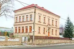
Lupenice
Lupenice | |
|---|---|
 Municipal office | |
 Flag  Coat of arms | |
 Lupenice Location in the Czech Republic | |
| Coordinates: 50°7′59″N 16°16′26″E / 50.13306°N 16.27389°E | |
| Country | |
| Region | Hradec Králové |
| District | Rychnov nad Kněžnou |
| First mentioned | 1360 |
| Area | |
• Total | 4.42 km2 (1.71 sq mi) |
| Elevation | 330 m (1,080 ft) |
| Population (2025-01-01)[1] | |
• Total | 272 |
| • Density | 62/km2 (160/sq mi) |
| Time zone | UTC+1 (CET) |
| • Summer (DST) | UTC+2 (CEST) |
| Postal code | 517 41 |
| Website | www |
Lupenice is a municipality and village in Rychnov nad Kněžnou District in the Hradec Králové Region of the Czech Republic. It has about 300 inhabitants.
Demographics
| Year | Pop. | ±% |
|---|---|---|
| 1869 | 383 | — |
| 1880 | 399 | +4.2% |
| 1890 | 377 | −5.5% |
| 1900 | 395 | +4.8% |
| 1910 | 427 | +8.1% |
| 1921 | 401 | −6.1% |
| 1930 | 370 | −7.7% |
| 1950 | 302 | −18.4% |
| 1961 | 298 | −1.3% |
| 1970 | 298 | +0.0% |
| 1980 | 252 | −15.4% |
| 1991 | 256 | +1.6% |
| 2001 | 241 | −5.9% |
| 2011 | 260 | +7.9% |
| 2021 | 273 | +5.0% |
| Source: Censuses[2][3] | ||
References
- ^ "Population of Municipalities – 1 January 2025". Czech Statistical Office. 2025-05-16.
- ^ "Historický lexikon obcí České republiky 1869–2011" (in Czech). Czech Statistical Office. 2015-12-21.
- ^ "Population Census 2021: Population by sex". Public Database. Czech Statistical Office. 2021-03-27.
External links
Wikimedia Commons has media related to Lupenice.