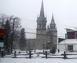
Lyster, Quebec
Lyster | |
|---|---|
 | |
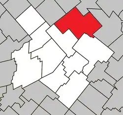 Location within L'Érable RCM | |
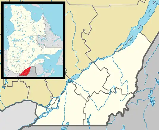 Lyster Location in southern Quebec | |
| Coordinates: 46°22′N 71°37′W / 46.367°N 71.617°W[1] | |
| Country | Canada |
| Province | Quebec |
| Region | Centre-du-Québec |
| RCM | L'Érable |
| Constituted | September 18, 1976 |
| Named after | Leicester[1] |
| Government | |
| • Mayor | Yves Boissonneault |
| • Federal riding | Mégantic—L'Érable |
| • Prov. riding | Arthabaska |
| Area | |
• Total | 167.80 km2 (64.79 sq mi) |
| • Land | 167.55 km2 (64.69 sq mi) |
| Population (2021)[3] | |
• Total | 1,587 |
| • Density | 9.5/km2 (25/sq mi) |
| • Pop 2016-2021 | |
| • Dwellings | 776 |
| Time zone | UTC−5 (EST) |
| • Summer (DST) | UTC−4 (EDT) |
| Postal code(s) | |
| Area code | 819 |
| Highways | |
| Website | www |
Lyster is a municipality in the Centre-du-Québec region of the province of Quebec in Canada. It was created with the fusion of Sainte-Anastasie-de-Nelson and the village of Lyster in 1976.
Demographics
| Year | Pop. | ±% |
|---|---|---|
| 1981 | 1,985 | — |
| 1986 | 1,872 | −5.7% |
| 1991 | 1,740 | −7.1% |
| 1996 | 1,715 | −1.4% |
| 2001 | 1,685 | −1.7% |
| 2006 | 1,644 | −2.4% |
| 2011 | 1,628 | −1.0% |
| 2016 | 1,605 | −1.4% |
| 2021 | 1,587 | −1.1% |
See also
References
- ^ a b "Banque de noms de lieux du Québec: Reference number 72467". toponymie.gouv.qc.ca (in French). Commission de toponymie du Québec.
- ^ a b "Répertoire des municipalités: Geographic code 32065". www.mamh.gouv.qc.ca (in French). Ministère des Affaires municipales et de l'Habitation.
- ^ a b "Profile table, Census Profile, 2021 Census of Population - Lyster, Municipalité (MÉ) [Census subdivision], Quebec". 9 February 2022.
- ^ Statistics Canada: 1996, 2001, 2006, 2011 census
External links
![]() Media related to Lyster at Wikimedia Commons
Media related to Lyster at Wikimedia Commons
Places adjacent to Lyster, Quebec | |
|---|---|
| Cities | |
|---|---|
| Municipalities | |
| Parishes | |
| |