Magdalena, Beni
Magdalena, Beni | |
|---|---|
Town | |
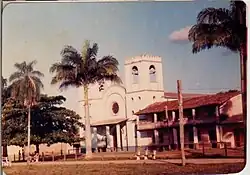 Magdalena Mission Church in 1990 | |
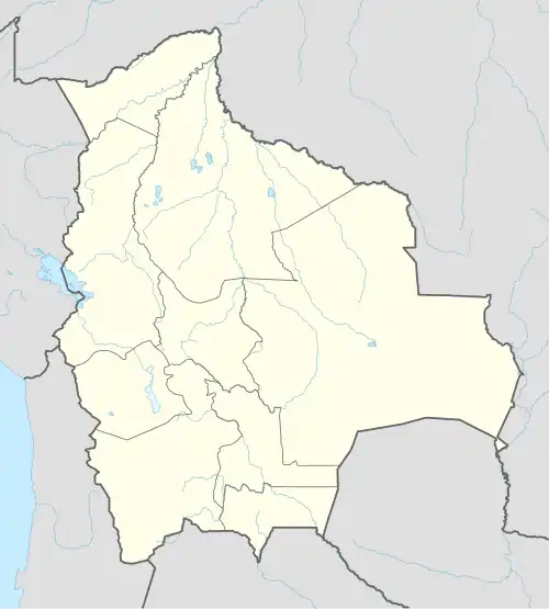 Magdalena, Beni Location of Magdalena, Beni town in Bolivia | |
| Coordinates: 13°15′38″S 64°03′10″W / 13.26056°S 64.05278°W | |
| Country | |
| Department | |
| Province | Iténez Province |
| Municipality | Magdalena Municipality |
| Elevation | 466 ft (142 m) |
| Population (2001) | |
• Total | 4,379 |
| Time zone | UTC-4 (BOT) |
| Website | www |
Magdalena is a town on the Itonomas River in the Beni Department in northern Bolivia, capital of the Iténez Province and the Magdalena Municipality.[1]
It is served by Magdalena Airport.
History
The Jesuit mission of Santa María Magdalena (or Santa Magdalena) was founded in 1720.[2] Itonama Indians resided at the mission.[3]
Climate
The yearly precipitation of the region is 1,600 mm, with a distinct dry season from May to September. Monthly average temperatures vary from 24 °C und 29 °C over the year. According to the Köppen classification system Magdalenas has a Tropical savanna climate, abbreviated "Aw".
| Climate data for Magdalena, elevation 141 m (463 ft) | |||||||||||||
|---|---|---|---|---|---|---|---|---|---|---|---|---|---|
| Month | Jan | Feb | Mar | Apr | May | Jun | Jul | Aug | Sep | Oct | Nov | Dec | Year |
| Record high °C (°F) | 39.6 (103.3) |
39.0 (102.2) |
38.9 (102.0) |
37.3 (99.1) |
37.4 (99.3) |
36.7 (98.1) |
39.0 (102.2) |
39.4 (102.9) |
39.9 (103.8) |
39.8 (103.6) |
38.8 (101.8) |
39.0 (102.2) |
39.9 (103.8) |
| Mean daily maximum °C (°F) | 31.5 (88.7) |
31.2 (88.2) |
31.7 (89.1) |
31.8 (89.2) |
30.9 (87.6) |
30.8 (87.4) |
31.7 (89.1) |
33.4 (92.1) |
33.7 (92.7) |
33.7 (92.7) |
32.5 (90.5) |
31.8 (89.2) |
32.1 (89.7) |
| Daily mean °C (°F) | 27.0 (80.6) |
26.9 (80.4) |
27.1 (80.8) |
26.9 (80.4) |
25.6 (78.1) |
24.6 (76.3) |
24.4 (75.9) |
25.8 (78.4) |
26.9 (80.4) |
27.7 (81.9) |
27.2 (81.0) |
27.1 (80.8) |
26.4 (79.6) |
| Mean daily minimum °C (°F) | 22.5 (72.5) |
22.4 (72.3) |
22.5 (72.5) |
22.0 (71.6) |
20.3 (68.5) |
18.4 (65.1) |
17.1 (62.8) |
18.1 (64.6) |
20.0 (68.0) |
21.7 (71.1) |
21.9 (71.4) |
22.4 (72.3) |
20.8 (69.4) |
| Record low °C (°F) | 14.5 (58.1) |
16.0 (60.8) |
13.2 (55.8) |
10.0 (50.0) |
6.2 (43.2) |
8.5 (47.3) |
3.7 (38.7) |
5.2 (41.4) |
9.0 (48.2) |
12.2 (54.0) |
10.7 (51.3) |
15.6 (60.1) |
3.7 (38.7) |
| Average precipitation mm (inches) | 243.6 (9.59) |
237.1 (9.33) |
236.7 (9.32) |
118.3 (4.66) |
57.0 (2.24) |
19.0 (0.75) |
13.4 (0.53) |
23.0 (0.91) |
59.6 (2.35) |
126.8 (4.99) |
186.3 (7.33) |
220.9 (8.70) |
1,541.7 (60.7) |
| Average precipitation days | 14.9 | 14.1 | 13.0 | 8.0 | 4.8 | 2.1 | 1.5 | 1.9 | 4.2 | 8.0 | 10.0 | 13.0 | 95.5 |
| Average relative humidity (%) | 82.4 | 82.5 | 81.4 | 80.2 | 78.4 | 75.6 | 68.8 | 64.7 | 67.8 | 73.3 | 78.7 | 81.3 | 76.3 |
| Source: Servicio Nacional de Meteorología e Hidrología de Bolivia[4][5] | |||||||||||||
References
- ^ Municipalities of Bolivia at www.editorialox.com
- ^ Block, David (1994). Mission culture on the upper Amazon: native tradition, Jesuit enterprise, and secular policy in Moxos, 1660-1880. Lincoln: University of Nebraska Press. ISBN 0-8032-1232-1..
- ^ Meireles, Denise Maldi. 1989. Guardiães da fronteira: Rio Guaporé, século XVIII. Petrópolis: Vozes. ISBN 85-326-0017-4.
- ^ "Base de datos Sistema Meteorológico–SISMET" (in Spanish). Servicio Nacional de Meteorología e Hidrología de Bolivia. Archived from the original on 7 June 2018. Retrieved 15 June 2024.
- ^ "índices climáticos para 149 estaciones meteorológicas en Bolivia" (in Spanish). Servicio Nacional de Meteorología e Hidrología de Bolivia. Retrieved 15 June 2024.
- www.ine.gov.bo
Capital: La Santísima Trinidad | ||
| Provinces | 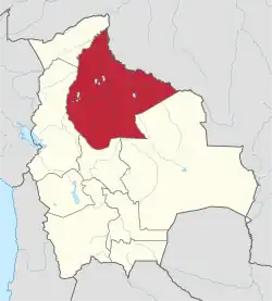 | |
| Municipalities and seats |
| |
| Missions |  | ||
|---|---|---|---|
| Peoples | |||
| Languages |
| ||
| Geography | |||