Manatí, Atlántico
Manatí, Atlántico | |
|---|---|
Municipality and town | |
 View of Manatí | |
.svg.png) Flag | |
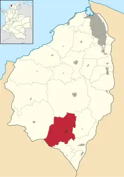 Location of the municipality and town of Manatí in the Department of Atlántico. | |
| Country | Colombia |
| Region | Caribbean |
| Department | Atlántico |
| Government | |
| • Mayor | Evaristo Enrique Olivero Pimienta (Liberal Party)[1] |
| Area | |
• Total | 206 km2 (80 sq mi) |
| Population (Census 2018[3]) | |
• Total | 19,233 |
| • Density | 93/km2 (240/sq mi) |
| Time zone | UTC-5 (Colombia Standard Time) |
| Climate | Aw |
| Website | www.manati-atlantico.gov.co/sitio.shtml |
Manatí is a Colombian municipality located to the south of the Atlántico department, approximately 44 miles from Barranquilla. It was created in 1639 in a place the natives used to call Mahabana. Its current population according to the latest DANE's (Colombian National Administrative Department of Statistics) census is 13.456 people.
Climate
Manatí has a very hot tropical savanna climate (Köppen: Aw)[4] with a dry season from December to March.
| Climate data for Manatí (Normal Manati), elevation 10 m (33 ft), (1981–2010) | |||||||||||||
|---|---|---|---|---|---|---|---|---|---|---|---|---|---|
| Month | Jan | Feb | Mar | Apr | May | Jun | Jul | Aug | Sep | Oct | Nov | Dec | Year |
| Mean daily maximum °C (°F) | 35.4 (95.7) |
36.0 (96.8) |
36.2 (97.2) |
35.7 (96.3) |
34.3 (93.7) |
34.2 (93.6) |
34.4 (93.9) |
34.4 (93.9) |
33.6 (92.5) |
33.1 (91.6) |
33.2 (91.8) |
34.2 (93.6) |
34.6 (94.3) |
| Daily mean °C (°F) | 27.7 (81.9) |
28.0 (82.4) |
28.1 (82.6) |
28.1 (82.6) |
27.7 (81.9) |
27.8 (82.0) |
27.8 (82.0) |
27.8 (82.0) |
27.5 (81.5) |
27.2 (81.0) |
27.3 (81.1) |
27.5 (81.5) |
27.7 (81.9) |
| Mean daily minimum °C (°F) | 22.3 (72.1) |
23.1 (73.6) |
23.7 (74.7) |
24.4 (75.9) |
24.4 (75.9) |
24.3 (75.7) |
24.1 (75.4) |
24.1 (75.4) |
23.9 (75.0) |
23.8 (74.8) |
23.6 (74.5) |
22.9 (73.2) |
23.7 (74.7) |
| Average precipitation mm (inches) | 12.0 (0.47) |
16.7 (0.66) |
23.7 (0.93) |
86.8 (3.42) |
157.7 (6.21) |
125.3 (4.93) |
99.1 (3.90) |
138.1 (5.44) |
143.8 (5.66) |
151.8 (5.98) |
96.5 (3.80) |
32.9 (1.30) |
1,084.3 (42.69) |
| Average precipitation days (≥ 1.0 mm) | 1 | 1 | 3 | 8 | 12 | 10 | 9 | 12 | 12 | 12 | 8 | 4 | 92 |
| Average relative humidity (%) | 81 | 80 | 79 | 80 | 82 | 82 | 82 | 82 | 83 | 84 | 84 | 82 | 82 |
| Mean monthly sunshine hours | 244.9 | 208.9 | 198.4 | 168.0 | 158.1 | 165.0 | 195.3 | 189.1 | 150.0 | 148.8 | 159.0 | 207.7 | 2,193.2 |
| Mean daily sunshine hours | 7.9 | 7.4 | 6.4 | 5.6 | 5.1 | 5.5 | 6.3 | 6.1 | 5.0 | 4.8 | 5.3 | 6.7 | 6.0 |
| Source: Instituto de Hidrologia Meteorologia y Estudios Ambientales[5] | |||||||||||||
References
- ^ (in Spanish) National Registry of the Civil State: 2007 regional election results
- ^ "Municipalities of Colombia". statoids. Retrieved 26 April 2020.
- ^ "Censo Nacional de Población y Vivienda 2018" (in Spanish). DANE. Retrieved 26 April 2020.
- ^ "Table 1 Overview of the Köppen-Geiger climate classes including the defining criteria". Nature: Scientific Data. 23 October 2023.
- ^ "Promedios Climatológicos 1981–2010" (in Spanish). Instituto de Hidrologia Meteorologia y Estudios Ambientales. Archived from the original on 15 August 2016. Retrieved 3 June 2024.
External links
- (in Spanish) Manatí official website
- (in Spanish) Manatí website
- (in Spanish) Gobernacion del Atlantico - Manatí
Municipalities in the Atlántico Department | ||
|---|---|---|