Mansfield, Georgia
Mansfield, Georgia | |
|---|---|
 Mansfield, Georgia | |
 Location in Newton County and the state of Georgia | |
| Coordinates: 33°31′7″N 83°44′7″W / 33.51861°N 83.73528°W | |
| Country | United States |
| State | Georgia |
| County | Newton |
| Area | |
• Total | 1.10 sq mi (2.84 km2) |
| • Land | 1.09 sq mi (2.83 km2) |
| • Water | 0.01 sq mi (0.01 km2) |
| Elevation | 761 ft (232 m) |
| Population (2020) | |
• Total | 442 |
| • Density | 404.39/sq mi (156.17/km2) |
| Time zone | UTC-5 (Eastern (EST)) |
| • Summer (DST) | UTC-4 (EDT) |
| ZIP code | 30055[2] |
| FIPS code | 13-49616[3] |
| GNIS feature ID | 0317666[4] |
| Website | www |
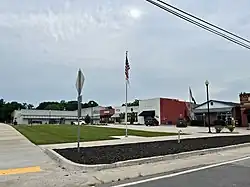
Mansfield is a city in Newton County, Georgia, United States. It is part of Metro Atlanta. As of the 2020 census, this city had a population of 442.
History
Early variant names were "Bob Lee" and "Carmel".[5] A post office called "Mansfield" has been in operation since 1897.[6] The Georgia General Assembly incorporated Mansfield as a town in 1903.[7]
Geography
Mansfield is located at 33°31′07″N 83°44′07″W / 33.518669°N 83.735405°W.[8]
According to the United States Census Bureau, the city has a total area of 1.1 square miles (2.8 km2), of which 1.1 square miles (2.8 km2) is land and 0.93% is water.
Demographics
| Census | Pop. | Note | %± |
|---|---|---|---|
| 1910 | 589 | — | |
| 1920 | 618 | 4.9% | |
| 1930 | 469 | −24.1% | |
| 1940 | 432 | −7.9% | |
| 1950 | 446 | 3.2% | |
| 1960 | 394 | −11.7% | |
| 1970 | 340 | −13.7% | |
| 1980 | 435 | 27.9% | |
| 1990 | 341 | −21.6% | |
| 2000 | 392 | 15.0% | |
| 2010 | 410 | 4.6% | |
| 2020 | 442 | 7.8% | |
| U.S. Decennial Census[9] | |||
As of the census[3] of 2000, there were 392 people, 132 households, and 105 families residing in the city. By 2020, its population was 442.
References
- ^ "2020 U.S. Gazetteer Files". United States Census Bureau. Archived from the original on March 18, 2021. Retrieved December 18, 2021.
- ^ "Mansfield ZIP Code". zipdatamaps.com. 2023. Archived from the original on January 14, 2023. Retrieved January 12, 2023.
- ^ a b "U.S. Census website". United States Census Bureau. Archived from the original on December 27, 1996. Retrieved January 31, 2008.
- ^ "US Board on Geographic Names". United States Geological Survey. October 25, 2007. Archived from the original on February 2, 2001. Retrieved January 31, 2008.
- ^ Krakow, Kenneth K. (1975). Georgia Place-Names: Their History and Origins (PDF). Macon, GA: Winship Press. p. 143. ISBN 0-915430-00-2. Archived (PDF) from the original on July 18, 2003. Retrieved May 23, 2024.
- ^ "Post Offices". Jim Forte Postal History. Archived from the original on January 13, 2021. Retrieved March 15, 2019.
- ^ Acts and Resolutions of the General Assembly of the State of Georgia. Clark & Hines, State Printers. 1903. p. 584.
- ^ "US Gazetteer files: 2010, 2000, and 1990". United States Census Bureau. February 12, 2011. Archived from the original on August 24, 2019. Retrieved April 23, 2011.
- ^ "Census of Population and Housing". Census.gov. Archived from the original on July 1, 2021. Retrieved June 4, 2015.
Municipalities and communities of Newton County, Georgia, United States | ||
|---|---|---|
| Cities |  | |
| Town | ||
| Unincorporated communities | ||
| Footnotes | ‡This populated place also has portions in an adjacent county or counties | |