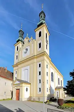
Maria Lanzendorf
Maria-Lanzendorf | |
|---|---|
 Coat of arms | |
 Maria-Lanzendorf Location within Austria | |
| Coordinates: 48°05′59″N 16°25′16″E / 48.09972°N 16.42111°E | |
| Country | Austria |
| State | Lower Austria |
| District | Bruck an der Leitha |
| Government | |
| • Mayor | Peter Wolf (SPÖ) |
| Area | |
• Total | 1.7 km2 (0.7 sq mi) |
| Elevation | 171 m (561 ft) |
| Population (2018-01-01)[2] | |
• Total | 2,129 |
| • Density | 1,300/km2 (3,200/sq mi) |
| Time zone | UTC+1 (CET) |
| • Summer (DST) | UTC+2 (CEST) |
| Postal code | 2326 |
| Area code | 02235 |
| Vehicle registration | BL |
| Website | www.maria-lanzendorf.gv.at |
Maria-Lanzendorf is a municipality in the district of Bruck an der Leitha in the Austrian state of Lower Austria.
It belonged to Wien-Umgebung District which was dissolved in 2016.[3][4]
Population
| Year | Pop. | ±% |
|---|---|---|
| 1971 | 1,147 | — |
| 1981 | 1,107 | −3.5% |
| 1991 | 1,487 | +34.3% |
| 2001 | 1,894 | +27.4% |
| 2011 | 2,045 | +8.0% |
| 2021 | 2,156 | +5.4% |
References
- ^ "Dauersiedlungsraum der Gemeinden Politischen Bezirke und Bundesländer - Gebietsstand 1.1.2018". Statistics Austria. Retrieved 10 March 2019.
- ^ "Einwohnerzahl 1.1.2018 nach Gemeinden mit Status, Gebietsstand 1.1.2018". Statistics Austria. Retrieved 9 March 2019.
- ^ "Bezirk Wien Umgebung wird aufgelöst". 10 September 2015.
- ^ "Wien-Umgebung: Aufteilung geändert", artikel in Niederösterreichische Nachrichten (NÖN.at), 24-9-2015