Mark Twain, St. Louis
Mark Twain | |
|---|---|
.jpg) Houses in Mark Twain, February 2011 | |
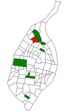 Location (red) of Mark Twain within St. Louis | |
| Country | United States |
| State | Missouri |
| City | St. Louis |
| Wards | 1, 21 |
| Area | |
• Total | 0.65 sq mi (1.7 km2) |
| Population (2020)[1] | |
• Total | 3,257 |
| • Density | 5,000/sq mi (1,900/km2) |
| ZIP code(s) | Parts of 63115, 63120 |
| Area code(s) | 314 |
| Website | stlouis-mo.gov |
Mark Twain is a neighborhood of St. Louis, Missouri named after author and Missouri native Mark Twain. It is located between Interstate 70 and Bellefontaine Cemetery.
Demographics
| Census | Pop. | Note | %± |
|---|---|---|---|
| 1990 | 6,902 | — | |
| 2000 | 4,999 | −27.6% | |
| 2010 | 4,188 | −16.2% | |
| 2020 | 3,257 | −22.2% | |
| Sources:[2][3] | |||
In 2020 Mark Twain's racial makeup was 95.1% Black, 2.4% White, 0.2% Native American, 0.3% Asian, 1.4% Two or More Races, and 0.6% Some Other Race. 1.0% of the population was of Hispanic or Latino origin.[4]
References
- ^ "2020 Census Neighborhood Results".
- ^ "Mark Twain Neighborhood Statistics". St Louis, MO. Retrieved January 26, 2023.
- ^ "Neighborhood Census Data". City of St. Louis. Retrieved January 26, 2023.
- ^ "City of St. Louis" (PDF). Retrieved September 26, 2021.
38°41′24″N 90°14′30″W / 38.6899°N 90.2417°W