Östliche Marzellspitze
| Marzellspitze | |
|---|---|
 | |
| Highest point | |
| Elevation | 3,555 m (11,663 ft) |
| Coordinates | 46°46′18″N 10°54′35″E / 46.77167°N 10.90972°E |
| Geography | |
| Location | Tyrol, Austria / South Tyrol, Italy |
| Parent range | Ötztal Alps |
| Climbing | |
| First ascent | 24 July 1872 by Hans Pinggera and V. Hecht |
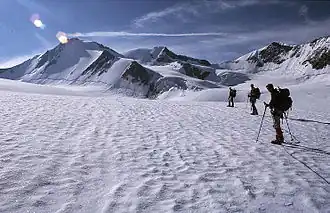
The Östliche Marzellspitze is a mountain in the Ötztal Alps on the border between Tyrol, Austria, and South Tyrol, Italy.[1]
References
Sources
- Alpenvereinskarte 1:25.000, Blatt 30/1 Ötztaler Alpen, Gurgl
External links
![]() Media related to Marzellspitzen at Wikimedia Commons
Media related to Marzellspitzen at Wikimedia Commons