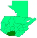
Masagua
Masagua | |
|---|---|
Municipality and town | |
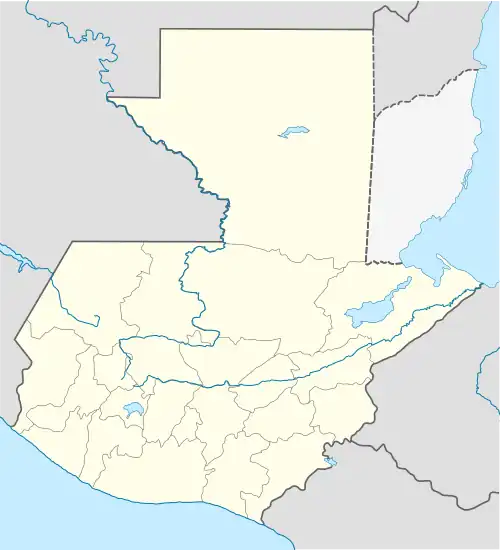 Masagua Location in Guatemala | |
| Coordinates: 14°12′00″N 90°51′00″W / 14.20000°N 90.85000°W | |
| Country | |
| Settled | 1825 |
| Government | |
| • Mayor | Blanca Alfaro[1] |
| Area | |
• Total | 456 km2 (176 sq mi) |
| Population (2018 census)[2] | |
• Total | 45,323 |
| • Density | 99/km2 (260/sq mi) |
| Climate | Aw |
Masagua (Spanish pronunciation: [maˈsaɣwa]) is a town with a population of 16,797 (2018 census),[3] and a municipality in the Escuintla department of Guatemala. In 2008 began construction for a massive power generation plant se property of Jaguar Energy in the municipality.[4]
Jaguar Energy power plant
Jaguar Energy is a corporation that owns a large coal-based electric generation plant located in Tierra Colorada, Masagua, next to the San Miguel Las Flores community and twenty five km away from Puerto de San José. The company is a subsidiary of the American corporation Ashmore Energy International Ltd.(AEI). It started operations in Guatemala in early 2008 and it plant has an estimated cost of US$750 million, intended to generate 300 MW. The energy produced will be sold to Energuate, the larger power distributor in Guatemala, a subsidiary of the British inversment firm ACTIS.[4]
Climate
Masagua has a tropical savanna climate (Köppen: Aw).
| Climate data for Masagua | |||||||||||||
|---|---|---|---|---|---|---|---|---|---|---|---|---|---|
| Month | Jan | Feb | Mar | Apr | May | Jun | Jul | Aug | Sep | Oct | Nov | Dec | Year |
| Mean daily maximum °C (°F) | 33.2 (91.8) |
33.6 (92.5) |
34.6 (94.3) |
34.7 (94.5) |
34.0 (93.2) |
32.7 (90.9) |
33.0 (91.4) |
32.9 (91.2) |
32.0 (89.6) |
31.9 (89.4) |
32.2 (90.0) |
32.7 (90.9) |
33.1 (91.6) |
| Daily mean °C (°F) | 26.6 (79.9) |
27.1 (80.8) |
28.2 (82.8) |
28.7 (83.7) |
28.7 (83.7) |
27.9 (82.2) |
28.1 (82.6) |
27.9 (82.2) |
27.4 (81.3) |
26.8 (80.2) |
26.8 (80.2) |
26.7 (80.1) |
27.6 (81.6) |
| Mean daily minimum °C (°F) | 20.1 (68.2) |
20.6 (69.1) |
21.9 (71.4) |
22.7 (72.9) |
23.4 (74.1) |
23.2 (73.8) |
23.3 (73.9) |
23.0 (73.4) |
22.8 (73.0) |
21.7 (71.1) |
21.4 (70.5) |
20.7 (69.3) |
22.1 (71.7) |
| Average precipitation mm (inches) | 4 (0.2) |
4 (0.2) |
19 (0.7) |
76 (3.0) |
273 (10.7) |
394 (15.5) |
317 (12.5) |
219 (8.6) |
451 (17.8) |
399 (15.7) |
81 (3.2) |
10 (0.4) |
2,247 (88.5) |
| Source: Climate-Data.org[5] | |||||||||||||
Geographic location
Borders
Masagua is situated 15 km from Escuintla. It is one of the municipalities that is enclosed within the Escuintla Department.
Places adjacent to Masagua | ||||||||||||||||
|---|---|---|---|---|---|---|---|---|---|---|---|---|---|---|---|---|
| ||||||||||||||||
See also
References
- ^ Prensa Libre (2011). "Ganadores del poder local en las elecciones de Guatemala 2011" (PDF) (in Spanish). Archived from the original (PDF) on 1 December 2011. Retrieved 13 September 2011.
- ^ Citypopulation.de Population of departments and municipalities in Guatemala
- ^ Citypopulation.de Population of cities & towns in Guatemala
- ^ a b Solano, Luis (13 July 2015). "Jaguar Energy: un multimillonario negocio en juego". Albedrío; Centro de Medios Independientes. Guatemala. Archived from the original on 14 July 2015. Retrieved 13 July 2015.
- ^ "Climate: Masagua". Climate-Data.org. Retrieved 24 August 2015.
- ^ a b SEGEPLAN (n.d.). "Municipios de Escuintla, Guatemala". Secretaría General de Planificación y Programación de la Presidencia de la República (in Spanish). Guatemala. Archived from the original on 14 July 2015. Retrieved 13 July 2015.
{{cite web}}: CS1 maint: year (link)