Masllorenç
Masllorenç | |
|---|---|
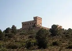 Masllorenç castle | |
 Coat of arms | |
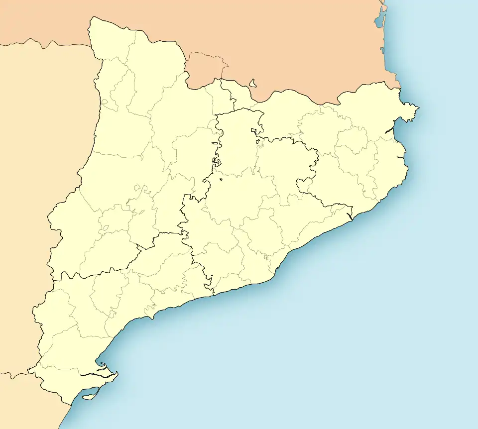 Masllorenç Location in Catalonia | |
| Coordinates: 41°16′16″N 1°24′56″E / 41.27111°N 1.41556°E | |
| Country | |
| Community | |
| Province | Tarragona |
| Comarca | Baix Penedès |
| Government | |
| • Mayor | Nuria Manchado Llorens (2015)[1] |
| Area | |
• Total | 6.6 km2 (2.5 sq mi) |
| Elevation | 320 m (1,050 ft) |
| Population (2018)[3] | |
• Total | 498 |
| • Density | 75/km2 (200/sq mi) |
| Website | www |
Masllorenç (Catalan pronunciation: [ˌmazʎuˈɾɛns]) is a municipality in the comarca of the Baix Penedès[1] in Catalonia, Spain. It is situated on the slopes of the Miramar range (864 m). A local road links the municipality with El Pla de Santa Maria, and with the A-2 autopista and the T-200 road. Masllorenç became part of the Baix Penedès in the comarcal revision of 1990: previously it formed part of the Alt Camp.
Demographics
It has a population of 573 (register office, 2024) ![]() .
.
| 1900 | 1930 | 1950 | 1970 | 1986 | 2001 |
|---|---|---|---|---|---|
| 911 | 812 | 634 | 460 | 418 | 453 |
References
- ^ "Ajuntament de Masllorenç". Generalitat of Catalonia. Retrieved 2015-11-13.
- ^ "El municipi en xifres: Masllorenç". Statistical Institute of Catalonia. Retrieved 2015-11-23.
- ^ Municipal Register of Spain 2018. National Statistics Institute.
Bibliography
- Panareda Clopés, Josep Maria; Rios Calvet, Jaume; Rabella Vives, Josep Maria (1989). Guia de Catalunya, Barcelona: Caixa de Catalunya. ISBN 84-87135-01-3 (Spanish). ISBN 84-87135-02-1 (Catalan).
External links
- Government data pages (in Catalan)
Places adjacent to Masllorenç | ||||||||||||||||
|---|---|---|---|---|---|---|---|---|---|---|---|---|---|---|---|---|
| ||||||||||||||||
Municipalities of Baix Penedès | ||
|---|---|---|