Maungaturoto (volcano)
| Maungaturoto | |
|---|---|
 Maungaturoto | |
| Highest point | |
| Elevation | 282[1] m (925 ft) |
| Coordinates | 35°22′10″S 173°52′50″E / 35.369385°S 173.880529°E[1] |
| Geography | |
| Geology | |
| Rock age | Pleistocene |
| Mountain type | Basalt cone |
| Rock type | Basalt |
| Volcanic field | Kaikohe-Bay of Islands volcanic field |
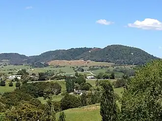
Maungaturoto is a 282 metres (925 ft) high[1] basaltic scoria cone, in the Kaikohe-Bay of Islands volcanic field in New Zealand.[2] It was the site of a pā.
References
- ^ a b c NZTopoMap:Maungaturoto
- ^ Hayward, Bruce; Smith, Ian (2002). "Field Trip 7: A Taste of Northland Geology" (PDF). In Smith, Vicki; Grenfell, Hugh (eds.). Field Trip Guides, GSNZ Annual Conference "Northland 2002". Geological Society of NZ Miscellaneous Publication 112B. Retrieved 28 March 2012.